Property Record
1139 Channel Ave, Memphis, TN 38106


NEARBY LISTINGS FOR SALE OR LEASE
Property Detail
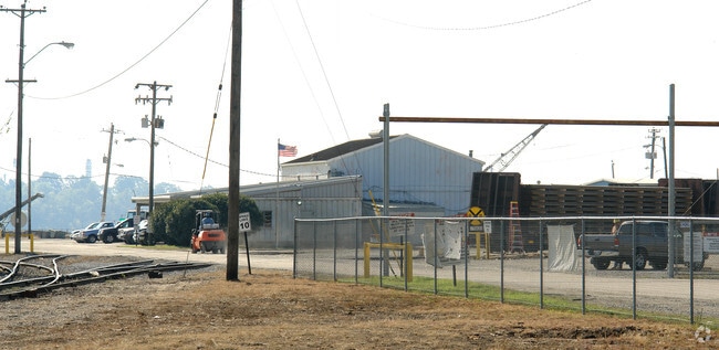
1139 Channel Ave
Memphis, TN-MS-AR
Memphis & Shelby County Port Commissions
05-0107-0-0004
INDUSTRIAL SUBDV SS & ES CHANNEL TO HARBOR CHANNEL LINE
Municipalproperty
Shelby
AE
Tennessee
05035C0475E
2
0
65.47 AC
2025
Southwest
980200
Memphis
DEMOGRAPHICS near 1139 Channel Ave
1 Mile
3 Mile
5 Mile
2024 Total Population
425
22,626
88,534
2029 Population
448
23,466
90,102
Pop Growth 2024-2029
+ 5.41%
+ 3.71%
+ 1.77%
Average Age
43
40
40
2024 Total Households
183
10,191
39,804
HH Growth 2024-2029
+ 5.46%
+ 3.02%
+ 1.57%
Median Household Inc
$20,859
$31,948
$34,682
Avg Household Size
2.30
2.10
2.10
2024 Avg HH Vehicles
1.00
1.00
1.00
Median Home Value
$74,137
$86,322
$78,402
Median Year Built
1957
1960
1963
Nearby Places
Map Layers
Map Styles
 Street
 Aerial
- Restaurants
- Banks
- Shops
- Fitness
- Groceries
PUBLIC TRANSPORTATION
AIRPORT
Memphis International
DRIVE
WALK
Distance
Memphis International
17 min
11.5 mi
Freight Ports
Port of Shreveport
DRIVE
WALK
Distance
Port of Shreveport
1 min
277.8 mi
Nearby Properties
Address
Land Use
TOTAL SIZE
Lot Size
Zoning
Address
Land Use
TOTAL SIZE
Lot Size
Zoning
438,763 SF
64.67 AC
IH
Address
Land Use
TOTAL SIZE
Lot Size
Zoning
233,547 SF
16.70 AC
SM
Address
Land Use
TOTAL SIZE
Lot Size
Zoning
57,424 SF
0.83 AC
SM
Address
Land Use
TOTAL SIZE
Lot Size
Zoning
48,729 SF
3.66 AC
BR
Address
Land Use
TOTAL SIZE
Lot Size
Zoning
70,634 SF
0.54 AC
SM
Address
Land Use
TOTAL SIZE
Lot Size
Zoning
26,824 SF
0.39 AC
SM
Address
Land Use
TOTAL SIZE
Lot Size
Zoning
62,470 SF
3.68 AC
BR
Address
Land Use
TOTAL SIZE
Lot Size
Zoning
61,469 SF
0.95 AC
SM
Address
Land Use
TOTAL SIZE
Lot Size
Zoning
26,952 SF
2.79 AC
BR
Address
Land Use
TOTAL SIZE
Lot Size
Zoning
342,931 SF
20.87 AC
IH
Address
Land Use
TOTAL SIZE
Lot Size
Zoning
222,777 SF
119.84 AC
IH
Address
Land Use
TOTAL SIZE
Lot Size
Zoning
127,513 SF
8.14 AC
R-R
Address
Land Use
TOTAL SIZE
Lot Size
Zoning
54,900 SF
0.72 AC
SM
Address
Land Use
TOTAL SIZE
Lot Size
Zoning
238,010 SF
16.58 AC
IH
Address
Land Use
TOTAL SIZE
Lot Size
Zoning
381.30 AC
R-15
Address
Land Use
TOTAL SIZE
Lot Size
Zoning
451,501 SF
21.78 AC
IH
Address
Land Use
TOTAL SIZE
Lot Size
Zoning
23,094 SF
2.92 AC
BR
Address
Land Use
TOTAL SIZE
Lot Size
Zoning
39,812 SF
1.90 AC
BR
Address
Land Use
TOTAL SIZE
Lot Size
Zoning
316,830 SF
23.55 AC
EMP
Address
Land Use
TOTAL SIZE
Lot Size
Zoning
54,000 SF
293.13 AC
IH
Address
Land Use
TOTAL SIZE
Lot Size
Zoning
24,409 SF
0.62 AC
BR
Address
Land Use
TOTAL SIZE
Lot Size
Zoning
4,000 SF
12.32 AC
IH
Address
Land Use
TOTAL SIZE
Lot Size
Zoning
5.32 AC
R-R
Address
Land Use
TOTAL SIZE
Lot Size
Zoning
31,875 SF
0.20 AC
SM
Address
Land Use
TOTAL SIZE
Lot Size
Zoning
42,263 SF
2.91 AC
GC
Address
Land Use
TOTAL SIZE
Lot Size
Zoning
19,848 SF
3.61 AC
RU-3
Address
Land Use
TOTAL SIZE
Lot Size
Zoning
371,916 SF
19.08 AC
IH
Address
Land Use
TOTAL SIZE
Lot Size
Zoning
8,172 SF
0.11 AC
SM
Address
Land Use
TOTAL SIZE
Lot Size
Zoning
66,720 SF
7.19 AC
IH
The World's #1 Commercial Real Estate Marketplace
Connect with us
© 2025 CoStar Group
The information above has been obtained from sources believed reliable. While we do not doubt its accuracy we have not verified it and make no guarantee, warranty or representation about it. It is your responsibility to independently confirm its accuracy and completeness. Any projections, opinions, assumptions, or estimates used are for example only and do not represent the current or future performance of the property. The value of this transaction to you depends on tax and other factors which should be evaluated by your tax, financial, and legal advisors. You and your advisors should conduct a careful, independent investigation of the property to determine to your satisfaction the suitability of the property for your needs.