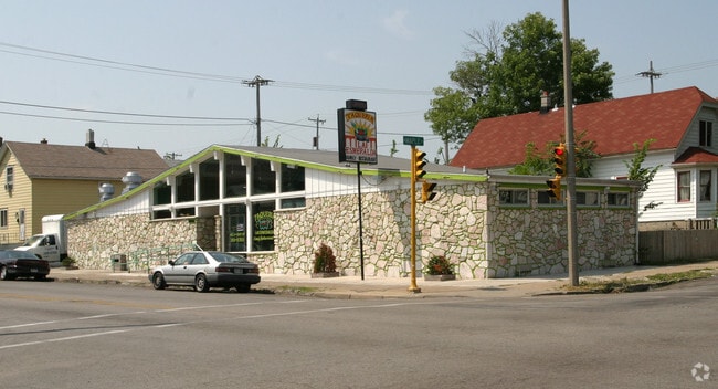
Property Record
1133 W Maple St, Milwaukee, WI 53204


NEARBY LISTINGS FOR SALE OR LEASE
Property Detail
1133 W Maple St
Milwaukee-Waukesha-West Allis, WI
Mitchells Subd
461-0654-100
Milwaukee
Duplex
Wisconsin
X
0.14 AC
55079C0093E
Milwaukee Near SW
1,364 SF
Milwaukee/Madison
DEMOGRAPHICS near 1133 W Maple St
1 Mile
3 Mile
5 Mile
2024 Total Population
46,102
189,490
431,742
2029 Population
44,988
185,634
423,688
Pop Growth 2024-2029
(2.42%)
(2.03%)
(1.87%)
Average Age
32
35
36
2024 Total Households
15,104
77,228
184,359
HH Growth 2024-2029
(2.47%)
(1.86%)
(1.88%)
Median Household Inc
$35,572
$46,412
$50,738
Avg Household Size
2.90
2.30
2.20
2024 Avg HH Vehicles
1.00
1.00
1.00
Median Home Value
$84,733
$167,620
$181,092
Median Year Built
1945
1948
1949
Nearby Places
Map Layers
Map Styles
 Street
 Aerial
- Restaurants
- Banks
- Shops
- Fitness
- Groceries
PUBLIC TRANSPORTATION
COMMUTER RAIL
DRIVE
WALK
Distance
7 min
3.0 mi
DRIVE
WALK
Distance
14 min
5.9 mi
AIRPORT
General Mitchell International
DRIVE
WALK
Distance
General Mitchell International
13 min
5.8 mi
Freight Ports
Port Milwaukee
DRIVE
WALK
Distance
Port Milwaukee
5 min
1.6 mi
SALE & LEASE HISTORY
LISTING DATE
SALE/LEASE

Jan 10, 2024
For Sale
Nearby Properties
Address
Land Use
TOTAL SIZE
Lot Size
Zoning
Address
Land Use
TOTAL SIZE
Lot Size
Zoning
1,140,196 SF
5.33 AC
C9F(A)
Address
Land Use
TOTAL SIZE
Lot Size
Zoning
8.05 AC
TL
Address
Land Use
TOTAL SIZE
Lot Size
Zoning
730,000 SF
6.94 AC
PD
Address
Land Use
TOTAL SIZE
Lot Size
Zoning
1,330,372 SF
2.48 AC
C9F(A)
Address
Land Use
TOTAL SIZE
Lot Size
Zoning
41.05 AC
IO2
Address
Land Use
TOTAL SIZE
Lot Size
Zoning
715,000 SF
2.71 AC
C9F(B)
Address
Land Use
TOTAL SIZE
Lot Size
Zoning
3.04 AC
TL
Address
Land Use
TOTAL SIZE
Lot Size
Zoning
523,726 SF
0.79 AC
C9B(B)
Address
Land Use
TOTAL SIZE
Lot Size
Zoning
607,577 SF
1.67 AC
PD
Address
Land Use
TOTAL SIZE
Lot Size
Zoning
370,160 SF
2.93 AC
C9F(A)
Address
Land Use
TOTAL SIZE
Lot Size
Zoning
380,817 SF
0.82 AC
C9F(A)
Address
Land Use
TOTAL SIZE
Lot Size
Zoning
362,007 SF
1.02 AC
C9F(A)
Address
Land Use
TOTAL SIZE
Lot Size
Zoning
495,212 SF
0.48 AC
C9F(A)
Address
Land Use
TOTAL SIZE
Lot Size
Zoning
414,410 SF
2.16 AC
C9F(A)
Address
Land Use
TOTAL SIZE
Lot Size
Zoning
280,000 SF
2.74 AC
RED
Address
Land Use
TOTAL SIZE
Lot Size
Zoning
173,610 SF
1.70 AC
IM
Address
Land Use
TOTAL SIZE
Lot Size
Zoning
378,717 SF
0.61 AC
C9D(A)
Address
Land Use
TOTAL SIZE
Lot Size
Zoning
535,904 SF
3.88 AC
C9A(A)
Address
Land Use
TOTAL SIZE
Lot Size
Zoning
491,759 SF
3 AC
C9F(A)
Address
Land Use
TOTAL SIZE
Lot Size
Zoning
272,475 SF
0.66 AC
PD
Address
Land Use
TOTAL SIZE
Lot Size
Zoning
319,559 SF
6.29 AC
PD
Address
Land Use
TOTAL SIZE
Lot Size
Zoning
300,416 SF
1.24 AC
PD
Address
Land Use
TOTAL SIZE
Lot Size
Zoning
4.53 AC
C9F(A)
Address
Land Use
TOTAL SIZE
Lot Size
Zoning
425,000 SF
1.42 AC
C9F(A)
Address
Land Use
TOTAL SIZE
Lot Size
Zoning
179 AC
IH
Address
Land Use
TOTAL SIZE
Lot Size
Zoning
180,407 SF
0.63 AC
PD
Address
Land Use
TOTAL SIZE
Lot Size
Zoning
534,786 SF
1.81 AC
C9D(A)
Address
Land Use
TOTAL SIZE
Lot Size
Zoning
210,552 SF
2.43 AC
C9D(A)
Address
Land Use
TOTAL SIZE
Lot Size
Zoning
122.53 AC
TL
Address
Land Use
TOTAL SIZE
Lot Size
Zoning
508,168 SF
14.56 AC
C9G
The World's #1 Commercial Real Estate Marketplace
Connect with us
© 2025 CoStar Group
The information above has been obtained from sources believed reliable. While we do not doubt its accuracy we have not verified it and make no guarantee, warranty or representation about it. It is your responsibility to independently confirm its accuracy and completeness. Any projections, opinions, assumptions, or estimates used are for example only and do not represent the current or future performance of the property. The value of this transaction to you depends on tax and other factors which should be evaluated by your tax, financial, and legal advisors. You and your advisors should conduct a careful, independent investigation of the property to determine to your satisfaction the suitability of the property for your needs.