Property Record
114 E Lauridsen Blvd, Port Angeles, WA 98362


NEARBY LISTINGS FOR SALE OR LEASE
Property Detail
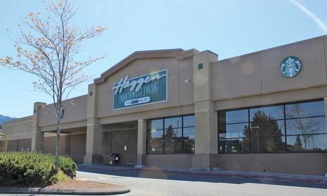
114 E Lauridsen Blvd
Port Angeles, WA
Albertsons Inc Sp
65223
LOT 1 ALBERTSONS INC SP V27 PG10 BLKS 24 AND 25 PSCC 2ND ADD
Storebuilding
Clallam
X
Washington
53009C1177F
1
2024
4.73 AC
2025
Bellingham/Northwest
001100
Other Market Areas
47,287 SF
DEMOGRAPHICS near 114 E Lauridsen Blvd
1 Mile
3 Mile
5 Mile
2024 Total Population
8,895
24,136
28,671
2029 Population
9,317
25,285
30,042
Pop Growth 2024-2029
+ 4.74%
+ 4.76%
+ 4.78%
Average Age
42
43
44
2024 Total Households
4,062
10,720
12,652
HH Growth 2024-2029
+ 4.70%
+ 4.77%
+ 4.78%
Median Household Inc
$54,944
$58,540
$59,897
Avg Household Size
2.10
2.20
2.20
2024 Avg HH Vehicles
2.00
2.00
2.00
Median Home Value
$298,012
$301,681
$311,815
Median Year Built
1955
1970
1972
Nearby Places
Map Layers
Map Styles
 Street
 Aerial
- Restaurants
- Banks
- Shops
- Fitness
- Groceries
SALE & LEASE HISTORY
LISTING DATE
SALE/LEASE

Sep 25, 2016
For Lease
Jul 10, 2017
For Sale
Dec 13, 2016
For Sale
Aug 18, 2017
For Sale
Nearby Properties
Address
Land Use
TOTAL SIZE
Lot Size
Zoning
Address
Land Use
TOTAL SIZE
Lot Size
Zoning
384,016 SF
12.06 AC
Address
Land Use
TOTAL SIZE
Lot Size
Zoning
15,388 SF
5.90 AC
CBD
Address
Land Use
TOTAL SIZE
Lot Size
Zoning
67,080 SF
3 AC
PIH
Address
Land Use
TOTAL SIZE
Lot Size
Zoning
58,145 SF
30.33 AC
M
Address
Land Use
TOTAL SIZE
Lot Size
Zoning
65.60 AC
Address
Land Use
TOTAL SIZE
Lot Size
Zoning
63,575 SF
2.03 AC
UNC
Address
Land Use
TOTAL SIZE
Lot Size
Zoning
33,120 SF
2.50 AC
PCSD
Address
Land Use
TOTAL SIZE
Lot Size
Zoning
55,164 SF
4.29 AC
PCSD
Address
Land Use
TOTAL SIZE
Lot Size
Zoning
44,076 SF
3.29 AC
UNC
Address
Land Use
TOTAL SIZE
Lot Size
Zoning
18,410 SF
0.64 AC
CSD
Address
Land Use
TOTAL SIZE
Lot Size
Zoning
2,391 SF
1.93 AC
PCA
Address
Land Use
TOTAL SIZE
Lot Size
Zoning
7.60 AC
Address
Land Use
TOTAL SIZE
Lot Size
Zoning
36,253 SF
44.94 AC
M
Address
Land Use
TOTAL SIZE
Lot Size
Zoning
17,118 SF
0.60 AC
UNC
Address
Land Use
TOTAL SIZE
Lot Size
Zoning
7.60 AC
Address
Land Use
TOTAL SIZE
Lot Size
Zoning
2.64 AC
Address
Land Use
TOTAL SIZE
Lot Size
Zoning
3,680 SF
1 AC
M
Address
Land Use
TOTAL SIZE
Lot Size
Zoning
16,693 SF
2.46 AC
PRHD
Address
Land Use
TOTAL SIZE
Lot Size
Zoning
32,601 SF
2.36 AC
RMD
Address
Land Use
TOTAL SIZE
Lot Size
Zoning
1,196 SF
4.15 AC
RHD
Address
Land Use
TOTAL SIZE
Lot Size
Zoning
Address
Land Use
TOTAL SIZE
Lot Size
Zoning
30,189 SF
2.63 AC
PCA
Address
Land Use
TOTAL SIZE
Lot Size
Zoning
22.85 AC
IH
Address
Land Use
TOTAL SIZE
Lot Size
Zoning
Address
Land Use
TOTAL SIZE
Lot Size
Zoning
24,087 SF
13.28 AC
Address
Land Use
TOTAL SIZE
Lot Size
Zoning
18,913 SF
0.96 AC
PCN
Address
Land Use
TOTAL SIZE
Lot Size
Zoning
27,814 SF
0.32 AC
PCBD
Address
Land Use
TOTAL SIZE
Lot Size
Zoning
21,208 SF
0.32 AC
PCBD
Address
Land Use
TOTAL SIZE
Lot Size
Zoning
14,340 SF
6.28 AC
UNC
The World's #1 Commercial Real Estate Marketplace
Connect with us
© 2025 CoStar Group
The information above has been obtained from sources believed reliable. While we do not doubt its accuracy we have not verified it and make no guarantee, warranty or representation about it. It is your responsibility to independently confirm its accuracy and completeness. Any projections, opinions, assumptions, or estimates used are for example only and do not represent the current or future performance of the property. The value of this transaction to you depends on tax and other factors which should be evaluated by your tax, financial, and legal advisors. You and your advisors should conduct a careful, independent investigation of the property to determine to your satisfaction the suitability of the property for your needs.