Property Record
114 Foreline St, Gainesville, TX 76240
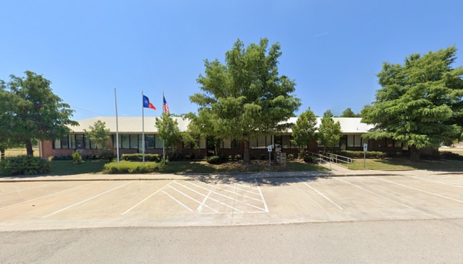

Property Detail
114 Foreline St
Gainesville, TX
COMPRESS PARK; LOT 5
74332
COOKE
Storebuilding
Texas
B and X Area of moderate flood hazard, usually the area between the limits of the 100-year and 500-year floods.
5
2024
1.38 AC
2025
Texas North Area
000600
Other Market Areas
12,375 SF
NEARBY LISTINGS FOR SALE OR LEASE
DEMOGRAPHICS near 114 Foreline St
1 mile
3 mile
5 mile
2025 Total Population
8,065
19,833
22,646
2030 Population
8,550
20,928
23,830
Pop Growth 2025-2030
+ 6.01%
+ 5.52%
+ 5.23%
Average Age
36
38
38
2025 Total Households
3,010
7,266
8,304
HH Growth 2025-2030
+ 6.05%
+ 5.55%
+ 5.27%
Median Household Inc
$52,482
$57,335
$59,190
Avg Household Size
2.60
2.60
2.60
2025 Avg HH Vehicles
2.00
2.00
2.00
Median Home Value
$158,333
$183,942
$195,314
Median Year Built
1963
1971
1973
Nearby Places
Map Layers
Map Styles
 Street
 Aerial
Transit
 Traffic
 Biking
Places
Listings with unknown addresses are not visible on the map
- Restaurants
- Banks
- Shops
- Fitness
- Groceries
PUBLIC TRANSPORTATION
COMMUTER RAIL
Drive
Walk
Distance
2 min
11 min
0.6 mi
SALE & LEASE HISTORY
LISTING DATE
SALE/LEASE

Aug 12, 2025
For Sale
The World's #1 Commercial Real Estate Marketplace
Connect with us
© 2026 CoStar Group
The information above has been obtained from sources believed reliable. While we do not doubt its accuracy we have not verified it and make no guarantee, warranty or representation about it. It is your responsibility to independently confirm its accuracy and completeness. Any projections, opinions, assumptions, or estimates used are for example only and do not represent the current or future performance of the property. The value of this transaction to you depends on tax and other factors which should be evaluated by your tax, financial, and legal advisors. You and your advisors should conduct a careful, independent investigation of the property to determine to your satisfaction the suitability of the property for your needs.