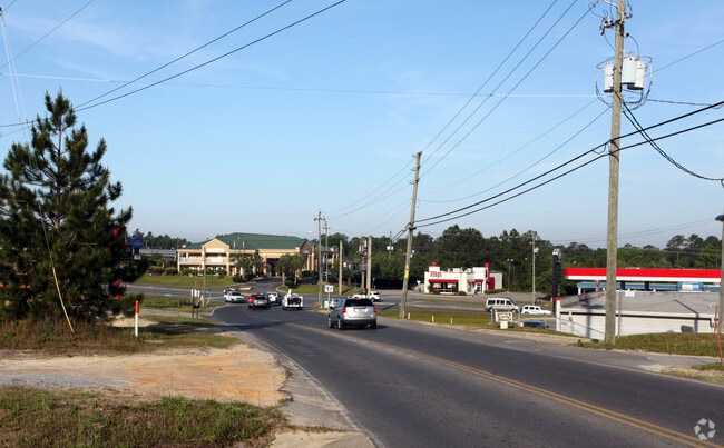
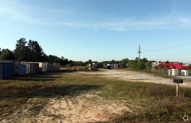
Property Record
114 John King Rd, Crestview, FL 32539

Property Detail
114 John King Rd
32-3N-23-0000-0027-0000
COM SW COR OF NW1/4 OF NE1/4 N 420 FT N 87 DEG E 420 FT TO POB E 210 FT N 633.94 FT S 57 DEG W 242.44 FT S 500 FT TO POB
Restaurantbuilding
OKALOOSA
B and X Area of moderate flood hazard, usually the area between the limits of the 100-year and 500-year floods.
Florida
2025
2.64 AC
2025
Fort Walton Beach
020702
Other Market Areas
8,000 SF
Crestview-Fort Walton Beach-Destin, FL
NEARBY LISTINGS FOR SALE OR LEASE
DEMOGRAPHICS near 114 John King Rd
1 mile
3 mile
5 mile
2025 Total Population
4,289
25,415
41,378
2030 Population
4,370
26,162
42,595
Pop Growth 2025-2030
+ 1.89%
+ 2.94%
+ 2.94%
Average Age
36
36
37
2025 Total Households
1,582
8,988
14,635
HH Growth 2025-2030
+ 1.83%
+ 2.86%
+ 2.85%
Median Household Inc
$87,019
$78,470
$78,235
Avg Household Size
2.70
2.60
2.60
2025 Avg HH Vehicles
2.00
2.00
2.00
Median Home Value
$335,497
$316,687
$309,543
Median Year Built
1998
2000
1999
Nearby Places
Map Layers
Map Styles
 Street
 Aerial
Layers
 Traffic
 Biking
Places
Listings with unknown addresses are not visible on the map
- Restaurants
- Banks
- Shops
- Fitness
- Groceries
PUBLIC TRANSPORTATION
AIRPORT
Eglin AFB/Destin-Ft Walton Beach
Drive
Walk
Distance
Eglin AFB/Destin-Ft Walton Beach
42 min
23.1 mi
Freight Ports
Port of Panama City
Drive
Walk
Distance
Port of Panama City
108 min
84.0 mi
Nearby Properties
Address
Land Use
TOTAL SIZE
Lot Size
Zoning
Address
Land Use
TOTAL SIZE
Lot Size
Zoning
124,093 SF
6.94 AC
R-2
Address
Land Use
TOTAL SIZE
Lot Size
Zoning
188,733 SF
7.90 AC
R-1
Address
Land Use
TOTAL SIZE
Lot Size
Zoning
Address
Land Use
TOTAL SIZE
Lot Size
Zoning
76,136 SF
7.45 AC
Address
Land Use
TOTAL SIZE
Lot Size
Zoning
179,054 SF
22.90 AC
Address
Land Use
TOTAL SIZE
Lot Size
Zoning
97,538 SF
7.21 AC
Address
Land Use
TOTAL SIZE
Lot Size
Zoning
267,567 SF
66.39 AC
Address
Land Use
TOTAL SIZE
Lot Size
Zoning
13,976 SF
19.04 AC
C-1
Address
Land Use
TOTAL SIZE
Lot Size
Zoning
233,285 SF
11.45 AC
C-1
Address
Land Use
TOTAL SIZE
Lot Size
Zoning
136,672 SF
13.63 AC
C-1
Address
Land Use
TOTAL SIZE
Lot Size
Zoning
61,672 SF
5.65 AC
Address
Land Use
TOTAL SIZE
Lot Size
Zoning
7,615 SF
70.60 AC
Address
Land Use
TOTAL SIZE
Lot Size
Zoning
99,035 SF
3.47 AC
Address
Land Use
TOTAL SIZE
Lot Size
Zoning
71,382 SF
2.55 AC
Address
Land Use
TOTAL SIZE
Lot Size
Zoning
79,992 SF
7.26 AC
Address
Land Use
TOTAL SIZE
Lot Size
Zoning
24,868 SF
2.03 AC
Address
Land Use
TOTAL SIZE
Lot Size
Zoning
87,672 SF
15.69 AC
Address
Land Use
TOTAL SIZE
Lot Size
Zoning
179,963 SF
22.48 AC
Address
Land Use
TOTAL SIZE
Lot Size
Zoning
26,634 SF
2.72 AC
Address
Land Use
TOTAL SIZE
Lot Size
Zoning
106,131 SF
6.50 AC
Address
Land Use
TOTAL SIZE
Lot Size
Zoning
54,986 SF
2.84 AC
Address
Land Use
TOTAL SIZE
Lot Size
Zoning
51,432 SF
3.95 AC
Address
Land Use
TOTAL SIZE
Lot Size
Zoning
139,185 SF
14.95 AC
Address
Land Use
TOTAL SIZE
Lot Size
Zoning
28,363 SF
2.34 AC
Address
Land Use
TOTAL SIZE
Lot Size
Zoning
113,123 SF
20.45 AC
C-1
Address
Land Use
TOTAL SIZE
Lot Size
Zoning
35,898 SF
5.26 AC
Address
Land Use
TOTAL SIZE
Lot Size
Zoning
88,248 SF
5.17 AC
Address
Land Use
TOTAL SIZE
Lot Size
Zoning
61,064 SF
4.80 AC
Address
Land Use
TOTAL SIZE
Lot Size
Zoning
53,892 SF
6.97 AC
Address
Land Use
TOTAL SIZE
Lot Size
Zoning
73,736 SF
6.24 AC
The World's #1 Commercial Real Estate Marketplace
Connect with us
© 2026 CoStar Group
The information above has been obtained from sources believed reliable. While we do not doubt its accuracy we have not verified it and make no guarantee, warranty or representation about it. It is your responsibility to independently confirm its accuracy and completeness. Any projections, opinions, assumptions, or estimates used are for example only and do not represent the current or future performance of the property. The value of this transaction to you depends on tax and other factors which should be evaluated by your tax, financial, and legal advisors. You and your advisors should conduct a careful, independent investigation of the property to determine to your satisfaction the suitability of the property for your needs.