Property Record
114 Lexington Tpke, Amherst, VA 24521
Current Lease Availabilities
NEARBY LISTINGS FOR SALE OR LEASE
-
-
View all Amherst listings for lease on LoopNet.com
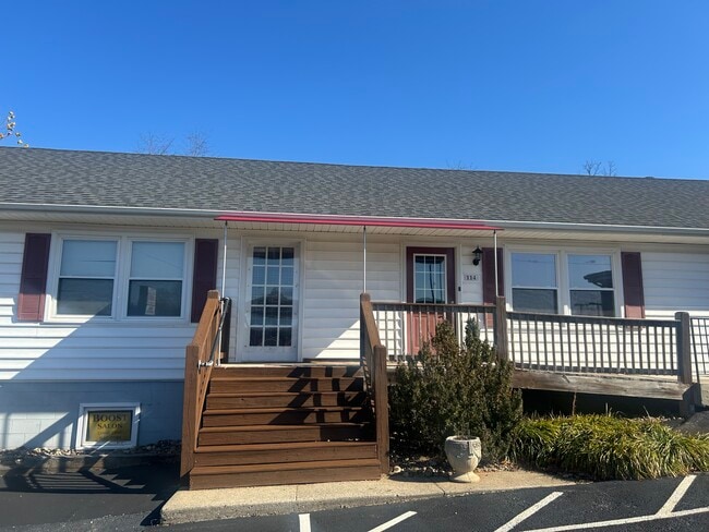
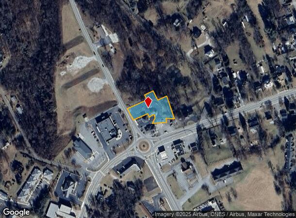
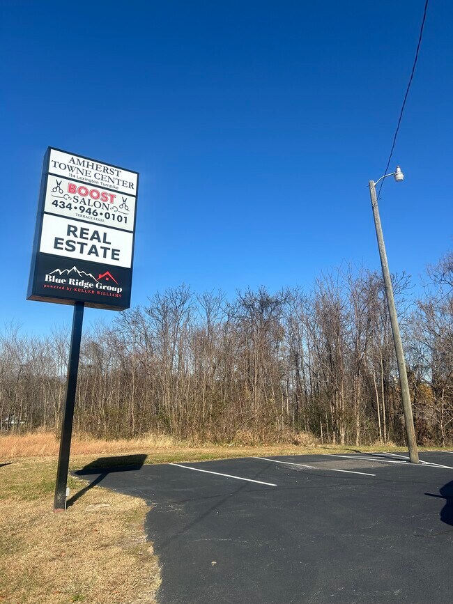
Property Detail
114 Lexington Tpke
Lynchburg, VA
Pla
96A4-A-221
ON RT 60 WEST NEAR CIRCLE LOT 4 SEE DB 1288-490 96A4 A 221
Officebuilding
Amherst
X
Virginia
51009C0283C
4
2024
0.79 AC
2025
Lynchburg
010201
Other Market Areas
1,968 SF
DEMOGRAPHICS near 114 Lexington Tpke
1 Mile
3 Mile
5 Mile
2024 Total Population
1,284
3,731
6,475
2029 Population
1,269
3,729
6,523
Pop Growth 2024-2029
(1.17%)
(0.05%)
+ 0.74%
Average Age
45
42
43
2024 Total Households
515
1,401
2,507
HH Growth 2024-2029
(1.75%)
(0.43%)
+ 0.60%
Median Household Inc
$38,442
$61,524
$65,326
Avg Household Size
2.10
2.20
2.30
2024 Avg HH Vehicles
2.00
2.00
2.00
Median Home Value
$168,468
$197,851
$210,066
Median Year Built
1968
1974
1977
Nearby Places
- Restaurants
- Banks
- Shops
- Fitness
- Groceries
PUBLIC TRANSPORTATION
AIRPORT
Lynchburg Regional/Preston Glenn Field
DRIVE
WALK
Distance
Lynchburg Regional/Preston Glenn Field
30 min
23.5 mi
Freight Ports
Virginia Port Authority - Richmond
DRIVE
WALK
Distance
Virginia Port Authority - Richmond
138 min
100.9 mi
Nearby Properties
Address
Land Use
TOTAL SIZE
Lot Size
Zoning
Address
Land Use
TOTAL SIZE
Lot Size
Zoning
4,356 SF
655.76 AC
A1
Address
Land Use
TOTAL SIZE
Lot Size
Zoning
227,125 SF
43 AC
R2
Address
Land Use
TOTAL SIZE
Lot Size
Zoning
91,320 SF
25.90 AC
P1
Address
Land Use
TOTAL SIZE
Lot Size
Zoning
40,635 SF
1.70 AC
B2
Address
Land Use
TOTAL SIZE
Lot Size
Zoning
313,186 SF
73.50 AC
M1
Address
Land Use
TOTAL SIZE
Lot Size
Zoning
54,324 SF
59.79 AC
P1
Address
Land Use
TOTAL SIZE
Lot Size
Zoning
52,573 SF
12.91 AC
R2
Address
Land Use
TOTAL SIZE
Lot Size
Zoning
100 AC
A1
Address
Land Use
TOTAL SIZE
Lot Size
Zoning
26,652 SF
0.70 AC
B2
Address
Land Use
TOTAL SIZE
Lot Size
Zoning
33,924 SF
3.98 AC
B2
Address
Land Use
TOTAL SIZE
Lot Size
Zoning
14,964 SF
17.98 AC
B2
Address
Land Use
TOTAL SIZE
Lot Size
Zoning
82,933 SF
19.45 AC
M1
Address
Land Use
TOTAL SIZE
Lot Size
Zoning
47.16 AC
E1
Address
Land Use
TOTAL SIZE
Lot Size
Zoning
30,800 SF
5.06 AC
B2
Address
Land Use
TOTAL SIZE
Lot Size
Zoning
21,560 SF
10.18 AC
R3
Address
Land Use
TOTAL SIZE
Lot Size
Zoning
3,080 SF
5.01 AC
R3
Address
Land Use
TOTAL SIZE
Lot Size
Zoning
2,304 SF
3.24 AC
B2R3
Address
Land Use
TOTAL SIZE
Lot Size
Zoning
15,676 SF
0.52 AC
A1
Address
Land Use
TOTAL SIZE
Lot Size
Zoning
18,734 SF
5 AC
E1
Address
Land Use
TOTAL SIZE
Lot Size
Zoning
74,578 SF
16.91 AC
M1
Address
Land Use
TOTAL SIZE
Lot Size
Zoning
11,068 SF
8.53 AC
B2
Address
Land Use
TOTAL SIZE
Lot Size
Zoning
5,908 SF
0.52 AC
A1
Address
Land Use
TOTAL SIZE
Lot Size
Zoning
11,504 SF
0.52 AC
A1
Address
Land Use
TOTAL SIZE
Lot Size
Zoning
11,027 SF
1.30 AC
CBD
Address
Land Use
TOTAL SIZE
Lot Size
Zoning
7,660 SF
1.69 AC
CBD
Address
Land Use
TOTAL SIZE
Lot Size
Zoning
9,496 SF
1.68 AC
T1
Address
Land Use
TOTAL SIZE
Lot Size
Zoning
6,698 SF
0.42 AC
B2
Address
Land Use
TOTAL SIZE
Lot Size
Zoning
9,008 SF
0.25 AC
B2
Address
Land Use
TOTAL SIZE
Lot Size
Zoning
17,397 SF
1.46 AC
R3T1
The World's #1 Commercial Real Estate Marketplace
Connect with us
© 2025 CoStar Group
The information above has been obtained from sources believed reliable. While we do not doubt its accuracy we have not verified it and make no guarantee, warranty or representation about it. It is your responsibility to independently confirm its accuracy and completeness. Any projections, opinions, assumptions, or estimates used are for example only and do not represent the current or future performance of the property. The value of this transaction to you depends on tax and other factors which should be evaluated by your tax, financial, and legal advisors. You and your advisors should conduct a careful, independent investigation of the property to determine to your satisfaction the suitability of the property for your needs.