Property Record
114 N Main St, Mullica Hill, NJ 08062

NEARBY LISTINGS FOR SALE OR LEASE
-
-
View all Mullica Hill listings for sale on LoopNet.com
Property Detail
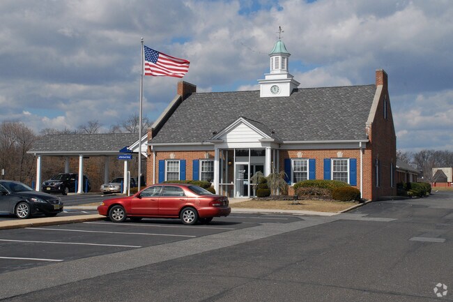
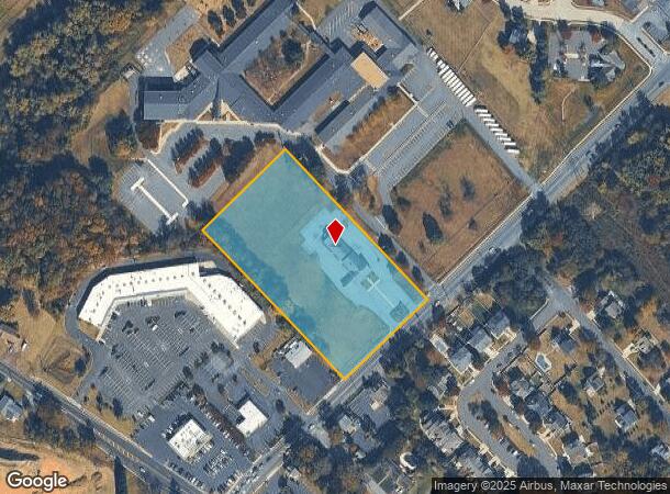
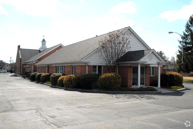
114 N Main St
08-00045-0000-00014-01
ADDITIONAL LOTS: SUSQUEHANNA BANK
Financialbuilding
Gloucester
X
New Jersey
34015C0176E
14.1
2024
4.36 AC
2025
Gloucester County
502001
Philadelphia
7,604 SF
Philadelphia-Camden-Wilmington, PA-NJ-DE-MD
DEMOGRAPHICS near 114 N Main St
1 Mile
3 Mile
5 Mile
2024 Total Population
3,743
17,362
57,664
2029 Population
3,840
17,824
59,488
Pop Growth 2024-2029
+ 2.59%
+ 2.66%
+ 3.16%
Average Age
39
39
40
2024 Total Households
1,236
5,652
20,536
HH Growth 2024-2029
+ 2.67%
+ 2.71%
+ 3.28%
Median Household Inc
$137,500
$147,155
$117,028
Avg Household Size
3.00
3.00
2.80
2024 Avg HH Vehicles
2.00
2.00
2.00
Median Home Value
$407,630
$437,611
$356,436
Median Year Built
1993
1994
1988
Nearby Places
Map Layers
Map Styles
 Street
 Aerial
- Restaurants
- Banks
- Shops
- Fitness
- Groceries
PUBLIC TRANSPORTATION
AIRPORT
Philadelphia International
DRIVE
WALK
Distance
Philadelphia International
35 min
20.9 mi
Freight Ports
Broadway Terminal - Pier 5
DRIVE
WALK
Distance
Broadway Terminal - Pier 5
24 min
15.6 mi
SALE & LEASE HISTORY
LISTING DATE
SALE/LEASE

Mar 28, 2019
For Sale
Apr 10, 2018
For Sale
Nearby Properties
Address
Land Use
TOTAL SIZE
Lot Size
Zoning
Address
Land Use
TOTAL SIZE
Lot Size
Zoning
80.26 AC
INS
Address
Land Use
TOTAL SIZE
Lot Size
Zoning
13.76 AC
INS
Address
Land Use
TOTAL SIZE
Lot Size
Zoning
14.14 AC
R11
Address
Land Use
TOTAL SIZE
Lot Size
Zoning
24.79 AC
R1
Address
Land Use
TOTAL SIZE
Lot Size
Zoning
5,893 SF
12.79 AC
INSH
Address
Land Use
TOTAL SIZE
Lot Size
Zoning
7.85 AC
R12
Address
Land Use
TOTAL SIZE
Lot Size
Zoning
13.20 AC
INS
Address
Land Use
TOTAL SIZE
Lot Size
Zoning
3.79 AC
PRC
Address
Land Use
TOTAL SIZE
Lot Size
Zoning
5.15 AC
C1
Address
Land Use
TOTAL SIZE
Lot Size
Zoning
3.90 AC
INS
Address
Land Use
TOTAL SIZE
Lot Size
Zoning
19.15 AC
INS
Address
Land Use
TOTAL SIZE
Lot Size
Zoning
23.26 AC
LI
Address
Land Use
TOTAL SIZE
Lot Size
Zoning
Address
Land Use
TOTAL SIZE
Lot Size
Zoning
5 AC
AR
Address
Land Use
TOTAL SIZE
Lot Size
Zoning
8 AC
C2
Address
Land Use
TOTAL SIZE
Lot Size
Zoning
4.73 AC
R1
Address
Land Use
TOTAL SIZE
Lot Size
Zoning
5.41 AC
LI
Address
Land Use
TOTAL SIZE
Lot Size
Zoning
2,984 SF
5.27 AC
R1
Address
Land Use
TOTAL SIZE
Lot Size
Zoning
9.59 AC
INS
Address
Land Use
TOTAL SIZE
Lot Size
Zoning
5.39 AC
C2
Address
Land Use
TOTAL SIZE
Lot Size
Zoning
6.66 AC
LI
Address
Land Use
TOTAL SIZE
Lot Size
Zoning
0.57 AC
C2
Address
Land Use
TOTAL SIZE
Lot Size
Zoning
3.70 AC
LI
Address
Land Use
TOTAL SIZE
Lot Size
Zoning
3.34 AC
LI
Address
Land Use
TOTAL SIZE
Lot Size
Zoning
15.76 AC
LI
Address
Land Use
TOTAL SIZE
Lot Size
Zoning
5.40 AC
PRC
Address
Land Use
TOTAL SIZE
Lot Size
Zoning
7.02 AC
C55
Address
Land Use
TOTAL SIZE
Lot Size
Zoning
10,112 SF
1.13 AC
C2
Address
Land Use
TOTAL SIZE
Lot Size
Zoning
12,040 SF
3.01 AC
Address
Land Use
TOTAL SIZE
Lot Size
Zoning
10,617 SF
17.22 AC
R1
The World's #1 Commercial Real Estate Marketplace
Connect with us
© 2025 CoStar Group
The information above has been obtained from sources believed reliable. While we do not doubt its accuracy we have not verified it and make no guarantee, warranty or representation about it. It is your responsibility to independently confirm its accuracy and completeness. Any projections, opinions, assumptions, or estimates used are for example only and do not represent the current or future performance of the property. The value of this transaction to you depends on tax and other factors which should be evaluated by your tax, financial, and legal advisors. You and your advisors should conduct a careful, independent investigation of the property to determine to your satisfaction the suitability of the property for your needs.