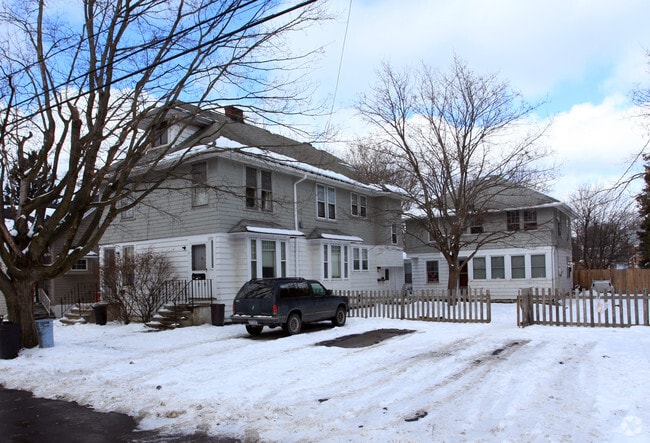
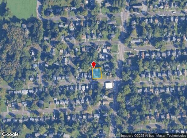
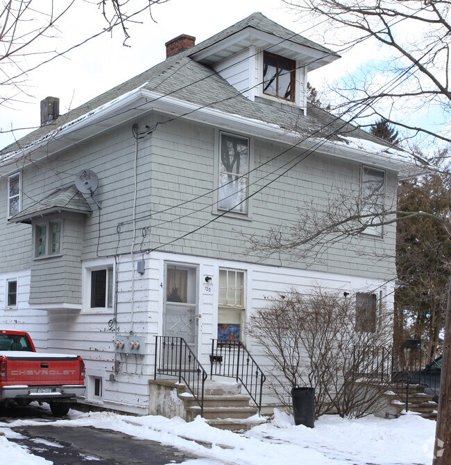
Property Record
114 Rosemont Dr, Syracuse, NY 13205
NEARBY LISTINGS FOR SALE OR LEASE
Property Detail
114 Rosemont Dr
311500-067-000-0017-010-000-0000
Onondaga
Apartment
New York
X
10.000
36067C0332F
0.18 AC
2025
Valley
2024
Syracuse
006103
Syracuse, NY
2,389 SF
DEMOGRAPHICS near 114 Rosemont Dr
1 Mile
3 Mile
5 Mile
2024 Total Population
8,737
56,051
153,335
2029 Population
8,550
55,153
150,294
Pop Growth 2024-2029
(2.14%)
(1.60%)
(1.98%)
Average Age
41
38
38
2024 Total Households
3,893
20,793
60,669
HH Growth 2024-2029
(2.29%)
(1.73%)
(1.98%)
Median Household Inc
$48,567
$47,660
$47,197
Avg Household Size
2.10
2.30
2.20
2024 Avg HH Vehicles
1.00
1.00
1.00
Median Home Value
$109,326
$140,265
$160,353
Median Year Built
1957
1955
1954
Nearby Places
- Restaurants
- Banks
- Shops
- Fitness
- Groceries
PUBLIC TRANSPORTATION
COMMUTER RAIL
DRIVE
WALK
Distance
13 min
6.6 mi
DRIVE
WALK
Distance
13 min
6.6 mi
AIRPORT
Syracuse Hancock International
DRIVE
WALK
Distance
Syracuse Hancock International
20 min
11.3 mi
Nearby Properties
Address
Land Use
TOTAL SIZE
Lot Size
Zoning
Address
Land Use
TOTAL SIZE
Lot Size
Zoning
70,284 SF
74.57 AC
25
Address
Land Use
TOTAL SIZE
Lot Size
Zoning
12.08 AC
Address
Land Use
TOTAL SIZE
Lot Size
Zoning
412,577 SF
39.43 AC
08 - GOVER
Address
Land Use
TOTAL SIZE
Lot Size
Zoning
348,998 SF
65.59 AC
25
Address
Land Use
TOTAL SIZE
Lot Size
Zoning
72,800 SF
1.89 AC
06 - INDUS
Address
Land Use
TOTAL SIZE
Lot Size
Zoning
1.67 AC
06 - INDUS
Address
Land Use
TOTAL SIZE
Lot Size
Zoning
168,000 SF
2.18 AC
06 - INDUS
Address
Land Use
TOTAL SIZE
Lot Size
Zoning
6,400 SF
86.36 AC
06 - INDUS
Address
Land Use
TOTAL SIZE
Lot Size
Zoning
50,472 SF
4.89 AC
10
Address
Land Use
TOTAL SIZE
Lot Size
Zoning
31,947 SF
1.23 AC
Address
Land Use
TOTAL SIZE
Lot Size
Zoning
92,724 SF
2.98 AC
25
Address
Land Use
TOTAL SIZE
Lot Size
Zoning
8,784 SF
52.79 AC
Address
Land Use
TOTAL SIZE
Lot Size
Zoning
7,392 SF
35.06 AC
06 - INDUS
Address
Land Use
TOTAL SIZE
Lot Size
Zoning
233,580 SF
10.73 AC
06 - INDUS
Address
Land Use
TOTAL SIZE
Lot Size
Zoning
6,400 SF
0.26 AC
06 - INDUS
Address
Land Use
TOTAL SIZE
Lot Size
Zoning
290,000 SF
11.44 AC
25
Address
Land Use
TOTAL SIZE
Lot Size
Zoning
83,640 SF
3.02 AC
06 - INDUS
Address
Land Use
TOTAL SIZE
Lot Size
Zoning
248,704 SF
0.17 AC
01 - NOT Z
Address
Land Use
TOTAL SIZE
Lot Size
Zoning
176,250 SF
5.86 AC
25
Address
Land Use
TOTAL SIZE
Lot Size
Zoning
11,928 SF
12.30 AC
06 - INDUS
Address
Land Use
TOTAL SIZE
Lot Size
Zoning
79,676 SF
6.36 AC
06 - INDUS
Address
Land Use
TOTAL SIZE
Lot Size
Zoning
93,020 SF
5.97 AC
06 - INDUS
Address
Land Use
TOTAL SIZE
Lot Size
Zoning
121,158 SF
0.74 AC
01 - NOT Z
Address
Land Use
TOTAL SIZE
Lot Size
Zoning
194,000 SF
9.61 AC
20
Address
Land Use
TOTAL SIZE
Lot Size
Zoning
5,643 SF
0.38 AC
06 - INDUS
Address
Land Use
TOTAL SIZE
Lot Size
Zoning
96,000 SF
0.87 AC
05 - COMME
Address
Land Use
TOTAL SIZE
Lot Size
Zoning
108,000 SF
3.15 AC
01 - NOT Z
Address
Land Use
TOTAL SIZE
Lot Size
Zoning
209,598 SF
8.07 AC
06 - INDUS
Address
Land Use
TOTAL SIZE
Lot Size
Zoning
209,598 SF
4.22 AC
06 - INDUS
Address
Land Use
TOTAL SIZE
Lot Size
Zoning
209,598 SF
8.62 AC
06 - INDUS
The World's #1 Commercial Real Estate Marketplace
Connect with us
© 2025 CoStar Group
The information above has been obtained from sources believed reliable. While we do not doubt its accuracy we have not verified it and make no guarantee, warranty or representation about it. It is your responsibility to independently confirm its accuracy and completeness. Any projections, opinions, assumptions, or estimates used are for example only and do not represent the current or future performance of the property. The value of this transaction to you depends on tax and other factors which should be evaluated by your tax, financial, and legal advisors. You and your advisors should conduct a careful, independent investigation of the property to determine to your satisfaction the suitability of the property for your needs.