Property Record
114 State St, Mazomanie, WI 53560

NEARBY LISTINGS FOR SALE OR LEASE
-
-
View all Mazomanie listings for sale on LoopNet.com
Property Detail
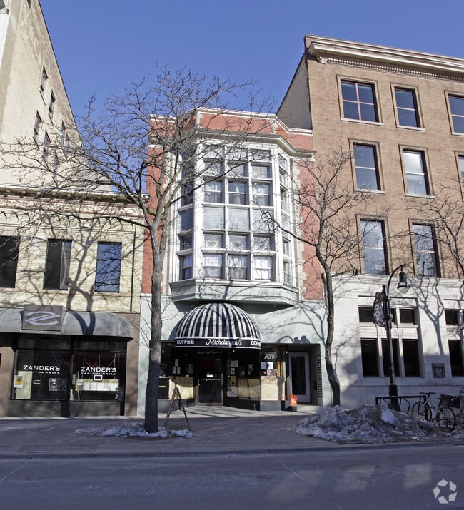
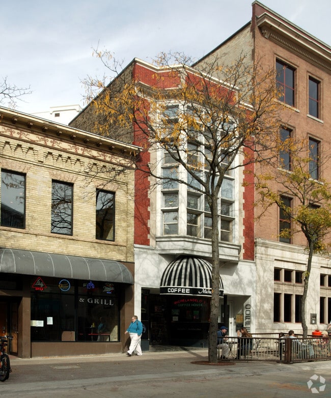
114 State St
Madison, WI
Original Plat, Blk 77, Part Of Lots 2
0709-144-2607-2
ORIGINAL PLAT, BLK 77, PART OF LOTS 2 & 3, DESC AS FOL: BEG ON SW LN OF CARROLL AT A PT WHICH IS 112.4 FT NW FROM INTERS OF SW LN OF CARROLL WITH N LN OF STATE ST, SD PT BEING 101.87 FT FROM PT OF INTERS OF SW LN OF CARROLL WITH THE SE LN O F DAYTON,
Commercialnec
Dane
X
Wisconsin
55025C0409G
2,3
2024
0.06 AC
2024
Central Campus
012501
Milwaukee/Madison
2,400 SF
DEMOGRAPHICS near 114 State St
1 Mile
3 Mile
5 Mile
2024 Total Population
40,770
106,447
206,674
2029 Population
41,562
109,385
213,319
Pop Growth 2024-2029
+ 1.94%
+ 2.76%
+ 3.22%
Average Age
28
33
36
2024 Total Households
17,809
47,483
93,032
HH Growth 2024-2029
+ 2.34%
+ 3.09%
+ 3.45%
Median Household Inc
$33,748
$53,079
$61,417
Avg Household Size
1.80
2.00
2.00
2024 Avg HH Vehicles
1.00
1.00
1.00
Median Home Value
$462,359
$389,792
$322,030
Median Year Built
1982
1966
1969
Nearby Places
Map Layers
Map Styles
 Street
 Aerial
- Restaurants
- Banks
- Shops
- Fitness
- Groceries
PUBLIC TRANSPORTATION
AIRPORT
Dane County Regional/Truax Field
DRIVE
WALK
Distance
Dane County Regional/Truax Field
43 min
27.5 mi
Freight Ports
Port Milwaukee
DRIVE
WALK
Distance
Port Milwaukee
130 min
104.5 mi
Nearby Properties
Address
Land Use
TOTAL SIZE
Lot Size
Zoning
Address
Land Use
TOTAL SIZE
Lot Size
Zoning
26.31 AC
Address
Land Use
TOTAL SIZE
Lot Size
Zoning
16.94 AC
Address
Land Use
TOTAL SIZE
Lot Size
Zoning
8.23 AC
Address
Land Use
TOTAL SIZE
Lot Size
Zoning
5 AC
C-2
Address
Land Use
TOTAL SIZE
Lot Size
Zoning
22.16 AC
Address
Land Use
TOTAL SIZE
Lot Size
Zoning
1.32 AC
Address
Land Use
TOTAL SIZE
Lot Size
Zoning
0.35 AC
Address
Land Use
TOTAL SIZE
Lot Size
Zoning
23 AC
RE-1
Address
Land Use
TOTAL SIZE
Lot Size
Zoning
38.69 AC
Address
Land Use
TOTAL SIZE
Lot Size
Zoning
26.19 AC
RH-4
Address
Land Use
TOTAL SIZE
Lot Size
Zoning
3.20 AC
Address
Land Use
TOTAL SIZE
Lot Size
Zoning
10.63 AC
A-2(8)
Address
Land Use
TOTAL SIZE
Lot Size
Zoning
41.36 AC
A-2
Address
Land Use
TOTAL SIZE
Lot Size
Zoning
57.42 AC
RH-1
Address
Land Use
TOTAL SIZE
Lot Size
Zoning
39.40 AC
R-1A
Address
Land Use
TOTAL SIZE
Lot Size
Zoning
39.10 AC
RH1
Address
Land Use
TOTAL SIZE
Lot Size
Zoning
0.24 AC
Address
Land Use
TOTAL SIZE
Lot Size
Zoning
26.05 AC
RH-4
Address
Land Use
TOTAL SIZE
Lot Size
Zoning
4.74 AC
B-1
Address
Land Use
TOTAL SIZE
Lot Size
Zoning
41.06 AC
A-1 EX
Address
Land Use
TOTAL SIZE
Lot Size
Zoning
34.50 AC
A-1 EX
Address
Land Use
TOTAL SIZE
Lot Size
Zoning
35 AC
A-1 EX
Address
Land Use
TOTAL SIZE
Lot Size
Zoning
11.02 AC
A28
Address
Land Use
TOTAL SIZE
Lot Size
Zoning
Address
Land Use
TOTAL SIZE
Lot Size
Zoning
40.20 AC
A-1 EX
Address
Land Use
TOTAL SIZE
Lot Size
Zoning
31.40 AC
RH-4
Address
Land Use
TOTAL SIZE
Lot Size
Zoning
14.06 AC
RH-3
The World's #1 Commercial Real Estate Marketplace
Connect with us
© 2025 CoStar Group
The information above has been obtained from sources believed reliable. While we do not doubt its accuracy we have not verified it and make no guarantee, warranty or representation about it. It is your responsibility to independently confirm its accuracy and completeness. Any projections, opinions, assumptions, or estimates used are for example only and do not represent the current or future performance of the property. The value of this transaction to you depends on tax and other factors which should be evaluated by your tax, financial, and legal advisors. You and your advisors should conduct a careful, independent investigation of the property to determine to your satisfaction the suitability of the property for your needs.