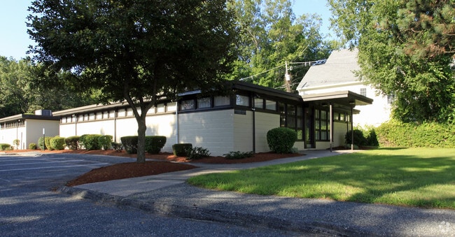
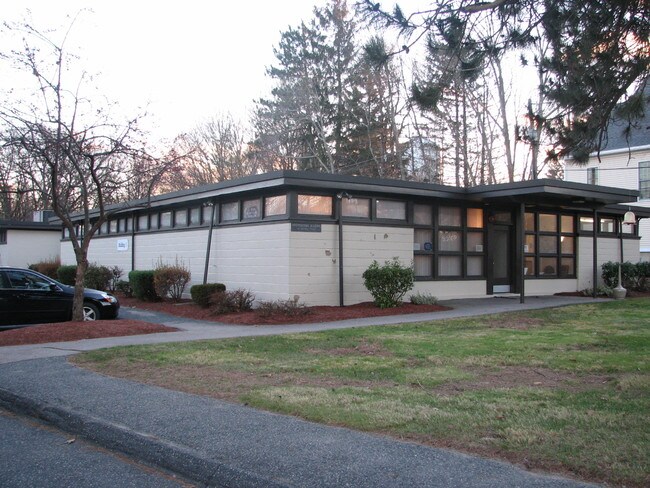
Property Record
114 Water St, Milford, MA 01757

Current Lease Availabilities
NEARBY LISTINGS FOR SALE OR LEASE
Property Detail
114 Water St
MILF-000049-000000-000049
Worcester
Commercialbuilding
Massachusetts
X
49
25027C0868F
6.44 AC
2025
Outlying Worcester
2025
Boston
744400
Worcester, MA-CT
10,032 SF
DEMOGRAPHICS near 114 Water St
1 Mile
3 Mile
5 Mile
2024 Total Population
12,182
37,114
65,651
2029 Population
12,008
36,840
65,303
Pop Growth 2024-2029
(1.43%)
(0.74%)
(0.53%)
Average Age
39
41
41
2024 Total Households
4,627
14,058
24,448
HH Growth 2024-2029
(1.45%)
(0.79%)
(0.58%)
Median Household Inc
$87,080
$97,372
$110,992
Avg Household Size
2.60
2.60
2.60
2024 Avg HH Vehicles
2.00
2.00
2.00
Median Home Value
$381,374
$407,594
$448,137
Median Year Built
1951
1970
1975
Nearby Places
Map Layers
Map Styles
 Street
 Aerial
- Restaurants
- Banks
- Shops
- Fitness
- Groceries
PUBLIC TRANSPORTATION
COMMUTER RAIL
Forge Park/Route 495 (Franklin Line - Massachusetts Bay Transportation Authority Commuter Rail (Purple Line))
DRIVE
WALK
Distance
Forge Park/Route 495 (Franklin Line - Massachusetts Bay Transportation Authority Commuter Rail (Purple Line))
15 min
8.0 mi
AIRPORT
Worcester Regional
DRIVE
WALK
Distance
Worcester Regional
46 min
25.3 mi
Rhode Island Tf Green International
DRIVE
WALK
Distance
Rhode Island Tf Green International
54 min
33.9 mi
General Edward Lawrence Logan International
DRIVE
WALK
Distance
General Edward Lawrence Logan International
59 min
43.0 mi
Freight Ports
Port of Boston
DRIVE
WALK
Distance
Port of Boston
58 min
41.3 mi
Nearby Properties
Address
Land Use
TOTAL SIZE
Lot Size
Zoning
Address
Land Use
TOTAL SIZE
Lot Size
Zoning
16.82 AC
BP
Address
Land Use
TOTAL SIZE
Lot Size
Zoning
204,879 SF
12.44 AC
OR
Address
Land Use
TOTAL SIZE
Lot Size
Zoning
381,306 SF
20 AC
RB
Address
Land Use
TOTAL SIZE
Lot Size
Zoning
616,875 SF
141 AC
LI
Address
Land Use
TOTAL SIZE
Lot Size
Zoning
186,720 SF
13.77 AC
RB
Address
Land Use
TOTAL SIZE
Lot Size
Zoning
24.81 AC
IB
Address
Land Use
TOTAL SIZE
Lot Size
Zoning
27.32 AC
IB
Address
Land Use
TOTAL SIZE
Lot Size
Zoning
67.20 AC
RB
Address
Land Use
TOTAL SIZE
Lot Size
Zoning
347,012 SF
29.23 AC
IB
Address
Land Use
TOTAL SIZE
Lot Size
Zoning
96,433 SF
5.40 AC
RB
Address
Land Use
TOTAL SIZE
Lot Size
Zoning
139,403 SF
21.44 AC
RB
Address
Land Use
TOTAL SIZE
Lot Size
Zoning
16.50 AC
RA
Address
Land Use
TOTAL SIZE
Lot Size
Zoning
7.36 AC
RA
Address
Land Use
TOTAL SIZE
Lot Size
Zoning
19.14 AC
IB
Address
Land Use
TOTAL SIZE
Lot Size
Zoning
106.49 AC
IB
Address
Land Use
TOTAL SIZE
Lot Size
Zoning
21.69 AC
IB
Address
Land Use
TOTAL SIZE
Lot Size
Zoning
14 AC
IB
Address
Land Use
TOTAL SIZE
Lot Size
Zoning
85,200 SF
35.18 AC
IB
Address
Land Use
TOTAL SIZE
Lot Size
Zoning
272,941 SF
34.05 AC
IB
Address
Land Use
TOTAL SIZE
Lot Size
Zoning
66,430 SF
10.19 AC
T
Address
Land Use
TOTAL SIZE
Lot Size
Zoning
135,579 SF
15.97 AC
IB
Address
Land Use
TOTAL SIZE
Lot Size
Zoning
11 AC
IB
Address
Land Use
TOTAL SIZE
Lot Size
Zoning
27.79 AC
IB
Address
Land Use
TOTAL SIZE
Lot Size
Zoning
4.17 AC
RB
Address
Land Use
TOTAL SIZE
Lot Size
Zoning
14.75 AC
IB
Address
Land Use
TOTAL SIZE
Lot Size
Zoning
7.80 AC
IB
Address
Land Use
TOTAL SIZE
Lot Size
Zoning
14.83 AC
CC
Address
Land Use
TOTAL SIZE
Lot Size
Zoning
142,594 SF
13.74 AC
IB
Address
Land Use
TOTAL SIZE
Lot Size
Zoning
69,139 SF
4.57 AC
CB
Address
Land Use
TOTAL SIZE
Lot Size
Zoning
167,299 SF
9.07 AC
IB
The World's #1 Commercial Real Estate Marketplace
Connect with us
© 2026 CoStar Group
The information above has been obtained from sources believed reliable. While we do not doubt its accuracy we have not verified it and make no guarantee, warranty or representation about it. It is your responsibility to independently confirm its accuracy and completeness. Any projections, opinions, assumptions, or estimates used are for example only and do not represent the current or future performance of the property. The value of this transaction to you depends on tax and other factors which should be evaluated by your tax, financial, and legal advisors. You and your advisors should conduct a careful, independent investigation of the property to determine to your satisfaction the suitability of the property for your needs.