Property Record
11402 Nw 41St St, Doral, FL 33178


NEARBY LISTINGS FOR SALE OR LEASE
Property Detail
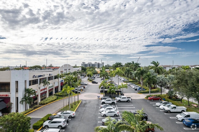
11402 Nw 41St St
Miami-Miami Beach-Kendall, FL
Miami Intl Business Park
35-3030-030-0010
MIAMI INTL BUSINESS PARK SEC 1 PB 151-8 T-19865 LOT 1 BLK 1 LOT SIZE 255328 SQ FT FAU 30-3030-001-0010-0011-0012 & 0060 OR 17907-3276 1297 1 F/A/U 30-3030-030-0010
Regionalshoppingcenterormallwithanchorstore
Miami/Dade
X
Florida
12086C0267L
1
2024
5.86 AC
2025
Miami Airport
009010
South Florida
126,793 SF
DEMOGRAPHICS near 11402 Nw 41St St
1 Mile
3 Mile
5 Mile
2024 Total Population
12,016
95,097
245,716
2029 Population
11,726
93,302
241,220
Pop Growth 2024-2029
(2.41%)
(1.89%)
(1.83%)
Average Age
37
39
41
2024 Total Households
3,854
29,935
79,951
HH Growth 2024-2029
(2.62%)
(2.28%)
(2.20%)
Median Household Inc
$73,560
$72,775
$63,640
Avg Household Size
3.00
3.10
2.90
2024 Avg HH Vehicles
2.00
2.00
2.00
Median Home Value
$432,163
$409,200
$365,715
Median Year Built
2000
1998
1988
Nearby Places
Map Layers
Map Styles
 Street
 Aerial
- Restaurants
- Banks
- Shops
- Fitness
- Groceries
PUBLIC TRANSPORTATION
COMMUTER RAIL
Palmetto (Metrorail Green Line - Miami-Dade Transit (Metrorail/Metromover))
DRIVE
WALK
Distance
Palmetto (Metrorail Green Line - Miami-Dade Transit (Metrorail/Metromover))
12 min
6.1 mi
Okeechobee (Metrorail Green Line - Miami-Dade Transit (Metrorail/Metromover))
DRIVE
WALK
Distance
Okeechobee (Metrorail Green Line - Miami-Dade Transit (Metrorail/Metromover))
15 min
8.0 mi
AIRPORT
Miami International
DRIVE
WALK
Distance
Miami International
16 min
7.1 mi
Fort Lauderdale/Hollywood International
DRIVE
WALK
Distance
Fort Lauderdale/Hollywood International
39 min
29.7 mi
Freight Ports
Port of Miami
DRIVE
WALK
Distance
Port of Miami
28 min
17.0 mi
SALE & LEASE HISTORY
LISTING DATE
SALE/LEASE

Mar 29, 2021
For Lease
Jul 19, 2017
For Lease
Aug 15, 2018
For Lease
Apr 28, 2021
For Sale
Nearby Properties
Address
Land Use
TOTAL SIZE
Lot Size
Zoning
Address
Land Use
TOTAL SIZE
Lot Size
Zoning
2,512,642 SF
100.78 AC
6400
Address
Land Use
TOTAL SIZE
Lot Size
Zoning
1,071,874 SF
6.73 AC
4802
Address
Land Use
TOTAL SIZE
Lot Size
Zoning
312,996 SF
157.16 AC
8900
Address
Land Use
TOTAL SIZE
Lot Size
Zoning
851,502 SF
11.73 AC
6119
Address
Land Use
TOTAL SIZE
Lot Size
Zoning
777,714 SF
7.59 AC
9450
Address
Land Use
TOTAL SIZE
Lot Size
Zoning
585,943 SF
22.41 AC
3800
Address
Land Use
TOTAL SIZE
Lot Size
Zoning
475,423 SF
14.56 AC
9450
Address
Land Use
TOTAL SIZE
Lot Size
Zoning
929,765 SF
453.69 AC
6119
Address
Land Use
TOTAL SIZE
Lot Size
Zoning
899,162 SF
9.89 AC
7700
Address
Land Use
TOTAL SIZE
Lot Size
Zoning
448,531 SF
37 AC
6400
Address
Land Use
TOTAL SIZE
Lot Size
Zoning
540,427 SF
26.86 AC
3700
Address
Land Use
TOTAL SIZE
Lot Size
Zoning
498,676 SF
25.96 AC
9450
Address
Land Use
TOTAL SIZE
Lot Size
Zoning
145.77 AC
7700
Address
Land Use
TOTAL SIZE
Lot Size
Zoning
687,804 SF
3.84 AC
9450
Address
Land Use
TOTAL SIZE
Lot Size
Zoning
755,156 SF
29.44 AC
7100
Address
Land Use
TOTAL SIZE
Lot Size
Zoning
359,107 SF
9.58 AC
9450
Address
Land Use
TOTAL SIZE
Lot Size
Zoning
428,212 SF
17.56 AC
3900
Address
Land Use
TOTAL SIZE
Lot Size
Zoning
468,218 SF
17.06 AC
7100
Address
Land Use
TOTAL SIZE
Lot Size
Zoning
468,411 SF
21.36 AC
7100
Address
Land Use
TOTAL SIZE
Lot Size
Zoning
344,101 SF
0.74 AC
6119
Address
Land Use
TOTAL SIZE
Lot Size
Zoning
533,605 SF
10.86 AC
9450
Address
Land Use
TOTAL SIZE
Lot Size
Zoning
255,793 SF
17.14 AC
8000
Address
Land Use
TOTAL SIZE
Lot Size
Zoning
527,157 SF
4.15 AC
6119
Address
Land Use
TOTAL SIZE
Lot Size
Zoning
206,535 SF
7100
Address
Land Use
TOTAL SIZE
Lot Size
Zoning
298,603 SF
24.12 AC
7100
Address
Land Use
TOTAL SIZE
Lot Size
Zoning
355,631 SF
2.02 AC
6119
Address
Land Use
TOTAL SIZE
Lot Size
Zoning
318,775 SF
18.88 AC
3700
Address
Land Use
TOTAL SIZE
Lot Size
Zoning
1,182,342 SF
14.60 AC
7100
Address
Land Use
TOTAL SIZE
Lot Size
Zoning
388,143 SF
1.60 AC
6119
The World's #1 Commercial Real Estate Marketplace
Connect with us
© 2026 CoStar Group
The information above has been obtained from sources believed reliable. While we do not doubt its accuracy we have not verified it and make no guarantee, warranty or representation about it. It is your responsibility to independently confirm its accuracy and completeness. Any projections, opinions, assumptions, or estimates used are for example only and do not represent the current or future performance of the property. The value of this transaction to you depends on tax and other factors which should be evaluated by your tax, financial, and legal advisors. You and your advisors should conduct a careful, independent investigation of the property to determine to your satisfaction the suitability of the property for your needs.