Property Record
11415 W 61 St S, Sand Springs, OK 74063

NEARBY LISTINGS FOR SALE OR LEASE
-
-
View all Sand Springs listings for sale on LoopNet.com
Property Detail
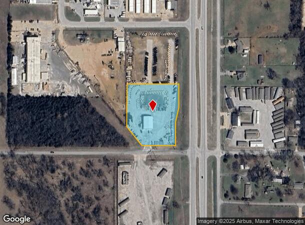
11415 W 61 St S
Tulsa, OK
Prattville Industrial Park South
55381-91-34-60410
LT 1 BLK 1
Autorepair
Tulsa
X
Oklahoma
40143C0328K
1
2025
3.01 AC
2025
West
009401
Tulsa
4,800 SF
DEMOGRAPHICS near 11415 W 61 St S
1 Mile
3 Mile
5 Mile
2024 Total Population
2,457
15,304
38,187
2029 Population
2,549
15,809
39,712
Pop Growth 2024-2029
+ 3.74%
+ 3.30%
+ 3.99%
Average Age
41
41
41
2024 Total Households
952
5,863
14,876
HH Growth 2024-2029
+ 3.78%
+ 3.31%
+ 4.06%
Median Household Inc
$73,346
$70,006
$61,745
Avg Household Size
2.50
2.60
2.50
2024 Avg HH Vehicles
2.00
2.00
2.00
Median Home Value
$176,046
$173,244
$167,202
Median Year Built
2001
1983
1979
Nearby Places
Map Layers
Map Styles
 Street
 Aerial
- Restaurants
- Banks
- Shops
- Fitness
- Groceries
PUBLIC TRANSPORTATION
AIRPORT
Tulsa International
DRIVE
WALK
Distance
Tulsa International
29 min
20.3 mi
Freight Ports
Tulsa Port Of Catoosa
DRIVE
WALK
Distance
Tulsa Port Of Catoosa
39 min
29.5 mi
SALE & LEASE HISTORY
LISTING DATE
SALE/LEASE

Sep 25, 2016
For Lease
Oct 29, 2019
For Sale
Nearby Properties
Address
Land Use
TOTAL SIZE
Lot Size
Zoning
Address
Land Use
TOTAL SIZE
Lot Size
Zoning
45,095 SF
46.36 AC
AG
Address
Land Use
TOTAL SIZE
Lot Size
Zoning
45,125 SF
7.05 AC
RM1
Address
Land Use
TOTAL SIZE
Lot Size
Zoning
41,456 SF
2.39 AC
RS2
Address
Land Use
TOTAL SIZE
Lot Size
Zoning
33,195 SF
2.60 AC
RS2
Address
Land Use
TOTAL SIZE
Lot Size
Zoning
22,350 SF
14.91 AC
AG
Address
Land Use
TOTAL SIZE
Lot Size
Zoning
16,456 SF
5.67 AC
RE
Address
Land Use
TOTAL SIZE
Lot Size
Zoning
12,306 SF
2.10 AC
AG
Address
Land Use
TOTAL SIZE
Lot Size
Zoning
21,694 SF
3.99 AC
AG
Address
Land Use
TOTAL SIZE
Lot Size
Zoning
8,784 SF
7.93 AC
CG
Address
Land Use
TOTAL SIZE
Lot Size
Zoning
21,349 SF
2.10 AC
RS2
Address
Land Use
TOTAL SIZE
Lot Size
Zoning
4,200 SF
1.73 AC
RE
Address
Land Use
TOTAL SIZE
Lot Size
Zoning
9,060 SF
2.05 AC
CS
Address
Land Use
TOTAL SIZE
Lot Size
Zoning
13,964 SF
3 AC
RS1
Address
Land Use
TOTAL SIZE
Lot Size
Zoning
8,400 SF
8.86 AC
RE
Address
Land Use
TOTAL SIZE
Lot Size
Zoning
20,625 SF
13.39 AC
TM
Address
Land Use
TOTAL SIZE
Lot Size
Zoning
13,953 SF
3.74 AC
RE
Address
Land Use
TOTAL SIZE
Lot Size
Zoning
11,682 SF
2.07 AC
AG
Address
Land Use
TOTAL SIZE
Lot Size
Zoning
7,266 SF
5 AC
RS3
Address
Land Use
TOTAL SIZE
Lot Size
Zoning
89,421 SF
6.14 AC
CS
Address
Land Use
TOTAL SIZE
Lot Size
Zoning
9,600 SF
3.02 AC
Address
Land Use
TOTAL SIZE
Lot Size
Zoning
35,824 SF
3.04 AC
RM1
Address
Land Use
TOTAL SIZE
Lot Size
Zoning
13,017 SF
2.35 AC
RE
Address
Land Use
TOTAL SIZE
Lot Size
Zoning
51,981 SF
4.87 AC
CS
Address
Land Use
TOTAL SIZE
Lot Size
Zoning
5,853 SF
0.91 AC
RS2
Address
Land Use
TOTAL SIZE
Lot Size
Zoning
50,880 SF
4.08 AC
RS2
Address
Land Use
TOTAL SIZE
Lot Size
Zoning
12,428 SF
2.44 AC
RS1
Address
Land Use
TOTAL SIZE
Lot Size
Zoning
4,324 SF
1.99 AC
CS
Address
Land Use
TOTAL SIZE
Lot Size
Zoning
71,287 SF
4.60 AC
CS
Address
Land Use
TOTAL SIZE
Lot Size
Zoning
5,770 SF
1.18 AC
CG
Address
Land Use
TOTAL SIZE
Lot Size
Zoning
25,675 SF
18.15 AC
The World's #1 Commercial Real Estate Marketplace
Connect with us
© 2025 CoStar Group
The information above has been obtained from sources believed reliable. While we do not doubt its accuracy we have not verified it and make no guarantee, warranty or representation about it. It is your responsibility to independently confirm its accuracy and completeness. Any projections, opinions, assumptions, or estimates used are for example only and do not represent the current or future performance of the property. The value of this transaction to you depends on tax and other factors which should be evaluated by your tax, financial, and legal advisors. You and your advisors should conduct a careful, independent investigation of the property to determine to your satisfaction the suitability of the property for your needs.