Property Record
11422 E Northridge St, Mesa, AZ 85207
NEARBY LISTINGS FOR SALE OR LEASE
Property Detail
11422 E Northridge St
Phoenix-Mesa-Chandler, AZ
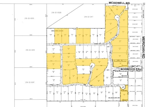
Tonto Forest Estates
219-32-013
TONTO FOREST ESTATES MCR 620-01
Residentialacreage
Maricopa
X
Arizona
04021C0004F
9
2025
1.02 AC
2025
Mesa East
420110
Phoenix
DEMOGRAPHICS near 11422 E Northridge St
1 Mile
3 Mile
5 Mile
2024 Total Population
854
14,310
87,246
2029 Population
1,024
16,673
100,021
Pop Growth 2024-2029
+ 19.91%
+ 16.51%
+ 14.64%
Average Age
47
45
44
2024 Total Households
334
5,627
34,881
HH Growth 2024-2029
+ 20.36%
+ 17.24%
+ 15.05%
Median Household Inc
$101,736
$71,447
$64,214
Avg Household Size
2.50
2.50
2.40
2024 Avg HH Vehicles
3.00
2.00
2.00
Median Home Value
$477,868
$402,876
$293,746
Median Year Built
1989
1994
1994
Nearby Places
Map Layers
Map Styles
 Street
 Aerial
- Restaurants
- Banks
- Shops
- Fitness
- Groceries
PUBLIC TRANSPORTATION
AIRPORT
Phoenix-Mesa Gateway
DRIVE
WALK
Distance
Phoenix-Mesa Gateway
29 min
17.5 mi
Phoenix Sky Harbor International
DRIVE
WALK
Distance
Phoenix Sky Harbor International
43 min
29.6 mi
Freight Ports
Port of San Diego
DRIVE
WALK
Distance
Port of San Diego
434 min
390.0 mi
Nearby Properties
Address
Land Use
TOTAL SIZE
Lot Size
Zoning
Address
Land Use
TOTAL SIZE
Lot Size
Zoning
244,351 SF
18.46 AC
RS43
Address
Land Use
TOTAL SIZE
Lot Size
Zoning
52,500 SF
16.04 AC
PF
Address
Land Use
TOTAL SIZE
Lot Size
Zoning
63,601 SF
12.81 AC
R-43
Address
Land Use
TOTAL SIZE
Lot Size
Zoning
4,527 SF
8.22 AC
UNDESIGNAT
Address
Land Use
TOTAL SIZE
Lot Size
Zoning
3,900 SF
623.74 AC
R-70
Address
Land Use
TOTAL SIZE
Lot Size
Zoning
33,565 SF
6.30 AC
R-35
Address
Land Use
TOTAL SIZE
Lot Size
Zoning
110 SF
8.99 AC
UNDESIGNAT
Address
Land Use
TOTAL SIZE
Lot Size
Zoning
144 SF
8.77 AC
UNDESIGNAT
Address
Land Use
TOTAL SIZE
Lot Size
Zoning
472.61 AC
R-70
Address
Land Use
TOTAL SIZE
Lot Size
Zoning
134 SF
10.21 AC
UNDESIGNAT
Address
Land Use
TOTAL SIZE
Lot Size
Zoning
100 SF
10 AC
UNDESIGNAT
Address
Land Use
TOTAL SIZE
Lot Size
Zoning
57.29 AC
PS
Address
Land Use
TOTAL SIZE
Lot Size
Zoning
22,395 SF
5.63 AC
RS35
Address
Land Use
TOTAL SIZE
Lot Size
Zoning
324.16 AC
RU-43
Address
Land Use
TOTAL SIZE
Lot Size
Zoning
10 SF
40 AC
R-190
Address
Land Use
TOTAL SIZE
Lot Size
Zoning
Address
Land Use
TOTAL SIZE
Lot Size
Zoning
25,691 SF
6.89 AC
R-43
Address
Land Use
TOTAL SIZE
Lot Size
Zoning
21,430 SF
1.13 AC
UNDESIGNAT
Address
Land Use
TOTAL SIZE
Lot Size
Zoning
320 AC
R-43
Address
Land Use
TOTAL SIZE
Lot Size
Zoning
Address
Land Use
TOTAL SIZE
Lot Size
Zoning
197.92 AC
R-70
Address
Land Use
TOTAL SIZE
Lot Size
Zoning
13,066 SF
0.89 AC
UNDESIGNAT
Address
Land Use
TOTAL SIZE
Lot Size
Zoning
4.14 AC
R-43
Address
Land Use
TOTAL SIZE
Lot Size
Zoning
Address
Land Use
TOTAL SIZE
Lot Size
Zoning
3.79 AC
UNDESIGNAT
Address
Land Use
TOTAL SIZE
Lot Size
Zoning
2,280 SF
0.29 AC
Address
Land Use
TOTAL SIZE
Lot Size
Zoning
Address
Land Use
TOTAL SIZE
Lot Size
Zoning
2.50 AC
GR
Address
Land Use
TOTAL SIZE
Lot Size
Zoning
9,920 SF
0.71 AC
UNDESIGNAT
Address
Land Use
TOTAL SIZE
Lot Size
Zoning
The World's #1 Commercial Real Estate Marketplace
Connect with us
© 2026 CoStar Group
The information above has been obtained from sources believed reliable. While we do not doubt its accuracy we have not verified it and make no guarantee, warranty or representation about it. It is your responsibility to independently confirm its accuracy and completeness. Any projections, opinions, assumptions, or estimates used are for example only and do not represent the current or future performance of the property. The value of this transaction to you depends on tax and other factors which should be evaluated by your tax, financial, and legal advisors. You and your advisors should conduct a careful, independent investigation of the property to determine to your satisfaction the suitability of the property for your needs.