Property Record
11440 8Th St Ne, Hanover, MN 55341
NEARBY LISTINGS FOR SALE OR LEASE
-
-
View all Hanover listings for sale on LoopNet.com
Property Detail
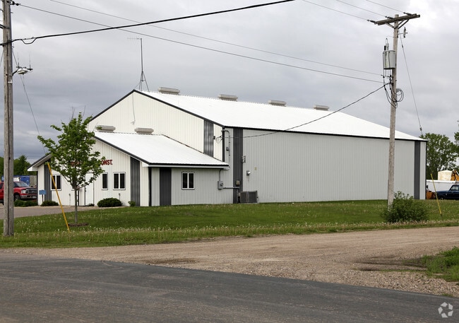
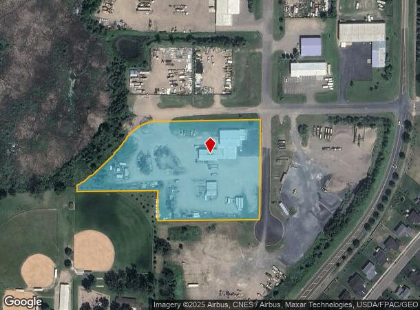
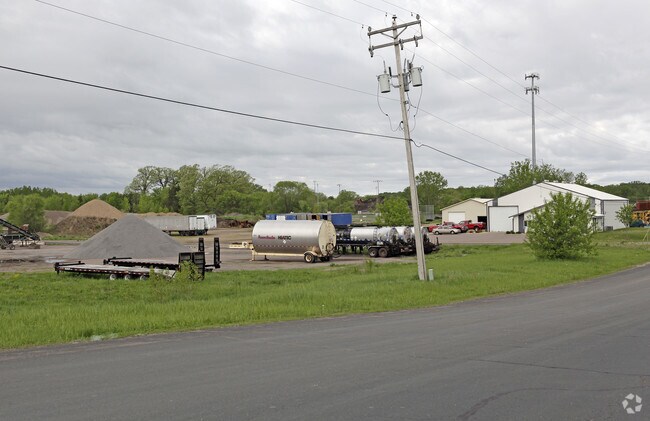
11440 8Th St Ne
108-500-362403
Unplatted Land Hanover
Warehouse
SECT-36 TWP-120 RANGE-024 UNPLATTED LAND HANOVER TH PRT OF SE1/4 OF NW1/4 DES BEG NW COR OF S 995FT TH E ALG N LN OF SD S995F
AE
Wright
27053C0016F
Minnesota
2025
5 AC
2025
Wright County
100805
Minneapolis/St Paul
4,800 SF
Minneapolis-St. Paul-Bloomington, MN-WI
DEMOGRAPHICS near 11440 8Th St Ne
1 Mile
3 Mile
5 Mile
2024 Total Population
2,985
11,807
34,872
2029 Population
3,331
12,998
37,873
Pop Growth 2024-2029
+ 11.59%
+ 10.09%
+ 8.61%
Average Age
37
38
37
2024 Total Households
993
3,907
11,549
HH Growth 2024-2029
+ 11.48%
+ 9.98%
+ 8.59%
Median Household Inc
$132,132
$129,922
$124,278
Avg Household Size
3.00
3.00
3.00
2024 Avg HH Vehicles
2.00
2.00
2.00
Median Home Value
$341,744
$360,782
$346,883
Median Year Built
2004
2000
1999
Nearby Places
Map Layers
Map Styles
 Street
 Aerial
- Restaurants
- Banks
- Shops
- Fitness
- Groceries
PUBLIC TRANSPORTATION
AIRPORT
Minneapolis-St Paul International/Wold-Chamberlain
DRIVE
WALK
Distance
Minneapolis-St Paul International/Wold-Chamberlain
62 min
42.1 mi
Freight Ports
Port Milwaukee
DRIVE
WALK
Distance
Port Milwaukee
414 min
367.2 mi
Nearby Properties
Address
Land Use
TOTAL SIZE
Lot Size
Zoning
Address
Land Use
TOTAL SIZE
Lot Size
Zoning
Address
Land Use
TOTAL SIZE
Lot Size
Zoning
992 SF
77.92 AC
Address
Land Use
TOTAL SIZE
Lot Size
Zoning
6.44 AC
Address
Land Use
TOTAL SIZE
Lot Size
Zoning
71,030 SF
27.94 AC
Address
Land Use
TOTAL SIZE
Lot Size
Zoning
4,500 SF
11.45 AC
Address
Land Use
TOTAL SIZE
Lot Size
Zoning
Address
Land Use
TOTAL SIZE
Lot Size
Zoning
28.73 AC
Address
Land Use
TOTAL SIZE
Lot Size
Zoning
Address
Land Use
TOTAL SIZE
Lot Size
Zoning
9,872 SF
20.08 AC
Address
Land Use
TOTAL SIZE
Lot Size
Zoning
31,632 SF
37.97 AC
Address
Land Use
TOTAL SIZE
Lot Size
Zoning
61.51 AC
Address
Land Use
TOTAL SIZE
Lot Size
Zoning
2,316 SF
4.70 AC
Address
Land Use
TOTAL SIZE
Lot Size
Zoning
14,000 SF
3.97 AC
Address
Land Use
TOTAL SIZE
Lot Size
Zoning
2,890 SF
16.54 AC
Address
Land Use
TOTAL SIZE
Lot Size
Zoning
Address
Land Use
TOTAL SIZE
Lot Size
Zoning
161.02 AC
Address
Land Use
TOTAL SIZE
Lot Size
Zoning
13,162 SF
12 AC
Address
Land Use
TOTAL SIZE
Lot Size
Zoning
Address
Land Use
TOTAL SIZE
Lot Size
Zoning
16,593 SF
4.45 AC
Address
Land Use
TOTAL SIZE
Lot Size
Zoning
62.40 AC
Address
Land Use
TOTAL SIZE
Lot Size
Zoning
6,589 SF
4.78 AC
Address
Land Use
TOTAL SIZE
Lot Size
Zoning
2,640 SF
1.62 AC
Address
Land Use
TOTAL SIZE
Lot Size
Zoning
99.05 AC
Address
Land Use
TOTAL SIZE
Lot Size
Zoning
2,250 SF
1.79 AC
Address
Land Use
TOTAL SIZE
Lot Size
Zoning
154.58 AC
Address
Land Use
TOTAL SIZE
Lot Size
Zoning
2,968 SF
113.46 AC
Address
Land Use
TOTAL SIZE
Lot Size
Zoning
9,000 SF
1.55 AC
Address
Land Use
TOTAL SIZE
Lot Size
Zoning
7,068 SF
3.98 AC
The World's #1 Commercial Real Estate Marketplace
Connect with us
© 2026 CoStar Group
The information above has been obtained from sources believed reliable. While we do not doubt its accuracy we have not verified it and make no guarantee, warranty or representation about it. It is your responsibility to independently confirm its accuracy and completeness. Any projections, opinions, assumptions, or estimates used are for example only and do not represent the current or future performance of the property. The value of this transaction to you depends on tax and other factors which should be evaluated by your tax, financial, and legal advisors. You and your advisors should conduct a careful, independent investigation of the property to determine to your satisfaction the suitability of the property for your needs.