Property Record
1146 Ferris Rd, Amelia, OH 45102


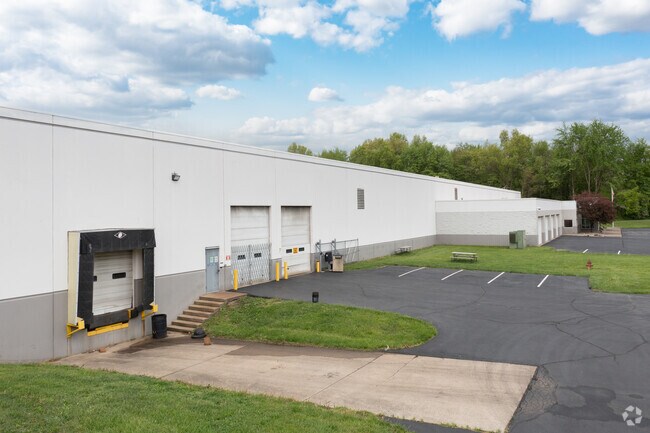
Property Detail
1146 Ferris Rd
41-31-12C-022
SEE 413112C022T ABATED
Manufacturinglight
Clermont
B and X Area of moderate flood hazard, usually the area between the limits of the 100-year and 500-year floods.
Ohio
2025
20.17 AC
2025
East
041202
Cincinnati/Dayton
70,885 SF
Cincinnati, OH-KY-IN
NEARBY LISTINGS FOR SALE OR LEASE
DEMOGRAPHICS near 1146 Ferris Rd
1 mile
3 mile
5 mile
2025 Total Population
3,824
50,296
99,692
2030 Population
3,900
51,648
102,114
Pop Growth 2025-2030
+ 1.99%
+ 2.69%
+ 2.43%
Average Age
41
41
41
2025 Total Households
1,506
21,111
40,803
HH Growth 2025-2030
+ 2.12%
+ 2.85%
+ 2.62%
Median Household Inc
$80,992
$75,814
$79,323
Avg Household Size
2.50
2.30
2.40
2025 Avg HH Vehicles
2.00
2.00
2.00
Median Home Value
$268,030
$285,200
$279,390
Median Year Built
1987
1990
1986
Nearby Places
Map Layers
Map Styles
 Street
 Aerial
Layers
 Traffic
 Biking
Places
Listings with unknown addresses are not visible on the map
- Restaurants
- Banks
- Shops
- Fitness
- Groceries
PUBLIC TRANSPORTATION
AIRPORT
Cincinnati/Northern Kentucky International
Drive
Walk
Distance
Cincinnati/Northern Kentucky International
44 min
27.0 mi
Nearby Properties
Address
Land Use
TOTAL SIZE
Lot Size
Zoning
Address
Land Use
TOTAL SIZE
Lot Size
Zoning
7,560 SF
79.10 AC
Address
Land Use
TOTAL SIZE
Lot Size
Zoning
104,856 SF
46.13 AC
Address
Land Use
TOTAL SIZE
Lot Size
Zoning
50,382 SF
33.05 AC
Address
Land Use
TOTAL SIZE
Lot Size
Zoning
8,914 SF
37.70 AC
Address
Land Use
TOTAL SIZE
Lot Size
Zoning
154,426 SF
35.05 AC
Address
Land Use
TOTAL SIZE
Lot Size
Zoning
Address
Land Use
TOTAL SIZE
Lot Size
Zoning
52,178 SF
5.98 AC
Address
Land Use
TOTAL SIZE
Lot Size
Zoning
236,920 SF
18.94 AC
Address
Land Use
TOTAL SIZE
Lot Size
Zoning
49.15 AC
Address
Land Use
TOTAL SIZE
Lot Size
Zoning
88,932 SF
11.21 AC
Address
Land Use
TOTAL SIZE
Lot Size
Zoning
56,080 SF
4.40 AC
Address
Land Use
TOTAL SIZE
Lot Size
Zoning
16.02 AC
Address
Land Use
TOTAL SIZE
Lot Size
Zoning
42,078 SF
58.22 AC
Address
Land Use
TOTAL SIZE
Lot Size
Zoning
14.24 AC
Address
Land Use
TOTAL SIZE
Lot Size
Zoning
26,637 SF
6.97 AC
Address
Land Use
TOTAL SIZE
Lot Size
Zoning
26,498 SF
50.11 AC
Address
Land Use
TOTAL SIZE
Lot Size
Zoning
980 SF
5.01 AC
Address
Land Use
TOTAL SIZE
Lot Size
Zoning
3,803 SF
21.34 AC
Address
Land Use
TOTAL SIZE
Lot Size
Zoning
70,456 SF
15.28 AC
Address
Land Use
TOTAL SIZE
Lot Size
Zoning
44,047 SF
3.37 AC
Address
Land Use
TOTAL SIZE
Lot Size
Zoning
79,064 SF
6.27 AC
Address
Land Use
TOTAL SIZE
Lot Size
Zoning
83,608 SF
4.45 AC
Address
Land Use
TOTAL SIZE
Lot Size
Zoning
11,442 SF
9.70 AC
Address
Land Use
TOTAL SIZE
Lot Size
Zoning
168,266 SF
105.07 AC
Address
Land Use
TOTAL SIZE
Lot Size
Zoning
59,730 SF
19.46 AC
Address
Land Use
TOTAL SIZE
Lot Size
Zoning
42,300 SF
10.72 AC
Address
Land Use
TOTAL SIZE
Lot Size
Zoning
70,489 SF
8.57 AC
Address
Land Use
TOTAL SIZE
Lot Size
Zoning
110,954 SF
9.61 AC
Address
Land Use
TOTAL SIZE
Lot Size
Zoning
65,720 SF
7.49 AC
Address
Land Use
TOTAL SIZE
Lot Size
Zoning
12,488 SF
64.96 AC
The World's #1 Commercial Real Estate Marketplace
Connect with us
© 2026 CoStar Group
The information above has been obtained from sources believed reliable. While we do not doubt its accuracy we have not verified it and make no guarantee, warranty or representation about it. It is your responsibility to independently confirm its accuracy and completeness. Any projections, opinions, assumptions, or estimates used are for example only and do not represent the current or future performance of the property. The value of this transaction to you depends on tax and other factors which should be evaluated by your tax, financial, and legal advisors. You and your advisors should conduct a careful, independent investigation of the property to determine to your satisfaction the suitability of the property for your needs.