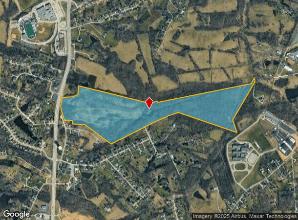
Property Record
11461 Water Tower Way, Independence, KY 41051

NEARBY LISTINGS FOR SALE OR LEASE
Property Detail
11461 Water Tower Way
048-00-00-004.00
76.490 ES MADISON PK N MAPLE TREE LN
Vacantlandnec
Kenton
X
Kentucky
21015C0250D
80.52 AC
2025
Outlying N Kentucky
2025
Cincinnati/Dayton
063609
Cincinnati, OH-KY-IN
DEMOGRAPHICS near 11461 Water Tower Way
1 Mile
3 Mile
5 Mile
2024 Total Population
2,203
19,443
49,434
2029 Population
2,258
19,901
50,709
Pop Growth 2024-2029
+ 2.50%
+ 2.36%
+ 2.58%
Average Age
41
38
37
2024 Total Households
809
6,743
16,983
HH Growth 2024-2029
+ 2.35%
+ 2.31%
+ 2.54%
Median Household Inc
$84,219
$89,728
$89,543
Avg Household Size
2.70
2.90
2.90
2024 Avg HH Vehicles
2.00
2.00
2.00
Median Home Value
$227,545
$233,881
$229,083
Median Year Built
1974
1996
1995
Nearby Places
Map Layers
Map Styles
 Street
 Aerial
- Restaurants
- Banks
- Shops
- Fitness
- Groceries
PUBLIC TRANSPORTATION
AIRPORT
Cincinnati/Northern Kentucky International
DRIVE
WALK
Distance
Cincinnati/Northern Kentucky International
31 min
18.0 mi
Freight Ports
Port of Toledo
DRIVE
WALK
Distance
Port of Toledo
262 min
221.0 mi
SALE & LEASE HISTORY
LISTING DATE
SALE/LEASE

Jan 06, 2017
For Sale
Nearby Properties
Address
Land Use
TOTAL SIZE
Lot Size
Zoning
Address
Land Use
TOTAL SIZE
Lot Size
Zoning
28.50 AC
Address
Land Use
TOTAL SIZE
Lot Size
Zoning
50.66 AC
Address
Land Use
TOTAL SIZE
Lot Size
Zoning
1,568 SF
40.46 AC
Address
Land Use
TOTAL SIZE
Lot Size
Zoning
123,480 SF
11.96 AC
Address
Land Use
TOTAL SIZE
Lot Size
Zoning
Address
Land Use
TOTAL SIZE
Lot Size
Zoning
13.27 AC
Address
Land Use
TOTAL SIZE
Lot Size
Zoning
25.04 AC
Address
Land Use
TOTAL SIZE
Lot Size
Zoning
Address
Land Use
TOTAL SIZE
Lot Size
Zoning
39,000 SF
5.70 AC
Address
Land Use
TOTAL SIZE
Lot Size
Zoning
15.65 AC
Address
Land Use
TOTAL SIZE
Lot Size
Zoning
Address
Land Use
TOTAL SIZE
Lot Size
Zoning
105,205 SF
6.71 AC
Address
Land Use
TOTAL SIZE
Lot Size
Zoning
10.08 AC
Address
Land Use
TOTAL SIZE
Lot Size
Zoning
11.73 AC
Address
Land Use
TOTAL SIZE
Lot Size
Zoning
26,000 SF
6.86 AC
Address
Land Use
TOTAL SIZE
Lot Size
Zoning
12,520 SF
3.06 AC
Address
Land Use
TOTAL SIZE
Lot Size
Zoning
1,200 SF
8.05 AC
Address
Land Use
TOTAL SIZE
Lot Size
Zoning
Address
Land Use
TOTAL SIZE
Lot Size
Zoning
14,820 SF
2.11 AC
Address
Land Use
TOTAL SIZE
Lot Size
Zoning
24.12 AC
Address
Land Use
TOTAL SIZE
Lot Size
Zoning
26,252 SF
2.98 AC
Address
Land Use
TOTAL SIZE
Lot Size
Zoning
Address
Land Use
TOTAL SIZE
Lot Size
Zoning
8,228 SF
2.46 AC
Address
Land Use
TOTAL SIZE
Lot Size
Zoning
5,270 SF
1.68 AC
Address
Land Use
TOTAL SIZE
Lot Size
Zoning
1,260 SF
4.03 AC
Address
Land Use
TOTAL SIZE
Lot Size
Zoning
2,201 SF
3.39 AC
Address
Land Use
TOTAL SIZE
Lot Size
Zoning
12,662 SF
2.48 AC
Address
Land Use
TOTAL SIZE
Lot Size
Zoning
1.97 AC
Address
Land Use
TOTAL SIZE
Lot Size
Zoning
12,785 SF
24.30 AC
Address
Land Use
TOTAL SIZE
Lot Size
Zoning
21,962 SF
5.58 AC
The World's #1 Commercial Real Estate Marketplace
Connect with us
© 2025 CoStar Group
The information above has been obtained from sources believed reliable. While we do not doubt its accuracy we have not verified it and make no guarantee, warranty or representation about it. It is your responsibility to independently confirm its accuracy and completeness. Any projections, opinions, assumptions, or estimates used are for example only and do not represent the current or future performance of the property. The value of this transaction to you depends on tax and other factors which should be evaluated by your tax, financial, and legal advisors. You and your advisors should conduct a careful, independent investigation of the property to determine to your satisfaction the suitability of the property for your needs.