Property Record
1147 Briarbrook Dr, Wheaton, IL 60189
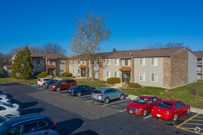


Property Detail
1147 Briarbrook Dr
05-27-317-016
BRIARCLIFFE UNIT #2
Commercialnec
DUPAGE
M
Illinois
C and X Area of minimal flood hazard, usually depicted on FIRMs as above the 500-year flood level.
461
2024
19.49 AC
2024
Glen Ellyn to West Chicago Corridor
842702
Chicago
300,104 SF
Chicago-Naperville-Elgin, IL-IN
NEARBY LISTINGS FOR SALE OR LEASE
DEMOGRAPHICS near 1147 Briarbrook Dr
1 mile
3 mile
5 mile
2025 Total Population
10,353
81,262
243,009
2030 Population
10,459
82,089
246,241
Pop Growth 2025-2030
+ 1.02%
+ 1.02%
+ 1.33%
Average Age
41
41
41
2025 Total Households
4,226
31,188
94,898
HH Growth 2025-2030
+ 0.83%
+ 1.02%
+ 1.40%
Median Household Inc
$119,286
$116,178
$113,020
Avg Household Size
2.40
2.50
2.40
2025 Avg HH Vehicles
2.00
2.00
2.00
Median Home Value
$467,336
$457,830
$439,747
Median Year Built
1978
1975
1976
Nearby Places
Map Layers
Map Styles
 Street
 Aerial
Transit
 Traffic
 Biking
Places
Listings with unknown addresses are not visible on the map
- Restaurants
- Banks
- Shops
- Fitness
- Groceries
PUBLIC TRANSPORTATION
COMMUTER RAIL
Wheaton Station (Union Pacific West Line - Northeast Illinois Regional Commuter Railroad (Metra))
Drive
Walk
Distance
Wheaton Station (Union Pacific West Line - Northeast Illinois Regional Commuter Railroad (Metra))
7 min
3.8 mi
Lisle Station (Burlington Northern-Santa Fe Railway Line - Northeast Illinois Regional Commuter Railroad (Metra))
Drive
Walk
Distance
Lisle Station (Burlington Northern-Santa Fe Railway Line - Northeast Illinois Regional Commuter Railroad (Metra))
11 min
4.0 mi
AIRPORT
Chicago Midway International
Drive
Walk
Distance
Chicago Midway International
36 min
21.6 mi
Chicago O'Hare International
Drive
Walk
Distance
Chicago O'Hare International
35 min
22.5 mi
Freight Ports
Port Milwaukee
Drive
Walk
Distance
Port Milwaukee
117 min
94.2 mi
Nearby Properties
Address
Land Use
TOTAL SIZE
Lot Size
Zoning
Address
Land Use
TOTAL SIZE
Lot Size
Zoning
818,262 SF
13.70 AC
M
Address
Land Use
TOTAL SIZE
Lot Size
Zoning
83.99 AC
Address
Land Use
TOTAL SIZE
Lot Size
Zoning
594,125 SF
2.60 AC
Address
Land Use
TOTAL SIZE
Lot Size
Zoning
376,629 SF
16.26 AC
C
Address
Land Use
TOTAL SIZE
Lot Size
Zoning
Address
Land Use
TOTAL SIZE
Lot Size
Zoning
8.08 AC
C
Address
Land Use
TOTAL SIZE
Lot Size
Zoning
Address
Land Use
TOTAL SIZE
Lot Size
Zoning
295,773 SF
17.45 AC
M
Address
Land Use
TOTAL SIZE
Lot Size
Zoning
264,227 SF
17.12 AC
M
Address
Land Use
TOTAL SIZE
Lot Size
Zoning
254,992 SF
14.21 AC
M
Address
Land Use
TOTAL SIZE
Lot Size
Zoning
254,201 SF
27.84 AC
Address
Land Use
TOTAL SIZE
Lot Size
Zoning
20.05 AC
C
Address
Land Use
TOTAL SIZE
Lot Size
Zoning
9.18 AC
C
Address
Land Use
TOTAL SIZE
Lot Size
Zoning
8.36 AC
C
Address
Land Use
TOTAL SIZE
Lot Size
Zoning
552,111 SF
4.48 AC
C
Address
Land Use
TOTAL SIZE
Lot Size
Zoning
201,048 SF
20.24 AC
Address
Land Use
TOTAL SIZE
Lot Size
Zoning
146,492 SF
0.42 AC
Address
Land Use
TOTAL SIZE
Lot Size
Zoning
259,374 SF
27.66 AC
C
Address
Land Use
TOTAL SIZE
Lot Size
Zoning
2.37 AC
Address
Land Use
TOTAL SIZE
Lot Size
Zoning
13.67 AC
M
Address
Land Use
TOTAL SIZE
Lot Size
Zoning
14.68 AC
I
Address
Land Use
TOTAL SIZE
Lot Size
Zoning
16.26 AC
C
Address
Land Use
TOTAL SIZE
Lot Size
Zoning
13.89 AC
M
Address
Land Use
TOTAL SIZE
Lot Size
Zoning
162,819 SF
19.82 AC
C
Address
Land Use
TOTAL SIZE
Lot Size
Zoning
13.27 AC
M
Address
Land Use
TOTAL SIZE
Lot Size
Zoning
162,815 SF
11.60 AC
M
Address
Land Use
TOTAL SIZE
Lot Size
Zoning
13.44 AC
C
Address
Land Use
TOTAL SIZE
Lot Size
Zoning
240,918 SF
8.13 AC
C
Address
Land Use
TOTAL SIZE
Lot Size
Zoning
135,355 SF
12.12 AC
C
The World's #1 Commercial Real Estate Marketplace
Connect with us
© 2026 CoStar Group
The information above has been obtained from sources believed reliable. While we do not doubt its accuracy we have not verified it and make no guarantee, warranty or representation about it. It is your responsibility to independently confirm its accuracy and completeness. Any projections, opinions, assumptions, or estimates used are for example only and do not represent the current or future performance of the property. The value of this transaction to you depends on tax and other factors which should be evaluated by your tax, financial, and legal advisors. You and your advisors should conduct a careful, independent investigation of the property to determine to your satisfaction the suitability of the property for your needs.