Property Record
11473 Rosecrans Ave, Norwalk, CA 90650
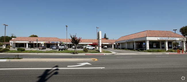


Property Detail
11473 Rosecrans Ave
Los Angeles-Long Beach-Glendale, CA
*TR=PARCEL MAP AS PER BK 150 P 74-75 OF P M LOT 2
8054-035-013
Los Angeles
Regionalshoppingcenterormallwithanchorstore
California
NOC3-P*
2
2025
1.72 AC
2025
Mid-Cities
552100
Los Angeles
59,176 SF
NEARBY LISTINGS FOR SALE OR LEASE
DEMOGRAPHICS near 11473 Rosecrans Ave
1 mile
3 mile
5 mile
2025 Total Population
36,489
224,700
619,903
2030 Population
35,957
221,919
612,518
Pop Growth 2025-2030
(1.46%)
(1.24%)
(1.19%)
Average Age
39
40
40
2025 Total Households
9,897
65,070
182,216
HH Growth 2025-2030
(1.74%)
(1.49%)
(1.43%)
Median Household Inc
$92,474
$91,678
$96,163
Avg Household Size
3.60
3.30
3.30
2025 Avg HH Vehicles
2.00
2.00
2.00
Median Home Value
$705,381
$741,126
$749,760
Median Year Built
1956
1960
1960
Nearby Places
Map Layers
Map Styles
 Street
 Aerial
Layers
 Traffic
 Biking
Places
Listings with unknown addresses are not visible on the map
- Restaurants
- Banks
- Shops
- Fitness
- Groceries
PUBLIC TRANSPORTATION
COMMUTER RAIL
Norwalk/Santa Fe Springs (91 Line - Southern California Regional Rail Authority (Metrolink), Orange County Line - Southern California Regional Rail Authority (Metrolink))
Drive
Walk
Distance
Norwalk/Santa Fe Springs (91 Line - Southern California Regional Rail Authority (Metrolink), Orange County Line - Southern California Regional Rail Authority (Metrolink))
6 min
2.7 mi
Buena Park (91 Line - Southern California Regional Rail Authority (Metrolink), Orange County Line - Southern California Regional Rail Authority (Metrolink))
Drive
Walk
Distance
Buena Park (91 Line - Southern California Regional Rail Authority (Metrolink), Orange County Line - Southern California Regional Rail Authority (Metrolink))
13 min
7.8 mi
AIRPORT
Long Beach (Daugherty Field)
Drive
Walk
Distance
Long Beach (Daugherty Field)
19 min
11.2 mi
Los Angeles International
Drive
Walk
Distance
Los Angeles International
28 min
21.2 mi
John Wayne/Orange County
Drive
Walk
Distance
John Wayne/Orange County
31 min
24.7 mi
Freight Ports
Port of Long Beach
Drive
Walk
Distance
Port of Long Beach
25 min
16.9 mi
SALE & LEASE HISTORY
LISTING DATE
SALE/LEASE

May 20, 2024
For Sale
Dec 23, 2024
For Lease
Apr 07, 2021
For Lease
Nearby Properties
Address
Land Use
TOTAL SIZE
Lot Size
Zoning
Address
Land Use
TOTAL SIZE
Lot Size
Zoning
1,339,758 SF
28.53 AC
DOM2-P*
Address
Land Use
TOTAL SIZE
Lot Size
Zoning
324,400 SF
55.03 AC
CECR
Address
Land Use
TOTAL SIZE
Lot Size
Zoning
634,060 SF
76.06 AC
SSM2
Address
Land Use
TOTAL SIZE
Lot Size
Zoning
383,495 SF
11.60 AC
DOR3PUD*
Address
Land Use
TOTAL SIZE
Lot Size
Zoning
730,731 SF
14.89 AC
BFCG*
Address
Land Use
TOTAL SIZE
Lot Size
Zoning
369,940 SF
8.70 AC
CEM
Address
Land Use
TOTAL SIZE
Lot Size
Zoning
353,001 SF
4.81 AC
CEM
Address
Land Use
TOTAL SIZE
Lot Size
Zoning
389,895 SF
3.43 AC
CECC
Address
Land Use
TOTAL SIZE
Lot Size
Zoning
166,712 SF
8.53 AC
NOM1(PF)-P
Address
Land Use
TOTAL SIZE
Lot Size
Zoning
322,048 SF
15.54 AC
SSM2-M1*
Address
Land Use
TOTAL SIZE
Lot Size
Zoning
224,131 SF
9.03 AC
CEM
Address
Land Use
TOTAL SIZE
Lot Size
Zoning
371,464 SF
9.28 AC
DOM2-P*
Address
Land Use
TOTAL SIZE
Lot Size
Zoning
518,296 SF
13.94 AC
NOCO(PF)*
Address
Land Use
TOTAL SIZE
Lot Size
Zoning
266,337 SF
2.40 AC
CE-ADP-16
Address
Land Use
TOTAL SIZE
Lot Size
Zoning
288,000 SF
13.56 AC
SSM2-BP*
Address
Land Use
TOTAL SIZE
Lot Size
Zoning
163,350 SF
7.58 AC
CEM
Address
Land Use
TOTAL SIZE
Lot Size
Zoning
154,616 SF
7.53 AC
CEM
Address
Land Use
TOTAL SIZE
Lot Size
Zoning
41,100 SF
8.42 AC
SSM2*
Address
Land Use
TOTAL SIZE
Lot Size
Zoning
289,454 SF
13.66 AC
SSM2*
Address
Land Use
TOTAL SIZE
Lot Size
Zoning
158,272 SF
7.09 AC
SSPF*
Address
Land Use
TOTAL SIZE
Lot Size
Zoning
73,661 SF
4.25 AC
SSR1
Address
Land Use
TOTAL SIZE
Lot Size
Zoning
834,952 SF
33.06 AC
SSM2
Address
Land Use
TOTAL SIZE
Lot Size
Zoning
168,912 SF
8.09 AC
CEM
Address
Land Use
TOTAL SIZE
Lot Size
Zoning
124,820 SF
4.11 AC
NOM2*
Address
Land Use
TOTAL SIZE
Lot Size
Zoning
161,650 SF
6 AC
CEM(D1)*
Address
Land Use
TOTAL SIZE
Lot Size
Zoning
500,374 SF
9.46 AC
SSM2*
Address
Land Use
TOTAL SIZE
Lot Size
Zoning
300,102 SF
11.94 AC
SSM2*
Address
Land Use
TOTAL SIZE
Lot Size
Zoning
145,520 SF
6.64 AC
CEADP1
Address
Land Use
TOTAL SIZE
Lot Size
Zoning
62,612 SF
21.49 AC
SSM2
Address
Land Use
TOTAL SIZE
Lot Size
Zoning
145,372 SF
7.21 AC
SSM2*
The World's #1 Commercial Real Estate Marketplace
Connect with us
© 2026 CoStar Group
The information above has been obtained from sources believed reliable. While we do not doubt its accuracy we have not verified it and make no guarantee, warranty or representation about it. It is your responsibility to independently confirm its accuracy and completeness. Any projections, opinions, assumptions, or estimates used are for example only and do not represent the current or future performance of the property. The value of this transaction to you depends on tax and other factors which should be evaluated by your tax, financial, and legal advisors. You and your advisors should conduct a careful, independent investigation of the property to determine to your satisfaction the suitability of the property for your needs.