Property Record
11474 15 Mile Rd, Sterling Heights, MI 48312


NEARBY LISTINGS FOR SALE OR LEASE
Property Detail
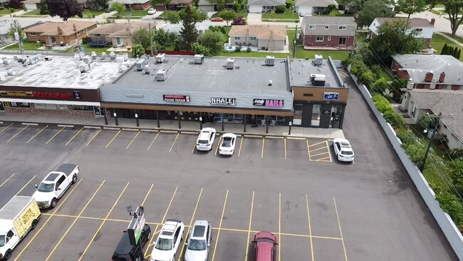
11474 15 Mile Rd
10-10-34-229-003
M 751B2 $T2N,R12E SEC 34 W 130.0 FT OF FOLL DESC; E 330.0 FT OF N 264.0 FT OF N 30 ACRES OF E 40 ACRES OF NE 1/4 SEC 34.
Commercialnec
Macomb
X
Michigan
26099C0317G
0.61 AC
2025
Macomb West
2025
Detroit
232200
Detroit-Warren-Dearborn, MI
4,816 SF
DEMOGRAPHICS near 11474 15 Mile Rd
1 Mile
3 Mile
5 Mile
2024 Total Population
12,126
98,466
298,315
2029 Population
11,966
97,171
294,889
Pop Growth 2024-2029
(1.32%)
(1.32%)
(1.15%)
Average Age
42
42
42
2024 Total Households
4,716
38,998
120,304
HH Growth 2024-2029
(1.36%)
(1.33%)
(1.13%)
Median Household Inc
$67,531
$67,738
$66,220
Avg Household Size
2.50
2.50
2.40
2024 Avg HH Vehicles
2.00
2.00
2.00
Median Home Value
$222,114
$202,973
$193,260
Median Year Built
1973
1970
1971
Nearby Places
Map Layers
Map Styles
 Street
 Aerial
- Restaurants
- Banks
- Shops
- Fitness
- Groceries
PUBLIC TRANSPORTATION
COMMUTER RAIL
DRIVE
WALK
Distance
20 min
9.6 mi
AIRPORT
Windsor International
DRIVE
WALK
Distance
Windsor International
53 min
31.2 mi
Detroit Metro Wayne County
DRIVE
WALK
Distance
Detroit Metro Wayne County
57 min
40.8 mi
SALE & LEASE HISTORY
LISTING DATE
SALE/LEASE

Sep 25, 2016
For Lease
May 05, 2021
For Lease
Jan 17, 2017
For Lease
Dec 16, 2016
For Lease
Nearby Properties
Address
Land Use
TOTAL SIZE
Lot Size
Zoning
Address
Land Use
TOTAL SIZE
Lot Size
Zoning
1,177,879 SF
104 AC
MZ
Address
Land Use
TOTAL SIZE
Lot Size
Zoning
920,611 SF
M-2
Address
Land Use
TOTAL SIZE
Lot Size
Zoning
1,596,307 SF
Address
Land Use
TOTAL SIZE
Lot Size
Zoning
1,024,233 SF
287.20 AC
M-2
Address
Land Use
TOTAL SIZE
Lot Size
Zoning
1,107,643 SF
173.73 AC
MZ
Address
Land Use
TOTAL SIZE
Lot Size
Zoning
983,373 SF
60.16 AC
M-2
Address
Land Use
TOTAL SIZE
Lot Size
Zoning
2,726,159 SF
199.39 AC
M-2
Address
Land Use
TOTAL SIZE
Lot Size
Zoning
569,813 SF
62.54 AC
M-2
Address
Land Use
TOTAL SIZE
Lot Size
Zoning
2,727,131 SF
155.26 AC
M-2
Address
Land Use
TOTAL SIZE
Lot Size
Zoning
226,380 SF
46.45 AC
M-1
Address
Land Use
TOTAL SIZE
Lot Size
Zoning
229,624 SF
13.55 AC
M-2
Address
Land Use
TOTAL SIZE
Lot Size
Zoning
645 SF
23.16 AC
RM-2
Address
Land Use
TOTAL SIZE
Lot Size
Zoning
2,984,492 SF
M-2
Address
Land Use
TOTAL SIZE
Lot Size
Zoning
423,027 SF
46.73 AC
M-1
Address
Land Use
TOTAL SIZE
Lot Size
Zoning
98,265 SF
7.04 AC
RM-2
Address
Land Use
TOTAL SIZE
Lot Size
Zoning
201,873 SF
M-1
Address
Land Use
TOTAL SIZE
Lot Size
Zoning
283,685 SF
19.90 AC
R-3
Address
Land Use
TOTAL SIZE
Lot Size
Zoning
559,929 SF
41.57 AC
M-1
Address
Land Use
TOTAL SIZE
Lot Size
Zoning
148,330 SF
37.86 AC
RM-2
Address
Land Use
TOTAL SIZE
Lot Size
Zoning
24.38 AC
RML
Address
Land Use
TOTAL SIZE
Lot Size
Zoning
82,475 SF
16.81 AC
RM-2
Address
Land Use
TOTAL SIZE
Lot Size
Zoning
135,274 SF
20.55 AC
RM-2
Address
Land Use
TOTAL SIZE
Lot Size
Zoning
139,846 SF
16 AC
RM-2
Address
Land Use
TOTAL SIZE
Lot Size
Zoning
210,000 SF
M-1
Address
Land Use
TOTAL SIZE
Lot Size
Zoning
159,750 SF
16.76 AC
M-1
Address
Land Use
TOTAL SIZE
Lot Size
Zoning
205,993 SF
19.90 AC
MZ
Address
Land Use
TOTAL SIZE
Lot Size
Zoning
16.11 AC
RM-2
Address
Land Use
TOTAL SIZE
Lot Size
Zoning
243,132 SF
7.06 AC
C-2
Address
Land Use
TOTAL SIZE
Lot Size
Zoning
219,437 SF
18.80 AC
PCD
Address
Land Use
TOTAL SIZE
Lot Size
Zoning
91,104 SF
11.99 AC
RM-2
The World's #1 Commercial Real Estate Marketplace
Connect with us
© 2026 CoStar Group
The information above has been obtained from sources believed reliable. While we do not doubt its accuracy we have not verified it and make no guarantee, warranty or representation about it. It is your responsibility to independently confirm its accuracy and completeness. Any projections, opinions, assumptions, or estimates used are for example only and do not represent the current or future performance of the property. The value of this transaction to you depends on tax and other factors which should be evaluated by your tax, financial, and legal advisors. You and your advisors should conduct a careful, independent investigation of the property to determine to your satisfaction the suitability of the property for your needs.