Property Record
1148 E Oglethorpe Hwy, Hinesville, GA 31313

Property Detail
1148 E Oglethorpe Hwy
069C-035
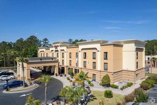
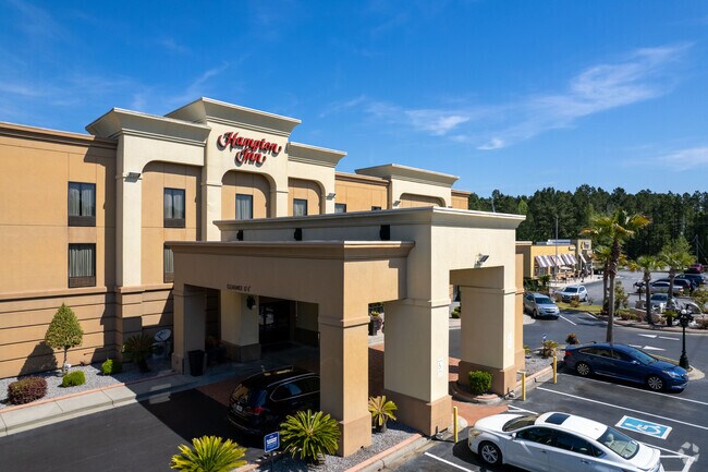
1.53 ACRE 17 GMD HWY 84 HAMPTON INN
Motel
Liberty
C3
Georgia
B and X Area of moderate flood hazard, usually the area between the limits of the 100-year and 500-year floods.
1.53 AC
2025
Georgia South Area
2025
Savannah
010302
Hinesville, GA
31,488 SF
NEARBY LISTINGS FOR SALE OR LEASE
-
-
View all Hinesville listings for sale on LoopNet.com
DEMOGRAPHICS near 1148 E Oglethorpe Hwy
1 mile
3 mile
5 mile
2025 Total Population
3,233
24,351
45,552
2030 Population
3,413
25,794
48,156
Pop Growth 2025-2030
+ 5.57%
+ 5.93%
+ 5.72%
Average Age
32
31
31
2025 Total Households
1,309
8,681
16,081
HH Growth 2025-2030
+ 5.88%
+ 6.30%
+ 5.98%
Median Household Inc
$54,173
$56,864
$57,468
Avg Household Size
2.40
2.60
2.70
2025 Avg HH Vehicles
1.00
2.00
2.00
Median Home Value
$191,907
$207,912
$192,728
Median Year Built
1986
1990
1991
Nearby Places
Map Layers
Map Styles
 Street
 Aerial
Layers
 Traffic
 Biking
Places
Listings with unknown addresses are not visible on the map
- Restaurants
- Banks
- Shops
- Fitness
- Groceries
PUBLIC TRANSPORTATION
AIRPORT
Savannah/Hilton Head International
Drive
Walk
Distance
Savannah/Hilton Head International
53 min
37.3 mi
Freight Ports
Georgia Ports - Savannah
Drive
Walk
Distance
Georgia Ports - Savannah
56 min
39.4 mi
Nearby Properties
Address
Land Use
TOTAL SIZE
Lot Size
Zoning
Address
Land Use
TOTAL SIZE
Lot Size
Zoning
315,645 SF
57.37 AC
A1/R8
Address
Land Use
TOTAL SIZE
Lot Size
Zoning
2,352 SF
22.31 AC
ATR/MFR
Address
Land Use
TOTAL SIZE
Lot Size
Zoning
144,251 SF
51.30 AC
R20
Address
Land Use
TOTAL SIZE
Lot Size
Zoning
102,939 SF
2.53 AC
C1
Address
Land Use
TOTAL SIZE
Lot Size
Zoning
148,364 SF
18.53 AC
PUD
Address
Land Use
TOTAL SIZE
Lot Size
Zoning
60,432 SF
23.64 AC
R20
Address
Land Use
TOTAL SIZE
Lot Size
Zoning
41,670 SF
1.89 AC
C1
Address
Land Use
TOTAL SIZE
Lot Size
Zoning
100,765 SF
33.20 AC
C2
Address
Land Use
TOTAL SIZE
Lot Size
Zoning
90,886 SF
10.78 AC
C2
Address
Land Use
TOTAL SIZE
Lot Size
Zoning
1,884 SF
9.25 AC
C2
Address
Land Use
TOTAL SIZE
Lot Size
Zoning
39,252 SF
4.93 AC
MFR
Address
Land Use
TOTAL SIZE
Lot Size
Zoning
205,730 SF
21.03 AC
C3
Address
Land Use
TOTAL SIZE
Lot Size
Zoning
155,001 SF
10.56 AC
MFR
Address
Land Use
TOTAL SIZE
Lot Size
Zoning
83,217 SF
11.18 AC
C2
Address
Land Use
TOTAL SIZE
Lot Size
Zoning
57,980 SF
10.72 AC
C2
Address
Land Use
TOTAL SIZE
Lot Size
Zoning
110,150 SF
14.83 AC
C3
Address
Land Use
TOTAL SIZE
Lot Size
Zoning
139,565 SF
14.96 AC
C2
Address
Land Use
TOTAL SIZE
Lot Size
Zoning
17,376 SF
29.45 AC
OI
Address
Land Use
TOTAL SIZE
Lot Size
Zoning
10.58 AC
PUD
Address
Land Use
TOTAL SIZE
Lot Size
Zoning
9,320 SF
6.74 AC
C2/C3
Address
Land Use
TOTAL SIZE
Lot Size
Zoning
27,627 SF
4.97 AC
C2
Address
Land Use
TOTAL SIZE
Lot Size
Zoning
52,416 SF
3.70 AC
C2
Address
Land Use
TOTAL SIZE
Lot Size
Zoning
42,572 SF
5.87 AC
C2
Address
Land Use
TOTAL SIZE
Lot Size
Zoning
34,334 SF
7.10 AC
C2
Address
Land Use
TOTAL SIZE
Lot Size
Zoning
24,144 SF
9.24 AC
C3
Address
Land Use
TOTAL SIZE
Lot Size
Zoning
42,110 SF
5.86 AC
C3
Address
Land Use
TOTAL SIZE
Lot Size
Zoning
35,588 SF
8.88 AC
FTSTEWART
Address
Land Use
TOTAL SIZE
Lot Size
Zoning
34,484 SF
1.92 AC
C2
Address
Land Use
TOTAL SIZE
Lot Size
Zoning
52,137 SF
6.12 AC
C2
The World's #1 Commercial Real Estate Marketplace
Connect with us
© 2026 CoStar Group
The information above has been obtained from sources believed reliable. While we do not doubt its accuracy we have not verified it and make no guarantee, warranty or representation about it. It is your responsibility to independently confirm its accuracy and completeness. Any projections, opinions, assumptions, or estimates used are for example only and do not represent the current or future performance of the property. The value of this transaction to you depends on tax and other factors which should be evaluated by your tax, financial, and legal advisors. You and your advisors should conduct a careful, independent investigation of the property to determine to your satisfaction the suitability of the property for your needs.