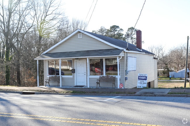
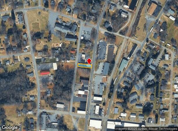
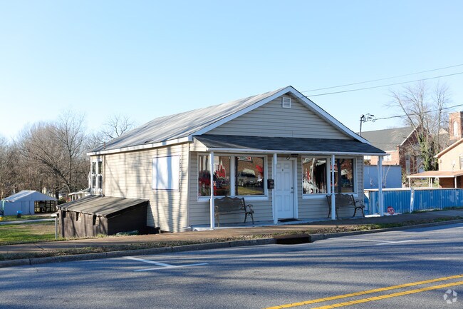
Property Record
1148 N Main Ave, Newton, NC 28658
NEARBY LISTINGS FOR SALE OR LEASE
Property Detail
1148 N Main Ave
Hickory-Lenoir-Morganton, NC
V F Shipp Lands
3740050737280000
LOT 9 PT 8 10 PL 1-331
Restaurantbuilding
Catawba
X
North Carolina
3710374000J
9
2024
0.12 AC
2025
Catawba County
011200
Charlotte
2,143 SF
DEMOGRAPHICS near 1148 N Main Ave
1 Mile
3 Mile
5 Mile
2024 Total Population
5,235
20,904
41,365
2029 Population
5,492
21,901
43,245
Pop Growth 2024-2029
+ 4.91%
+ 4.77%
+ 4.54%
Average Age
39
41
41
2024 Total Households
2,103
8,407
16,377
HH Growth 2024-2029
+ 4.85%
+ 4.70%
+ 4.48%
Median Household Inc
$52,820
$56,027
$57,753
Avg Household Size
2.40
2.40
2.40
2024 Avg HH Vehicles
2.00
2.00
2.00
Median Home Value
$132,330
$169,836
$176,037
Median Year Built
1976
1978
1984
Nearby Places
- Restaurants
- Banks
- Shops
- Fitness
- Groceries
SALE & LEASE HISTORY
LISTING DATE
SALE/LEASE

Sep 24, 2016
For Sale
Jan 04, 2017
For Sale
Jan 03, 2017
For Sale
Dec 30, 2016
For Sale
Apr 20, 2017
For Sale
Nearby Properties
Address
Land Use
TOTAL SIZE
Lot Size
Zoning
Address
Land Use
TOTAL SIZE
Lot Size
Zoning
125,462 SF
18.74 AC
PD-O&I
Address
Land Use
TOTAL SIZE
Lot Size
Zoning
502,665 SF
53.28 AC
EM-1-CD
Address
Land Use
TOTAL SIZE
Lot Size
Zoning
6,751 SF
85.40 AC
PD-CCRC
Address
Land Use
TOTAL SIZE
Lot Size
Zoning
1,937 SF
62 AC
PD-CCRC
Address
Land Use
TOTAL SIZE
Lot Size
Zoning
248,173 SF
53.73 AC
B-4
Address
Land Use
TOTAL SIZE
Lot Size
Zoning
222,605 SF
20.66 AC
EM-1
Address
Land Use
TOTAL SIZE
Lot Size
Zoning
188,250 SF
32.34 AC
EM-1
Address
Land Use
TOTAL SIZE
Lot Size
Zoning
218,009 SF
90.48 AC
M-1
Address
Land Use
TOTAL SIZE
Lot Size
Zoning
103,090 SF
36.13 AC
R-9
Address
Land Use
TOTAL SIZE
Lot Size
Zoning
124,940 SF
33.32 AC
M-1
Address
Land Use
TOTAL SIZE
Lot Size
Zoning
150,498 SF
11.27 AC
M-1
Address
Land Use
TOTAL SIZE
Lot Size
Zoning
9,064 SF
4.59 AC
B-2-CD
Address
Land Use
TOTAL SIZE
Lot Size
Zoning
283,942 SF
26.59 AC
M-1
Address
Land Use
TOTAL SIZE
Lot Size
Zoning
270,125 SF
19.98 AC
EM-1
Address
Land Use
TOTAL SIZE
Lot Size
Zoning
222,786 SF
14.02 AC
EM-1
Address
Land Use
TOTAL SIZE
Lot Size
Zoning
226,704 SF
24.60 AC
EM-1
Address
Land Use
TOTAL SIZE
Lot Size
Zoning
67,085 SF
15.80 AC
PD-SC-M
Address
Land Use
TOTAL SIZE
Lot Size
Zoning
213,422 SF
33.51 AC
M-1
Address
Land Use
TOTAL SIZE
Lot Size
Zoning
637,521 SF
87.22 AC
M-1
Address
Land Use
TOTAL SIZE
Lot Size
Zoning
7,680 SF
9.22 AC
PD-H
Address
Land Use
TOTAL SIZE
Lot Size
Zoning
20.90 AC
M-1
Address
Land Use
TOTAL SIZE
Lot Size
Zoning
318,757 SF
23.50 AC
M-1
Address
Land Use
TOTAL SIZE
Lot Size
Zoning
234,094 SF
15.22 AC
EM-1
Address
Land Use
TOTAL SIZE
Lot Size
Zoning
156,161 SF
17.22 AC
M-1
Address
Land Use
TOTAL SIZE
Lot Size
Zoning
136,903 SF
43.43 AC
EM-1
Address
Land Use
TOTAL SIZE
Lot Size
Zoning
10.85 AC
R-7
Address
Land Use
TOTAL SIZE
Lot Size
Zoning
249,849 SF
20.99 AC
M-1
Address
Land Use
TOTAL SIZE
Lot Size
Zoning
36,254 SF
13.18 AC
M-1
Address
Land Use
TOTAL SIZE
Lot Size
Zoning
132,516 SF
24.37 AC
M-1
Address
Land Use
TOTAL SIZE
Lot Size
Zoning
143,979 SF
11.68 AC
IND
The World's #1 Commercial Real Estate Marketplace
Connect with us
© 2025 CoStar Group
The information above has been obtained from sources believed reliable. While we do not doubt its accuracy we have not verified it and make no guarantee, warranty or representation about it. It is your responsibility to independently confirm its accuracy and completeness. Any projections, opinions, assumptions, or estimates used are for example only and do not represent the current or future performance of the property. The value of this transaction to you depends on tax and other factors which should be evaluated by your tax, financial, and legal advisors. You and your advisors should conduct a careful, independent investigation of the property to determine to your satisfaction the suitability of the property for your needs.