Property Record
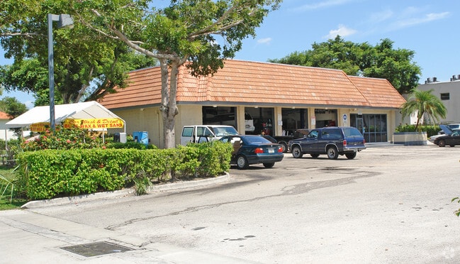
11491 W Sample Rd, Coral Springs, FL 33065

Property Detail
11491 W Sample Rd
48-41-17-06-1496
CASTLEWOOD 71-37 B PARCEL B,W 200 LESS N 72
Servicestationmarket
Broward
B-2
Florida
C and X Area of minimal flood hazard, usually depicted on FIRMs as above the 500-year flood level.
1.30 AC
2025
NW Broward/Coral Springs
2026
South Florida
020326
Fort Lauderdale-Pompano Beach-Sunrise, FL
2,919 SF
NEARBY LISTINGS FOR SALE OR LEASE
DEMOGRAPHICS near 11491 W Sample Rd
1 mile
3 mile
5 mile
2025 Total Population
17,971
110,540
250,474
2030 Population
18,713
115,595
263,424
Pop Growth 2025-2030
+ 4.13%
+ 4.57%
+ 5.17%
Average Age
36
39
41
2025 Total Households
5,584
36,939
89,159
HH Growth 2025-2030
+ 3.51%
+ 4.04%
+ 4.73%
Median Household Inc
$81,164
$91,757
$84,706
Avg Household Size
3.00
2.90
2.70
2025 Avg HH Vehicles
2.00
2.00
2.00
Median Home Value
$551,513
$601,923
$463,202
Median Year Built
1980
1986
1985
Nearby Places
Map Layers
Map Styles
 Street
 Aerial
Layers
 Traffic
 Biking
Places
Listings with unknown addresses are not visible on the map
- Restaurants
- Banks
- Shops
- Fitness
- Groceries
PUBLIC TRANSPORTATION
COMMUTER RAIL
Pompano Beach (Tri-County Commuter - South Florida Regional Transportation Authority (Tri-Rail))
Drive
Walk
Distance
Pompano Beach (Tri-County Commuter - South Florida Regional Transportation Authority (Tri-Rail))
19 min
9.5 mi
AIRPORT
Fort Lauderdale/Hollywood International
Drive
Walk
Distance
Fort Lauderdale/Hollywood International
38 min
24.2 mi
Miami International
Drive
Walk
Distance
Miami International
52 min
39.8 mi
Palm Beach International
Drive
Walk
Distance
Palm Beach International
54 min
40.6 mi
Freight Ports
Port Everglades
Drive
Walk
Distance
Port Everglades
38 min
26.2 mi
Nearby Properties
Address
Land Use
TOTAL SIZE
Lot Size
Zoning
Address
Land Use
TOTAL SIZE
Lot Size
Zoning
457,406 SF
21.26 AC
MC
Address
Land Use
TOTAL SIZE
Lot Size
Zoning
447,756 SF
45.30 AC
BCRM-5
Address
Land Use
TOTAL SIZE
Lot Size
Zoning
640,399 SF
2.41 AC
Address
Land Use
TOTAL SIZE
Lot Size
Zoning
399,296 SF
20.23 AC
RM-40
Address
Land Use
TOTAL SIZE
Lot Size
Zoning
572,683 SF
38.41 AC
IRD
Address
Land Use
TOTAL SIZE
Lot Size
Zoning
344,358 SF
23.27 AC
RM-20
Address
Land Use
TOTAL SIZE
Lot Size
Zoning
347,840 SF
16.76 AC
RM-20
Address
Land Use
TOTAL SIZE
Lot Size
Zoning
217,031 SF
22.25 AC
IRD
Address
Land Use
TOTAL SIZE
Lot Size
Zoning
354,535 SF
33.95 AC
RM-15
Address
Land Use
TOTAL SIZE
Lot Size
Zoning
566,155 SF
38.24 AC
B-3
Address
Land Use
TOTAL SIZE
Lot Size
Zoning
294,706 SF
17.10 AC
RM-20
Address
Land Use
TOTAL SIZE
Lot Size
Zoning
345,020 SF
13.79 AC
RM-20
Address
Land Use
TOTAL SIZE
Lot Size
Zoning
345,189 SF
9.66 AC
RM-30
Address
Land Use
TOTAL SIZE
Lot Size
Zoning
421,001 SF
44.62 AC
CF
Address
Land Use
TOTAL SIZE
Lot Size
Zoning
293,096 SF
11.84 AC
RM-20
Address
Land Use
TOTAL SIZE
Lot Size
Zoning
440,886 SF
23.17 AC
IRD
Address
Land Use
TOTAL SIZE
Lot Size
Zoning
236,208 SF
3.96 AC
B-3
Address
Land Use
TOTAL SIZE
Lot Size
Zoning
260,897 SF
12.62 AC
RM-20
Address
Land Use
TOTAL SIZE
Lot Size
Zoning
391,305 SF
30.78 AC
CF-E
Address
Land Use
TOTAL SIZE
Lot Size
Zoning
401,920 SF
16.93 AC
RM-15
Address
Land Use
TOTAL SIZE
Lot Size
Zoning
157,914 SF
15.11 AC
B-3
Address
Land Use
TOTAL SIZE
Lot Size
Zoning
261,574 SF
19.02 AC
RM-20
Address
Land Use
TOTAL SIZE
Lot Size
Zoning
242,692 SF
17.25 AC
RM-20
Address
Land Use
TOTAL SIZE
Lot Size
Zoning
349,250 SF
19.90 AC
CF
Address
Land Use
TOTAL SIZE
Lot Size
Zoning
304,837 SF
32.08 AC
CF-E
Address
Land Use
TOTAL SIZE
Lot Size
Zoning
123,317 SF
10.48 AC
B-2
Address
Land Use
TOTAL SIZE
Lot Size
Zoning
209,122 SF
15.26 AC
RM-20
Address
Land Use
TOTAL SIZE
Lot Size
Zoning
293,533 SF
10.04 AC
RM-20
Address
Land Use
TOTAL SIZE
Lot Size
Zoning
182,867 SF
17.91 AC
RM-15
Address
Land Use
TOTAL SIZE
Lot Size
Zoning
132,394 SF
14.98 AC
B-2
The World's #1 Commercial Real Estate Marketplace
Connect with us
© 2026 CoStar Group
The information above has been obtained from sources believed reliable. While we do not doubt its accuracy we have not verified it and make no guarantee, warranty or representation about it. It is your responsibility to independently confirm its accuracy and completeness. Any projections, opinions, assumptions, or estimates used are for example only and do not represent the current or future performance of the property. The value of this transaction to you depends on tax and other factors which should be evaluated by your tax, financial, and legal advisors. You and your advisors should conduct a careful, independent investigation of the property to determine to your satisfaction the suitability of the property for your needs.