Property Record
115 1St Ave E, Shakopee, MN 55379


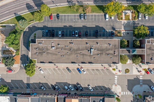
Property Detail
115 1St Ave E
Minneapolis-St. Paul-Bloomington, MN-WI
CITY OF SHAKOPEE LOT 001 BLOCK 003 P/O BLKS 3 & 4 & VACATED LEWIS &
27-001-034-0
SCOTT
Specialpurpose
Minnesota
B and X Area of moderate flood hazard, usually the area between the limits of the 100-year and 500-year floods.
1
2025
2.12 AC
2025
Scott Far Western Suburbs
080400
Minneapolis/St Paul
30,052 SF
NEARBY LISTINGS FOR SALE OR LEASE
-
-
View all Shakopee listings for sale on LoopNet.com
DEMOGRAPHICS near 115 1St Ave E
1 mile
3 mile
5 mile
2025 Total Population
7,395
44,914
102,094
2030 Population
7,558
46,273
104,809
Pop Growth 2025-2030
+ 2.20%
+ 3.03%
+ 2.66%
Average Age
40
38
39
2025 Total Households
2,822
15,704
37,230
HH Growth 2025-2030
+ 2.52%
+ 3.18%
+ 2.78%
Median Household Inc
$66,483
$103,240
$114,962
Avg Household Size
2.30
2.70
2.70
2025 Avg HH Vehicles
2.00
2.00
2.00
Median Home Value
$303,619
$377,924
$422,330
Median Year Built
1976
1996
1995
Nearby Places
Map Layers
Map Styles
 Street
 Aerial
Layers
 Traffic
 Biking
Places
Listings with unknown addresses are not visible on the map
- Restaurants
- Banks
- Shops
- Fitness
- Groceries
PUBLIC TRANSPORTATION
AIRPORT
Minneapolis-St Paul International/Wold-Chamberlain
Drive
Walk
Distance
Minneapolis-St Paul International/Wold-Chamberlain
31 min
21.3 mi
Freight Ports
Port Milwaukee
Drive
Walk
Distance
Port Milwaukee
400 min
358.5 mi
Nearby Properties
Address
Land Use
TOTAL SIZE
Lot Size
Zoning
Address
Land Use
TOTAL SIZE
Lot Size
Zoning
625,426 SF
40.47 AC
Address
Land Use
TOTAL SIZE
Lot Size
Zoning
66.08 AC
Address
Land Use
TOTAL SIZE
Lot Size
Zoning
475,471 SF
12.90 AC
Address
Land Use
TOTAL SIZE
Lot Size
Zoning
10.02 AC
Address
Land Use
TOTAL SIZE
Lot Size
Zoning
151,074 SF
17.27 AC
Address
Land Use
TOTAL SIZE
Lot Size
Zoning
33.02 AC
Address
Land Use
TOTAL SIZE
Lot Size
Zoning
Address
Land Use
TOTAL SIZE
Lot Size
Zoning
600,000 SF
31.21 AC
Address
Land Use
TOTAL SIZE
Lot Size
Zoning
397,347 SF
28.62 AC
Address
Land Use
TOTAL SIZE
Lot Size
Zoning
374,700 SF
24.09 AC
Address
Land Use
TOTAL SIZE
Lot Size
Zoning
16.08 AC
Address
Land Use
TOTAL SIZE
Lot Size
Zoning
Address
Land Use
TOTAL SIZE
Lot Size
Zoning
51,272 SF
2.11 AC
Address
Land Use
TOTAL SIZE
Lot Size
Zoning
1.80 AC
Address
Land Use
TOTAL SIZE
Lot Size
Zoning
164,809 SF
7.28 AC
Address
Land Use
TOTAL SIZE
Lot Size
Zoning
198,754 SF
27.50 AC
Address
Land Use
TOTAL SIZE
Lot Size
Zoning
52,280 SF
12.15 AC
Address
Land Use
TOTAL SIZE
Lot Size
Zoning
302,500 SF
23.79 AC
Address
Land Use
TOTAL SIZE
Lot Size
Zoning
Address
Land Use
TOTAL SIZE
Lot Size
Zoning
26.05 AC
Address
Land Use
TOTAL SIZE
Lot Size
Zoning
191,395 SF
5.16 AC
Address
Land Use
TOTAL SIZE
Lot Size
Zoning
73,937 SF
23.89 AC
Address
Land Use
TOTAL SIZE
Lot Size
Zoning
109,720 SF
10.65 AC
Address
Land Use
TOTAL SIZE
Lot Size
Zoning
242,004 SF
16.54 AC
Address
Land Use
TOTAL SIZE
Lot Size
Zoning
231,842 SF
21.61 AC
Address
Land Use
TOTAL SIZE
Lot Size
Zoning
138,865 SF
12.55 AC
Address
Land Use
TOTAL SIZE
Lot Size
Zoning
131,154 SF
21.76 AC
Address
Land Use
TOTAL SIZE
Lot Size
Zoning
39.80 AC
Address
Land Use
TOTAL SIZE
Lot Size
Zoning
176,648 SF
12.97 AC
Address
Land Use
TOTAL SIZE
Lot Size
Zoning
79,582 SF
4.86 AC
The World's #1 Commercial Real Estate Marketplace
Connect with us
© 2026 CoStar Group
The information above has been obtained from sources believed reliable. While we do not doubt its accuracy we have not verified it and make no guarantee, warranty or representation about it. It is your responsibility to independently confirm its accuracy and completeness. Any projections, opinions, assumptions, or estimates used are for example only and do not represent the current or future performance of the property. The value of this transaction to you depends on tax and other factors which should be evaluated by your tax, financial, and legal advisors. You and your advisors should conduct a careful, independent investigation of the property to determine to your satisfaction the suitability of the property for your needs.