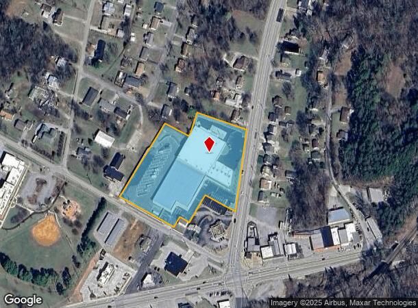
Property Record
115 Browns Ferry Rd, Chattanooga, TN 37419


NEARBY LISTINGS FOR SALE OR LEASE
Property Detail
115 Browns Ferry Rd
Chattanooga, TN-GA
Tiftonia Sec No 2
154C-A-011
LT 1 WESTSIDE LAND COMPANIES SECTION NO 2 OF TIFTONIA PB 13 PG 14 REV 43-56 REV 116-5
Publicstorage
Hamilton
X
Tennessee
47065C0338G
1
2025
4.45 AC
2025
South
012100
Chattanooga
77,937 SF
DEMOGRAPHICS near 115 Browns Ferry Rd
1 Mile
3 Mile
5 Mile
2024 Total Population
2,090
12,574
57,734
2029 Population
2,226
13,465
62,180
Pop Growth 2024-2029
+ 6.51%
+ 7.09%
+ 7.70%
Average Age
42
42
37
2024 Total Households
911
5,360
24,908
HH Growth 2024-2029
+ 6.59%
+ 7.22%
+ 8.35%
Median Household Inc
$62,329
$73,029
$52,491
Avg Household Size
2.30
2.30
2.10
2024 Avg HH Vehicles
2.00
2.00
2.00
Median Home Value
$237,410
$299,053
$290,048
Median Year Built
1974
1968
1976
Nearby Places
Map Layers
Map Styles
 Street
 Aerial
- Restaurants
- Banks
- Shops
- Fitness
- Groceries
PUBLIC TRANSPORTATION
AIRPORT
Lovell Field
DRIVE
WALK
Distance
Lovell Field
23 min
13.0 mi
Freight Ports
Georgia Ports - Savannah
DRIVE
WALK
Distance
Georgia Ports - Savannah
413 min
368.2 mi
Nearby Properties
Address
Land Use
TOTAL SIZE
Lot Size
Zoning
Address
Land Use
TOTAL SIZE
Lot Size
Zoning
182,932 SF
3.67 AC
M1
Address
Land Use
TOTAL SIZE
Lot Size
Zoning
288,371 SF
9.39 AC
Address
Land Use
TOTAL SIZE
Lot Size
Zoning
Address
Land Use
TOTAL SIZE
Lot Size
Zoning
521,245 SF
49.45 AC
M1
Address
Land Use
TOTAL SIZE
Lot Size
Zoning
529,308 SF
64.30 AC
M2
Address
Land Use
TOTAL SIZE
Lot Size
Zoning
377.86 AC
Address
Land Use
TOTAL SIZE
Lot Size
Zoning
56,000 SF
5.13 AC
M1
Address
Land Use
TOTAL SIZE
Lot Size
Zoning
86.41 AC
R2
Address
Land Use
TOTAL SIZE
Lot Size
Zoning
245,089 SF
46 AC
Address
Land Use
TOTAL SIZE
Lot Size
Zoning
103,396 SF
3.87 AC
Address
Land Use
TOTAL SIZE
Lot Size
Zoning
423,958 SF
15.20 AC
M1
Address
Land Use
TOTAL SIZE
Lot Size
Zoning
202,748 SF
25.49 AC
M3
Address
Land Use
TOTAL SIZE
Lot Size
Zoning
211,150 SF
40.70 AC
C2
Address
Land Use
TOTAL SIZE
Lot Size
Zoning
326.10 AC
Address
Land Use
TOTAL SIZE
Lot Size
Zoning
1.61 AC
R2
Address
Land Use
TOTAL SIZE
Lot Size
Zoning
725 AC
R1
Address
Land Use
TOTAL SIZE
Lot Size
Zoning
Address
Land Use
TOTAL SIZE
Lot Size
Zoning
428,595 SF
16.66 AC
M1
Address
Land Use
TOTAL SIZE
Lot Size
Zoning
14,801 SF
105 AC
M1
Address
Land Use
TOTAL SIZE
Lot Size
Zoning
110,809 SF
106.53 AC
M1
Address
Land Use
TOTAL SIZE
Lot Size
Zoning
53.45 AC
Address
Land Use
TOTAL SIZE
Lot Size
Zoning
920 SF
281 AC
Address
Land Use
TOTAL SIZE
Lot Size
Zoning
172,053 SF
8.07 AC
M1
Address
Land Use
TOTAL SIZE
Lot Size
Zoning
183.66 AC
Address
Land Use
TOTAL SIZE
Lot Size
Zoning
37,044 SF
3.88 AC
UGC
Address
Land Use
TOTAL SIZE
Lot Size
Zoning
265,799 SF
17.52 AC
Address
Land Use
TOTAL SIZE
Lot Size
Zoning
Address
Land Use
TOTAL SIZE
Lot Size
Zoning
120,648 SF
10.86 AC
Address
Land Use
TOTAL SIZE
Lot Size
Zoning
27,000 SF
2.65 AC
UGC
The World's #1 Commercial Real Estate Marketplace
Connect with us
© 2026 CoStar Group
The information above has been obtained from sources believed reliable. While we do not doubt its accuracy we have not verified it and make no guarantee, warranty or representation about it. It is your responsibility to independently confirm its accuracy and completeness. Any projections, opinions, assumptions, or estimates used are for example only and do not represent the current or future performance of the property. The value of this transaction to you depends on tax and other factors which should be evaluated by your tax, financial, and legal advisors. You and your advisors should conduct a careful, independent investigation of the property to determine to your satisfaction the suitability of the property for your needs.