Property Record
115 Bypass 28, Derry, NH 03038


Save to a Folder
{{folder.Name}}
{{folder.ListingIds.length}} Properties
{{folder.ListingIds.length}} Property
Create a New Folder
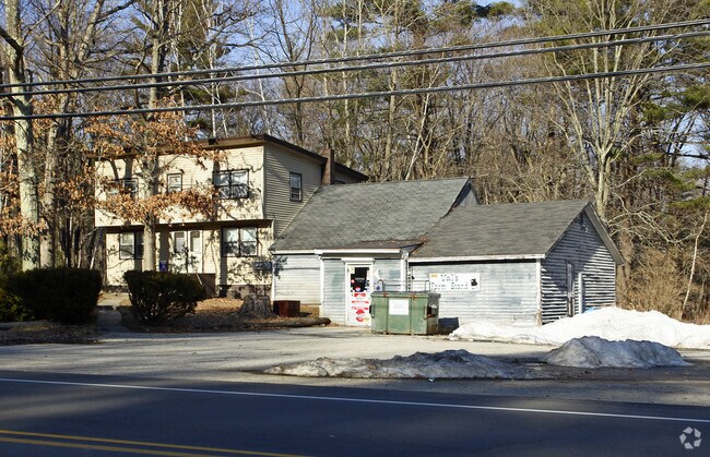
Property Detail
115 Bypass 28
Commercialnec
Rockingham
MDR
New Hampshire
B and X Area of moderate flood hazard, usually the area between the limits of the 100-year and 500-year floods.
2.53 AC
2025
Rockingham
2025
Boston
003302
Boston-Cambridge-Newton, MA-NH
4,205 SF
DERY-000008-000000-000160
NEARBY LISTINGS FOR SALE OR LEASE
DEMOGRAPHICS near 115 Bypass 28
1 mile
3 mile
5 mile
2025 Total Population
2,757
25,037
55,046
2030 Population
2,775
25,282
55,623
Pop Growth 2025-2030
+ 0.65%
+ 0.98%
+ 1.05%
Average Age
41
41
41
2025 Total Households
1,053
10,145
21,335
HH Growth 2025-2030
+ 0.47%
+ 0.81%
+ 0.96%
Median Household Inc
$114,915
$96,711
$110,587
Avg Household Size
2.60
2.40
2.50
2025 Avg HH Vehicles
2.00
2.00
2.00
Median Home Value
$442,857
$435,687
$454,608
Median Year Built
1979
1980
1982
Nearby Places
Map Layers
Map Styles
 Street
 Aerial
Layers
 Traffic
 Biking
Places
Listings with unknown addresses are not visible on the map
- Restaurants
- Banks
- Shops
- Fitness
- Groceries
PUBLIC TRANSPORTATION
AIRPORT
Manchester Boston Regional
Drive
Walk
Distance
Manchester Boston Regional
23 min
9.7 mi
Portsmouth International at Pease
Drive
Walk
Distance
Portsmouth International at Pease
67 min
44.7 mi
Nearby Properties
Address
Land Use
TOTAL SIZE
Lot Size
Zoning
Address
Land Use
TOTAL SIZE
Lot Size
Zoning
43.88 AC
MHDR
Address
Land Use
TOTAL SIZE
Lot Size
Zoning
15.44 AC
AR-I
Address
Land Use
TOTAL SIZE
Lot Size
Zoning
1,710 SF
65 AC
AR-I
Address
Land Use
TOTAL SIZE
Lot Size
Zoning
366,008 SF
41.69 AC
IND-I
Address
Land Use
TOTAL SIZE
Lot Size
Zoning
146,407 SF
15.39 AC
OMB
Address
Land Use
TOTAL SIZE
Lot Size
Zoning
40.50 AC
MDR
Address
Land Use
TOTAL SIZE
Lot Size
Zoning
487,970 SF
79.74 AC
IND-I
Address
Land Use
TOTAL SIZE
Lot Size
Zoning
12.94 AC
MFR
Address
Land Use
TOTAL SIZE
Lot Size
Zoning
23.03 AC
GC
Address
Land Use
TOTAL SIZE
Lot Size
Zoning
166,979 SF
22.08 AC
MHDR
Address
Land Use
TOTAL SIZE
Lot Size
Zoning
117,412 SF
12.86 AC
C-II
Address
Land Use
TOTAL SIZE
Lot Size
Zoning
33.45 AC
IND4
Address
Land Use
TOTAL SIZE
Lot Size
Zoning
154,551 SF
55.80 AC
IND4
Address
Land Use
TOTAL SIZE
Lot Size
Zoning
6 AC
RURAL
Address
Land Use
TOTAL SIZE
Lot Size
Zoning
86,168 SF
17 AC
MDR
Address
Land Use
TOTAL SIZE
Lot Size
Zoning
79,447 SF
6.83 AC
GC2
Address
Land Use
TOTAL SIZE
Lot Size
Zoning
69,266 SF
6.02 AC
MHDR
Address
Land Use
TOTAL SIZE
Lot Size
Zoning
125,060 SF
8.76 AC
IND-I
Address
Land Use
TOTAL SIZE
Lot Size
Zoning
16.50 AC
C-II
Address
Land Use
TOTAL SIZE
Lot Size
Zoning
121,108 SF
14.89 AC
IND2
Address
Land Use
TOTAL SIZE
Lot Size
Zoning
3.09 AC
IND4
Address
Land Use
TOTAL SIZE
Lot Size
Zoning
2.73 AC
IND4
Address
Land Use
TOTAL SIZE
Lot Size
Zoning
2.21 AC
GC
Address
Land Use
TOTAL SIZE
Lot Size
Zoning
4.10 AC
MFR
Address
Land Use
TOTAL SIZE
Lot Size
Zoning
9.18 AC
IND4
Address
Land Use
TOTAL SIZE
Lot Size
Zoning
4.14 AC
MFR
Address
Land Use
TOTAL SIZE
Lot Size
Zoning
4 AC
MFR
Address
Land Use
TOTAL SIZE
Lot Size
Zoning
54,940 SF
3.78 AC
MHDR
Address
Land Use
TOTAL SIZE
Lot Size
Zoning
25,946 SF
3.47 AC
GC2
Address
Land Use
TOTAL SIZE
Lot Size
Zoning
952 SF
199 AC
AR-I
The World's #1 Commercial Real Estate Marketplace
Connect with us
© 2026 CoStar Group
The information above has been obtained from sources believed reliable. While we do not doubt its accuracy we have not verified it and make no guarantee, warranty or representation about it. It is your responsibility to independently confirm its accuracy and completeness. Any projections, opinions, assumptions, or estimates used are for example only and do not represent the current or future performance of the property. The value of this transaction to you depends on tax and other factors which should be evaluated by your tax, financial, and legal advisors. You and your advisors should conduct a careful, independent investigation of the property to determine to your satisfaction the suitability of the property for your needs.