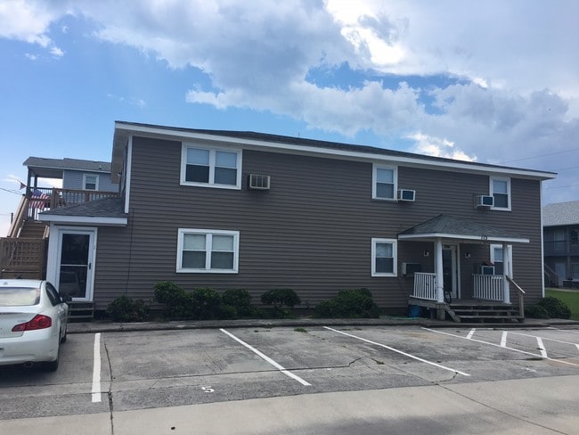
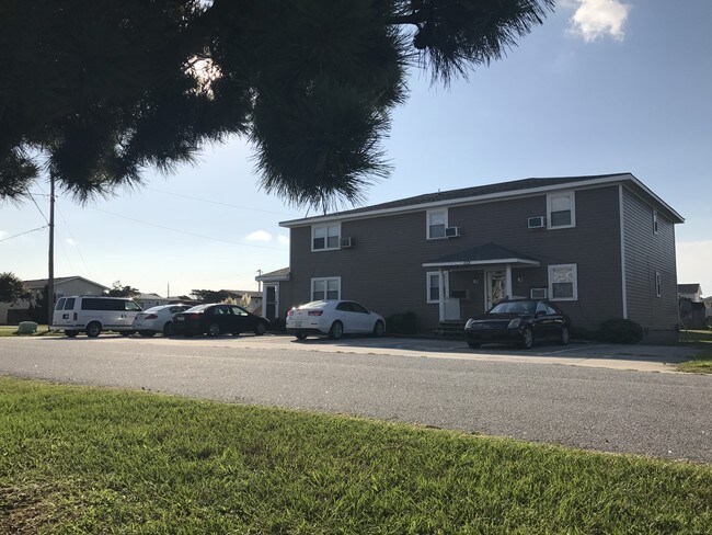
Property Record
115 E Sothel St, Kill Devil Hills, NC 27948
NEARBY LISTINGS FOR SALE OR LEASE
-
-
View all Kill Devil Hills listings for sale on LoopNet.com
Property Detail
115 E Sothel St
002998000
Virginia Dare Shores
Gardenaptcourtapt5plusunits
LOT: 17-20 BLK: 18 SEC: PL: 1 SL: 188
X
Dare
3720988500K
North Carolina
2025
17-20
2025
0.23 AC
970200
Other Market Areas
3,714 SF
Kill Devil Hills, NC
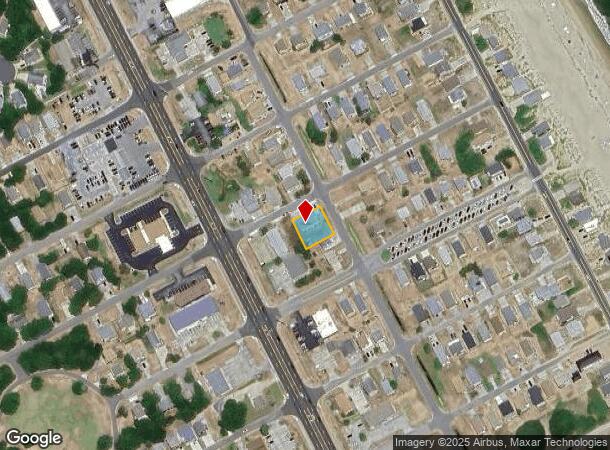
DEMOGRAPHICS near 115 E Sothel St
1 mile
3 mile
5 mile
2024 Total Population
3,717
11,706
19,803
2029 Population
4,122
12,845
21,685
Pop Growth 2024-2029
+ 10.90%
+ 9.73%
+ 9.50%
Average Age
44
44
45
2024 Total Households
1,697
5,065
8,483
HH Growth 2024-2029
+ 10.72%
+ 9.60%
+ 9.37%
Median Household Inc
$68,969
$69,958
$72,115
Avg Household Size
2.20
2.30
2.30
2024 Avg HH Vehicles
2.00
2.00
2.00
Median Home Value
$293,618
$318,906
$338,137
Median Year Built
1983
1985
1985
Nearby Places
Map Layers
Map Styles
 Street
 Aerial
Transit
 Traffic
 Biking
Places
Listings with unknown addresses are not visible on the map
- Restaurants
- Banks
- Shops
- Fitness
- Groceries
SALE & LEASE HISTORY
LISTING DATE
SALE/LEASE

Sep 01, 2017
For Sale
Nearby Properties
Address
Land Use
TOTAL SIZE
Lot Size
Zoning
Address
Land Use
TOTAL SIZE
Lot Size
Zoning
9,904 SF
403.08 AC
Address
Land Use
TOTAL SIZE
Lot Size
Zoning
140,367 SF
21.39 AC
Address
Land Use
TOTAL SIZE
Lot Size
Zoning
44,278 SF
4.70 AC
Address
Land Use
TOTAL SIZE
Lot Size
Zoning
37,116 SF
2.09 AC
Address
Land Use
TOTAL SIZE
Lot Size
Zoning
45,168 SF
7.62 AC
Address
Land Use
TOTAL SIZE
Lot Size
Zoning
84,383 SF
3.29 AC
Address
Land Use
TOTAL SIZE
Lot Size
Zoning
3,588 SF
11.67 AC
Address
Land Use
TOTAL SIZE
Lot Size
Zoning
Address
Land Use
TOTAL SIZE
Lot Size
Zoning
121,232 SF
12.71 AC
Address
Land Use
TOTAL SIZE
Lot Size
Zoning
Address
Land Use
TOTAL SIZE
Lot Size
Zoning
Address
Land Use
TOTAL SIZE
Lot Size
Zoning
108,315 SF
12.55 AC
Address
Land Use
TOTAL SIZE
Lot Size
Zoning
25,248 SF
23.32 AC
Address
Land Use
TOTAL SIZE
Lot Size
Zoning
40,576 SF
3.71 AC
Address
Land Use
TOTAL SIZE
Lot Size
Zoning
24,745 SF
3.31 AC
Address
Land Use
TOTAL SIZE
Lot Size
Zoning
Address
Land Use
TOTAL SIZE
Lot Size
Zoning
Address
Land Use
TOTAL SIZE
Lot Size
Zoning
Address
Land Use
TOTAL SIZE
Lot Size
Zoning
9,072 SF
1.38 AC
Address
Land Use
TOTAL SIZE
Lot Size
Zoning
46,031 SF
5.07 AC
Address
Land Use
TOTAL SIZE
Lot Size
Zoning
3,460 SF
24.75 AC
Address
Land Use
TOTAL SIZE
Lot Size
Zoning
53,153 SF
4 AC
Address
Land Use
TOTAL SIZE
Lot Size
Zoning
19,827 SF
0.96 AC
Address
Land Use
TOTAL SIZE
Lot Size
Zoning
119,104 SF
0.14 AC
Address
Land Use
TOTAL SIZE
Lot Size
Zoning
45,876 SF
2.17 AC
Address
Land Use
TOTAL SIZE
Lot Size
Zoning
12,480 SF
8.59 AC
Address
Land Use
TOTAL SIZE
Lot Size
Zoning
34,416 SF
7.74 AC
Address
Land Use
TOTAL SIZE
Lot Size
Zoning
14.30 AC
Address
Land Use
TOTAL SIZE
Lot Size
Zoning
24,878 SF
8.26 AC
Address
Land Use
TOTAL SIZE
Lot Size
Zoning
5,468 SF
2.61 AC
The World's #1 Commercial Real Estate Marketplace
Connect with us
© 2026 CoStar Group
The information above has been obtained from sources believed reliable. While we do not doubt its accuracy we have not verified it and make no guarantee, warranty or representation about it. It is your responsibility to independently confirm its accuracy and completeness. Any projections, opinions, assumptions, or estimates used are for example only and do not represent the current or future performance of the property. The value of this transaction to you depends on tax and other factors which should be evaluated by your tax, financial, and legal advisors. You and your advisors should conduct a careful, independent investigation of the property to determine to your satisfaction the suitability of the property for your needs.