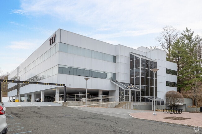
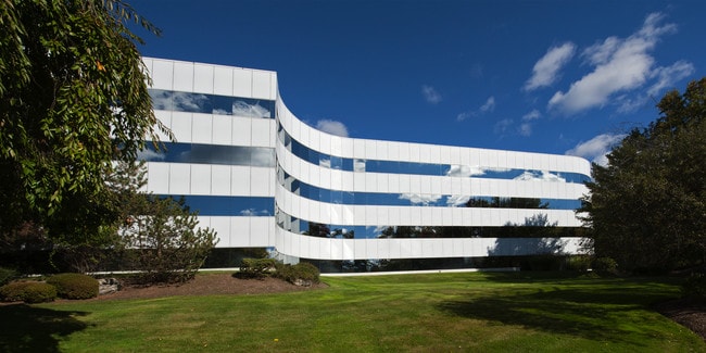
Property Record
115 E Stevens Ave E, Valhalla, NY 10595

Current Lease Availabilities
Property Detail
115 E Stevens Ave E
3489-112-019-00001-005-0000
WESTCHESTER
Officebuilding
New York
B and X Area of moderate flood hazard, usually the area between the limits of the 100-year and 500-year floods.
5.000
2025
5 AC
2024
West I-287 Corridor
012101
Westchester/So Connecticut
159,696 SF
New York-Jersey City-White Plains, NY-NJ
NEARBY LISTINGS FOR SALE OR LEASE
DEMOGRAPHICS near 115 E Stevens Ave E
1 mile
3 mile
5 mile
2024 Total Population
3,435
34,860
144,321
2029 Population
3,428
35,021
146,382
Pop Growth 2024-2029
(0.20%)
+ 0.46%
+ 1.43%
Average Age
43
41
42
2024 Total Households
1,152
11,304
53,303
HH Growth 2024-2029
(0.35%)
+ 0.34%
+ 1.51%
Median Household Inc
$134,234
$148,225
$130,344
Avg Household Size
2.90
2.80
2.60
2024 Avg HH Vehicles
2.00
2.00
2.00
Median Home Value
$748,593
$761,072
$741,047
Median Year Built
1957
1958
1963
Nearby Places
Map Layers
Map Styles
 Street
 Aerial
Transit
 Traffic
 Biking
Places
Listings with unknown addresses are not visible on the map
- Restaurants
- Banks
- Shops
- Fitness
- Groceries
PUBLIC TRANSPORTATION
COMMUTER RAIL
Mount Pleasant Station (Harlem Line - Metro-North Commuter Railroad Company (Metro-North))
Drive
Walk
Distance
Mount Pleasant Station (Harlem Line - Metro-North Commuter Railroad Company (Metro-North))
5 min
4 min
0.2 mi
Hawthorne Station (Harlem Line - Metro-North Commuter Railroad Company (Metro-North))
Drive
Walk
Distance
Hawthorne Station (Harlem Line - Metro-North Commuter Railroad Company (Metro-North))
6 min
2.1 mi
AIRPORT
Westchester County
Drive
Walk
Distance
Westchester County
19 min
8.4 mi
LaGuardia
Drive
Walk
Distance
LaGuardia
44 min
31.8 mi
Freight Ports
NY - Red Hook Container Terminal
Drive
Walk
Distance
NY - Red Hook Container Terminal
1 min
31.0 mi
Nearby Properties
Address
Land Use
TOTAL SIZE
Lot Size
Zoning
Address
Land Use
TOTAL SIZE
Lot Size
Zoning
358.83 AC
Address
Land Use
TOTAL SIZE
Lot Size
Zoning
29.42 AC
PUD
Address
Land Use
TOTAL SIZE
Lot Size
Zoning
39.83 AC
Address
Land Use
TOTAL SIZE
Lot Size
Zoning
50,000 SF
9.02 AC
PD
Address
Land Use
TOTAL SIZE
Lot Size
Zoning
29.14 AC
PUD
Address
Land Use
TOTAL SIZE
Lot Size
Zoning
3.56 AC
PD
Address
Land Use
TOTAL SIZE
Lot Size
Zoning
5.43 AC
R-40
Address
Land Use
TOTAL SIZE
Lot Size
Zoning
196,901 SF
4.76 AC
PD
Address
Land Use
TOTAL SIZE
Lot Size
Zoning
98,800 SF
6.83 AC
PD
Address
Land Use
TOTAL SIZE
Lot Size
Zoning
93,500 SF
7.19 AC
PD
Address
Land Use
TOTAL SIZE
Lot Size
Zoning
67.38 AC
R-20
Address
Land Use
TOTAL SIZE
Lot Size
Zoning
94,000 SF
4.69 AC
PD
Address
Land Use
TOTAL SIZE
Lot Size
Zoning
Address
Land Use
TOTAL SIZE
Lot Size
Zoning
25,000 SF
6.37 AC
PD
Address
Land Use
TOTAL SIZE
Lot Size
Zoning
80,000 SF
3.66 AC
PD
Address
Land Use
TOTAL SIZE
Lot Size
Zoning
8.36 AC
Address
Land Use
TOTAL SIZE
Lot Size
Zoning
1,404 SF
5.46 AC
IB
Address
Land Use
TOTAL SIZE
Lot Size
Zoning
92,000 SF
7.33 AC
PD
Address
Land Use
TOTAL SIZE
Lot Size
Zoning
87,114 SF
4.89 AC
PD
Address
Land Use
TOTAL SIZE
Lot Size
Zoning
41,600 SF
5.42 AC
PD
Address
Land Use
TOTAL SIZE
Lot Size
Zoning
Address
Land Use
TOTAL SIZE
Lot Size
Zoning
82,000 SF
3.46 AC
PD
Address
Land Use
TOTAL SIZE
Lot Size
Zoning
107,500 SF
4.59 AC
PD
Address
Land Use
TOTAL SIZE
Lot Size
Zoning
61,700 SF
2.94 AC
PD
Address
Land Use
TOTAL SIZE
Lot Size
Zoning
60,000 SF
2.51 AC
PD
Address
Land Use
TOTAL SIZE
Lot Size
Zoning
13,786 SF
88.05 AC
Address
Land Use
TOTAL SIZE
Lot Size
Zoning
74,900 SF
4.10 AC
PD
Address
Land Use
TOTAL SIZE
Lot Size
Zoning
67,200 SF
3.64 AC
PD
Address
Land Use
TOTAL SIZE
Lot Size
Zoning
2.05 AC
R-40
Address
Land Use
TOTAL SIZE
Lot Size
Zoning
5.99 AC
The World's #1 Commercial Real Estate Marketplace
Connect with us
© 2026 CoStar Group
The information above has been obtained from sources believed reliable. While we do not doubt its accuracy we have not verified it and make no guarantee, warranty or representation about it. It is your responsibility to independently confirm its accuracy and completeness. Any projections, opinions, assumptions, or estimates used are for example only and do not represent the current or future performance of the property. The value of this transaction to you depends on tax and other factors which should be evaluated by your tax, financial, and legal advisors. You and your advisors should conduct a careful, independent investigation of the property to determine to your satisfaction the suitability of the property for your needs.