Property Record
111 Magnolia Ave, Daytona Beach, FL 32114

NEARBY LISTINGS FOR SALE OR LEASE
Property Detail
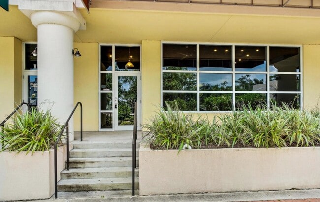
111 Magnolia Ave
Deltona-Daytona Beach-Ormond Beach, FL
Wall Street Lofts Condominium
5339-A9-00-1110
39-15-33 UNIT 115 WALL STREET LOFTS CONDOMINIUM PER OR 5762 PG 128 PER OR 5965 PG 1835 PER OR 5791 PGS 3678-3680
Officebuilding
Volusia
AE
Florida
12127C0359J
6
2025
0.03 AC
2026
Greater Daytona
082000
Deltona/Daytona Beach
1,388 SF
DEMOGRAPHICS near 111 Magnolia Ave
1 Mile
3 Mile
5 Mile
2024 Total Population
10,332
65,300
134,722
2029 Population
11,526
72,733
150,624
Pop Growth 2024-2029
+ 11.56%
+ 11.38%
+ 11.80%
Average Age
40
41
44
2024 Total Households
4,353
28,039
60,626
HH Growth 2024-2029
+ 12.13%
+ 11.95%
+ 12.36%
Median Household Inc
$28,027
$40,282
$44,590
Avg Household Size
1.90
2.10
2.00
2024 Avg HH Vehicles
1.00
1.00
1.00
Median Home Value
$173,522
$179,192
$191,000
Median Year Built
1968
1973
1978
Nearby Places
Map Layers
Map Styles
 Street
 Aerial
- Restaurants
- Banks
- Shops
- Fitness
- Groceries
PUBLIC TRANSPORTATION
AIRPORT
Daytona Beach International
DRIVE
WALK
Distance
Daytona Beach International
12 min
5.0 mi
Orlando Sanford International
DRIVE
WALK
Distance
Orlando Sanford International
60 min
43.8 mi
SALE & LEASE HISTORY
LISTING DATE
SALE/LEASE

May 26, 2020
For Sale
May 14, 2020
For Sale
Feb 24, 2020
For Lease
Nearby Properties
Address
Land Use
TOTAL SIZE
Lot Size
Zoning
Address
Land Use
TOTAL SIZE
Lot Size
Zoning
1,365,998 SF
13 AC
Address
Land Use
TOTAL SIZE
Lot Size
Zoning
1,842,969 SF
25.56 AC
Address
Land Use
TOTAL SIZE
Lot Size
Zoning
1,058,116 SF
54.22 AC
Address
Land Use
TOTAL SIZE
Lot Size
Zoning
664,082 SF
38.16 AC
02BA
Address
Land Use
TOTAL SIZE
Lot Size
Zoning
880,289 SF
4.98 AC
02T3
Address
Land Use
TOTAL SIZE
Lot Size
Zoning
Address
Land Use
TOTAL SIZE
Lot Size
Zoning
542,849 SF
1.56 AC
02T1
Address
Land Use
TOTAL SIZE
Lot Size
Zoning
472,750 SF
16.76 AC
Address
Land Use
TOTAL SIZE
Lot Size
Zoning
223,127 SF
14.47 AC
Address
Land Use
TOTAL SIZE
Lot Size
Zoning
353,548 SF
50.65 AC
Address
Land Use
TOTAL SIZE
Lot Size
Zoning
275,814 SF
13 AC
Address
Land Use
TOTAL SIZE
Lot Size
Zoning
Address
Land Use
TOTAL SIZE
Lot Size
Zoning
318,230 SF
21.28 AC
Address
Land Use
TOTAL SIZE
Lot Size
Zoning
300,038 SF
0.22 AC
Address
Land Use
TOTAL SIZE
Lot Size
Zoning
303,151 SF
13.58 AC
Address
Land Use
TOTAL SIZE
Lot Size
Zoning
269,133 SF
6.33 AC
Address
Land Use
TOTAL SIZE
Lot Size
Zoning
226,459 SF
0.57 AC
Address
Land Use
TOTAL SIZE
Lot Size
Zoning
243,418 SF
2.91 AC
02T1
Address
Land Use
TOTAL SIZE
Lot Size
Zoning
560,165 SF
37.79 AC
02BR2
Address
Land Use
TOTAL SIZE
Lot Size
Zoning
12,871 SF
0.20 AC
R4
Address
Land Use
TOTAL SIZE
Lot Size
Zoning
155,620 SF
1.81 AC
02T1
Address
Land Use
TOTAL SIZE
Lot Size
Zoning
5,774 SF
0.94 AC
B4
Address
Land Use
TOTAL SIZE
Lot Size
Zoning
153,293 SF
10.95 AC
Address
Land Use
TOTAL SIZE
Lot Size
Zoning
146,732 SF
2.12 AC
02T1
Address
Land Use
TOTAL SIZE
Lot Size
Zoning
105,866 SF
5.14 AC
Address
Land Use
TOTAL SIZE
Lot Size
Zoning
460,245 SF
2.92 AC
Address
Land Use
TOTAL SIZE
Lot Size
Zoning
259,453 SF
2.07 AC
Address
Land Use
TOTAL SIZE
Lot Size
Zoning
324,364 SF
11.59 AC
02RPUD
Address
Land Use
TOTAL SIZE
Lot Size
Zoning
209,027 SF
1.37 AC
03T
Address
Land Use
TOTAL SIZE
Lot Size
Zoning
92,927 SF
14.58 AC
The World's #1 Commercial Real Estate Marketplace
Connect with us
© 2026 CoStar Group
The information above has been obtained from sources believed reliable. While we do not doubt its accuracy we have not verified it and make no guarantee, warranty or representation about it. It is your responsibility to independently confirm its accuracy and completeness. Any projections, opinions, assumptions, or estimates used are for example only and do not represent the current or future performance of the property. The value of this transaction to you depends on tax and other factors which should be evaluated by your tax, financial, and legal advisors. You and your advisors should conduct a careful, independent investigation of the property to determine to your satisfaction the suitability of the property for your needs.