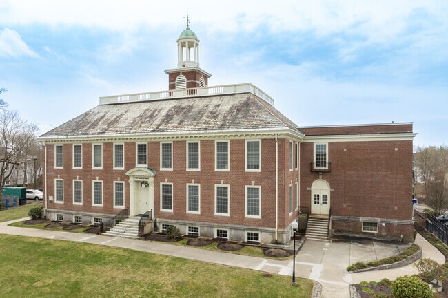
Property Record
115 Main St, North Easton, MA 02356


NEARBY LISTINGS FOR SALE OR LEASE
Property Detail
115 Main St
Officebuilding
Bristol
X
Massachusetts
25023C0175J
2.91 AC
2025
Attleboro/New Bedford
2025
Boston
600100
Providence-Warwick, RI-MA
32,915 SF
EAST-000017U-000072
DEMOGRAPHICS near 115 Main St
1 Mile
3 Mile
5 Mile
2024 Total Population
6,209
29,146
135,567
2029 Population
6,130
29,025
134,049
Pop Growth 2024-2029
(1.27%)
(0.42%)
(1.12%)
Average Age
37
41
40
2024 Total Households
1,807
9,737
46,992
HH Growth 2024-2029
(0.77%)
(0.32%)
(1.13%)
Median Household Inc
$99,906
$116,121
$90,270
Avg Household Size
2.50
2.70
2.70
2024 Avg HH Vehicles
2.00
2.00
2.00
Median Home Value
$497,625
$486,413
$457,605
Median Year Built
1962
1972
1965
Nearby Places
Map Layers
Map Styles
 Street
 Aerial
- Restaurants
- Banks
- Shops
- Fitness
- Groceries
PUBLIC TRANSPORTATION
COMMUTER RAIL
Brockton (Middleborough/Lakeville Line - Massachusetts Bay Transportation Authority Commuter Rail (Purple Line))
DRIVE
WALK
Distance
Brockton (Middleborough/Lakeville Line - Massachusetts Bay Transportation Authority Commuter Rail (Purple Line))
10 min
4.9 mi
Stoughton (Providence/Stoughton Line - Massachusetts Bay Transportation Authority Commuter Rail (Purple Line))
DRIVE
WALK
Distance
Stoughton (Providence/Stoughton Line - Massachusetts Bay Transportation Authority Commuter Rail (Purple Line))
9 min
5.1 mi
AIRPORT
General Edward Lawrence Logan International
DRIVE
WALK
Distance
General Edward Lawrence Logan International
43 min
28.5 mi
Rhode Island Tf Green International
DRIVE
WALK
Distance
Rhode Island Tf Green International
63 min
38.9 mi
Freight Ports
Port of Boston
DRIVE
WALK
Distance
Port of Boston
41 min
26.3 mi
SALE & LEASE HISTORY
LISTING DATE
SALE/LEASE

Jun 14, 2017
For Lease
Nearby Properties
Address
Land Use
TOTAL SIZE
Lot Size
Zoning
Address
Land Use
TOTAL SIZE
Lot Size
Zoning
Address
Land Use
TOTAL SIZE
Lot Size
Zoning
1,352 SF
66.81 AC
R1B
Address
Land Use
TOTAL SIZE
Lot Size
Zoning
22.56 AC
Address
Land Use
TOTAL SIZE
Lot Size
Zoning
270,179 SF
51 AC
Address
Land Use
TOTAL SIZE
Lot Size
Zoning
1,660 SF
31.95 AC
R1B
Address
Land Use
TOTAL SIZE
Lot Size
Zoning
97,262 SF
6.46 AC
Address
Land Use
TOTAL SIZE
Lot Size
Zoning
254,946 SF
11.22 AC
R2
Address
Land Use
TOTAL SIZE
Lot Size
Zoning
210,600 SF
19.86 AC
Address
Land Use
TOTAL SIZE
Lot Size
Zoning
1,576 SF
5.83 AC
C5
Address
Land Use
TOTAL SIZE
Lot Size
Zoning
2,574 SF
7.96 AC
I1
Address
Land Use
TOTAL SIZE
Lot Size
Zoning
211,030 SF
19.27 AC
Address
Land Use
TOTAL SIZE
Lot Size
Zoning
3,750 SF
80.39 AC
R1B
Address
Land Use
TOTAL SIZE
Lot Size
Zoning
103,765 SF
19.83 AC
Address
Land Use
TOTAL SIZE
Lot Size
Zoning
79,132 SF
21.54 AC
Address
Land Use
TOTAL SIZE
Lot Size
Zoning
1,374 SF
7.82 AC
C2
Address
Land Use
TOTAL SIZE
Lot Size
Zoning
79,958 SF
2.90 AC
Address
Land Use
TOTAL SIZE
Lot Size
Zoning
105,816 SF
5.80 AC
C5
Address
Land Use
TOTAL SIZE
Lot Size
Zoning
7.50 AC
Address
Land Use
TOTAL SIZE
Lot Size
Zoning
317 AC
Address
Land Use
TOTAL SIZE
Lot Size
Zoning
48,277 SF
2.59 AC
Address
Land Use
TOTAL SIZE
Lot Size
Zoning
22.92 AC
RC
Address
Land Use
TOTAL SIZE
Lot Size
Zoning
40,520 SF
2.99 AC
Address
Land Use
TOTAL SIZE
Lot Size
Zoning
3,891 SF
7.19 AC
I1
Address
Land Use
TOTAL SIZE
Lot Size
Zoning
773.37 AC
Address
Land Use
TOTAL SIZE
Lot Size
Zoning
13.80 AC
I1
Address
Land Use
TOTAL SIZE
Lot Size
Zoning
103.60 AC
R1B
Address
Land Use
TOTAL SIZE
Lot Size
Zoning
40,755 SF
2.62 AC
Address
Land Use
TOTAL SIZE
Lot Size
Zoning
1,666 SF
22.18 AC
I1
Address
Land Use
TOTAL SIZE
Lot Size
Zoning
1,904 SF
13.88 AC
R1B
Address
Land Use
TOTAL SIZE
Lot Size
Zoning
78,890 SF
15.27 AC
The World's #1 Commercial Real Estate Marketplace
Connect with us
© 2025 CoStar Group
The information above has been obtained from sources believed reliable. While we do not doubt its accuracy we have not verified it and make no guarantee, warranty or representation about it. It is your responsibility to independently confirm its accuracy and completeness. Any projections, opinions, assumptions, or estimates used are for example only and do not represent the current or future performance of the property. The value of this transaction to you depends on tax and other factors which should be evaluated by your tax, financial, and legal advisors. You and your advisors should conduct a careful, independent investigation of the property to determine to your satisfaction the suitability of the property for your needs.