Property Record
115 Meyer St, Taft, TX 78390


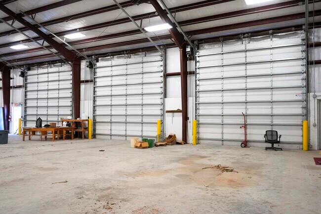
Property Detail
115 Meyer St
62257
TR C 142X143.57 ABST. 135 JOH N GIBBS SUR 0.46 ACRES
Commercialnec
SAN PATRICIO
B and X Area of moderate flood hazard, usually the area between the limits of the 100-year and 500-year floods.
Texas
2024
0.46 AC
2025
West San Patricio Cnty
010800
Corpus Christi
9,712 SF
Corpus Christi, TX
NEARBY LISTINGS FOR SALE OR LEASE
-
-
View all Taft listings for sale on LoopNet.com
DEMOGRAPHICS near 115 Meyer St
1 mile
3 mile
5 mile
2025 Total Population
3,631
4,587
4,894
2030 Population
3,759
4,751
5,063
Pop Growth 2025-2030
+ 3.53%
+ 3.58%
+ 3.45%
Average Age
39
39
39
2025 Total Households
1,241
1,558
1,669
HH Growth 2025-2030
+ 3.38%
+ 3.40%
+ 3.30%
Median Household Inc
$61,586
$58,778
$60,592
Avg Household Size
2.80
2.80
2.80
2025 Avg HH Vehicles
2.00
2.00
2.00
Median Home Value
$121,826
$117,520
$122,295
Median Year Built
1969
1969
1969
Nearby Places
Map Layers
Map Styles
 Street
 Aerial
Transit
 Traffic
 Biking
Places
Listings with unknown addresses are not visible on the map
- Restaurants
- Banks
- Shops
- Fitness
- Groceries
PUBLIC TRANSPORTATION
AIRPORT
Corpus Christi International
Drive
Walk
Distance
Corpus Christi International
34 min
26.3 mi
Freight Ports
Port of Corpus Christi
Drive
Walk
Distance
Port of Corpus Christi
22 min
18.3 mi
SALE & LEASE HISTORY
LISTING DATE
SALE/LEASE

Mar 24, 2022
For Sale
Nearby Properties
Address
Land Use
TOTAL SIZE
Lot Size
Zoning
Address
Land Use
TOTAL SIZE
Lot Size
Zoning
48,400 SF
9 AC
Address
Land Use
TOTAL SIZE
Lot Size
Zoning
721 SF
4 AC
Address
Land Use
TOTAL SIZE
Lot Size
Zoning
36,929 SF
2.68 AC
Address
Land Use
TOTAL SIZE
Lot Size
Zoning
40,488 SF
12.93 AC
Address
Land Use
TOTAL SIZE
Lot Size
Zoning
13,929 SF
1.89 AC
Address
Land Use
TOTAL SIZE
Lot Size
Zoning
14,827 SF
1.21 AC
Address
Land Use
TOTAL SIZE
Lot Size
Zoning
12,496 SF
5.58 AC
Address
Land Use
TOTAL SIZE
Lot Size
Zoning
11,842 SF
1.03 AC
Address
Land Use
TOTAL SIZE
Lot Size
Zoning
48,112 SF
3.56 AC
Address
Land Use
TOTAL SIZE
Lot Size
Zoning
12.55 AC
Address
Land Use
TOTAL SIZE
Lot Size
Zoning
33,888 SF
3.98 AC
Address
Land Use
TOTAL SIZE
Lot Size
Zoning
15,336 SF
1.17 AC
Address
Land Use
TOTAL SIZE
Lot Size
Zoning
10,711 SF
1 AC
Address
Land Use
TOTAL SIZE
Lot Size
Zoning
4,800 SF
3.69 AC
Address
Land Use
TOTAL SIZE
Lot Size
Zoning
15,365 SF
1.17 AC
Address
Land Use
TOTAL SIZE
Lot Size
Zoning
8,886 SF
1.50 AC
Address
Land Use
TOTAL SIZE
Lot Size
Zoning
14,112 SF
0.96 AC
Address
Land Use
TOTAL SIZE
Lot Size
Zoning
2,304 SF
11.36 AC
Address
Land Use
TOTAL SIZE
Lot Size
Zoning
12,800 SF
1.58 AC
Address
Land Use
TOTAL SIZE
Lot Size
Zoning
15,576 SF
1.10 AC
Address
Land Use
TOTAL SIZE
Lot Size
Zoning
416 SF
11.93 AC
Address
Land Use
TOTAL SIZE
Lot Size
Zoning
35,106 SF
3.20 AC
Address
Land Use
TOTAL SIZE
Lot Size
Zoning
4,233 SF
372 AC
Address
Land Use
TOTAL SIZE
Lot Size
Zoning
6,504 SF
0.95 AC
Address
Land Use
TOTAL SIZE
Lot Size
Zoning
7,600 SF
2.77 AC
Address
Land Use
TOTAL SIZE
Lot Size
Zoning
500 SF
6.27 AC
Address
Land Use
TOTAL SIZE
Lot Size
Zoning
32,106 SF
6.09 AC
Address
Land Use
TOTAL SIZE
Lot Size
Zoning
18,261 SF
2.75 AC
Address
Land Use
TOTAL SIZE
Lot Size
Zoning
35.85 AC
The World's #1 Commercial Real Estate Marketplace
Connect with us
© 2026 CoStar Group
The information above has been obtained from sources believed reliable. While we do not doubt its accuracy we have not verified it and make no guarantee, warranty or representation about it. It is your responsibility to independently confirm its accuracy and completeness. Any projections, opinions, assumptions, or estimates used are for example only and do not represent the current or future performance of the property. The value of this transaction to you depends on tax and other factors which should be evaluated by your tax, financial, and legal advisors. You and your advisors should conduct a careful, independent investigation of the property to determine to your satisfaction the suitability of the property for your needs.