Property Record
115 N Highway 44 N, Caledonia, MN 55921

Property Detail
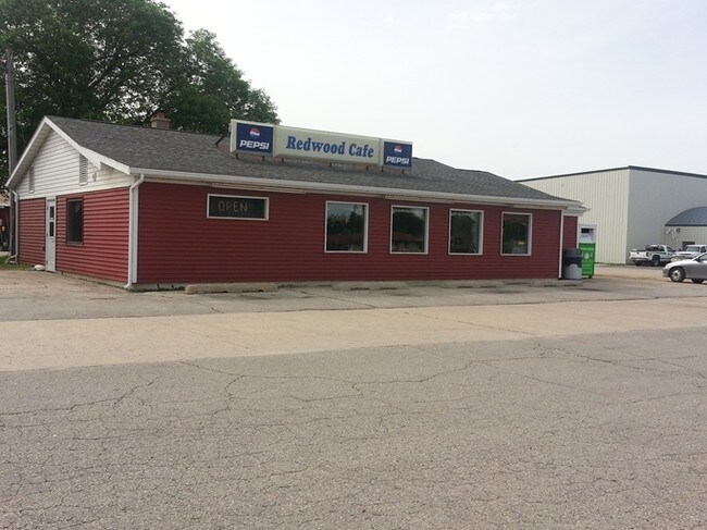
115 N Highway 44 N
La Crosse-Onalaska, WI-MN
SECT-13 TWP-102 RANGE-006 BETZ ADDITION LOTS 1 & 2 & 3 BLK 3 BETZ ADD DAIRYLAND POWER COOP R/W EASEMENT - DOC 119109 EASEMENT
R-21.0578.000
HOUSTON
Financialbuilding
Minnesota
B and X Area of moderate flood hazard, usually the area between the limits of the 100-year and 500-year floods.
1,2
2025
0.94 AC
2025
Minnesota South Area
020500
Other Market Areas
7,333 SF
NEARBY LISTINGS FOR SALE OR LEASE
-
-
View all Caledonia listings for sale on LoopNet.com
DEMOGRAPHICS near 115 N Highway 44 N
1 mile
3 mile
5 mile
2025 Total Population
3,116
3,541
3,937
2030 Population
3,096
3,516
3,899
Pop Growth 2025-2030
(0.64%)
(0.71%)
(0.97%)
Average Age
42
42
42
2025 Total Households
1,335
1,516
1,682
HH Growth 2025-2030
(0.67%)
(0.73%)
(0.95%)
Median Household Inc
$75,514
$75,255
$74,882
Avg Household Size
2.20
2.20
2.20
2025 Avg HH Vehicles
2.00
2.00
2.00
Median Home Value
$185,100
$186,404
$190,228
Median Year Built
1969
1969
1968
Nearby Places
Map Layers
Map Styles
 Street
 Aerial
Transit
 Traffic
 Biking
Places
Listings with unknown addresses are not visible on the map
- Restaurants
- Banks
- Shops
- Fitness
- Groceries
PUBLIC TRANSPORTATION
AIRPORT
La Crosse Regional
Drive
Walk
Distance
La Crosse Regional
40 min
25.5 mi
SALE & LEASE HISTORY
LISTING DATE
SALE/LEASE

Sep 23, 2016
For Sale
May 06, 2019
For Sale
Nearby Properties
Address
Land Use
TOTAL SIZE
Lot Size
Zoning
Address
Land Use
TOTAL SIZE
Lot Size
Zoning
7,570 SF
4 AC
Address
Land Use
TOTAL SIZE
Lot Size
Zoning
1,512 SF
18.09 AC
Address
Land Use
TOTAL SIZE
Lot Size
Zoning
35,276 SF
1.07 AC
Address
Land Use
TOTAL SIZE
Lot Size
Zoning
22,470 SF
8.79 AC
Address
Land Use
TOTAL SIZE
Lot Size
Zoning
20,882 SF
1.47 AC
Address
Land Use
TOTAL SIZE
Lot Size
Zoning
4,476 SF
4 AC
Address
Land Use
TOTAL SIZE
Lot Size
Zoning
8,347 SF
1.14 AC
Address
Land Use
TOTAL SIZE
Lot Size
Zoning
7,315 SF
1.97 AC
Address
Land Use
TOTAL SIZE
Lot Size
Zoning
4,416 SF
0.69 AC
Address
Land Use
TOTAL SIZE
Lot Size
Zoning
11,500 SF
0.66 AC
Address
Land Use
TOTAL SIZE
Lot Size
Zoning
3,136 SF
1.25 AC
Address
Land Use
TOTAL SIZE
Lot Size
Zoning
4,512 SF
1.88 AC
Address
Land Use
TOTAL SIZE
Lot Size
Zoning
3,696 SF
1.78 AC
Address
Land Use
TOTAL SIZE
Lot Size
Zoning
7,770 SF
6.15 AC
Address
Land Use
TOTAL SIZE
Lot Size
Zoning
6,960 SF
2.25 AC
Address
Land Use
TOTAL SIZE
Lot Size
Zoning
1,118 SF
118.40 AC
Address
Land Use
TOTAL SIZE
Lot Size
Zoning
118.80 AC
Address
Land Use
TOTAL SIZE
Lot Size
Zoning
11,025 SF
1.67 AC
Address
Land Use
TOTAL SIZE
Lot Size
Zoning
6,356 SF
0.66 AC
Address
Land Use
TOTAL SIZE
Lot Size
Zoning
160 SF
1.32 AC
Address
Land Use
TOTAL SIZE
Lot Size
Zoning
7,274 SF
0.51 AC
Address
Land Use
TOTAL SIZE
Lot Size
Zoning
1,820 SF
138.84 AC
Address
Land Use
TOTAL SIZE
Lot Size
Zoning
9,504 SF
3.41 AC
Address
Land Use
TOTAL SIZE
Lot Size
Zoning
416 SF
1.06 AC
Address
Land Use
TOTAL SIZE
Lot Size
Zoning
4,448 SF
1.58 AC
Address
Land Use
TOTAL SIZE
Lot Size
Zoning
5,832 SF
32.46 AC
Address
Land Use
TOTAL SIZE
Lot Size
Zoning
24,000 SF
3.07 AC
Address
Land Use
TOTAL SIZE
Lot Size
Zoning
1,632 SF
2.50 AC
Address
Land Use
TOTAL SIZE
Lot Size
Zoning
1,344 SF
3.02 AC
The World's #1 Commercial Real Estate Marketplace
Connect with us
© 2026 CoStar Group
The information above has been obtained from sources believed reliable. While we do not doubt its accuracy we have not verified it and make no guarantee, warranty or representation about it. It is your responsibility to independently confirm its accuracy and completeness. Any projections, opinions, assumptions, or estimates used are for example only and do not represent the current or future performance of the property. The value of this transaction to you depends on tax and other factors which should be evaluated by your tax, financial, and legal advisors. You and your advisors should conduct a careful, independent investigation of the property to determine to your satisfaction the suitability of the property for your needs.