Property Record
320 E Capitol Ave, Pierre, SD 57501


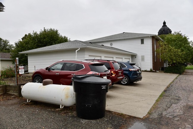
Property Detail
320 E Capitol Ave
Pierre, SD
FOURTH RAILWAY ADDITION BLOCK 19 LOTS 14 THRU 17
8298
HUGHES
Commercialnec
South Dakota
B and X Area of moderate flood hazard, usually the area between the limits of the 100-year and 500-year floods.
14-17
2025
0.38 AC
2025
South Dakota Area
977700
Other Market Areas
NEARBY LISTINGS FOR SALE OR LEASE
-
-
View all Pierre listings for sale on LoopNet.com
DEMOGRAPHICS near 320 E Capitol Ave
1 mile
3 mile
5 mile
2025 Total Population
6,411
15,942
16,955
2030 Population
6,319
15,691
16,709
Pop Growth 2025-2030
(1.44%)
(1.57%)
(1.45%)
Average Age
40
40
40
2025 Total Households
2,895
6,679
7,044
HH Growth 2025-2030
(1.35%)
(1.60%)
(1.48%)
Median Household Inc
$68,223
$75,433
$76,441
Avg Household Size
2.20
2.30
2.30
2025 Avg HH Vehicles
2.00
2.00
2.00
Median Home Value
$240,536
$248,489
$249,739
Median Year Built
1970
1976
1977
Nearby Places
Map Layers
Map Styles
 Street
 Aerial
Transit
 Traffic
 Biking
Places
Listings with unknown addresses are not visible on the map
- Restaurants
- Banks
- Shops
- Fitness
- Groceries
SALE & LEASE HISTORY
LISTING DATE
SALE/LEASE

Jul 31, 2019
For Sale
Nearby Properties
Address
Land Use
TOTAL SIZE
Lot Size
Zoning
Address
Land Use
TOTAL SIZE
Lot Size
Zoning
18.92 AC
Address
Land Use
TOTAL SIZE
Lot Size
Zoning
61,699 SF
Address
Land Use
TOTAL SIZE
Lot Size
Zoning
8.73 AC
Address
Land Use
TOTAL SIZE
Lot Size
Zoning
56,000 SF
9.72 AC
Address
Land Use
TOTAL SIZE
Lot Size
Zoning
17.37 AC
Address
Land Use
TOTAL SIZE
Lot Size
Zoning
2.93 AC
Address
Land Use
TOTAL SIZE
Lot Size
Zoning
Address
Land Use
TOTAL SIZE
Lot Size
Zoning
48,390 SF
3.46 AC
Address
Land Use
TOTAL SIZE
Lot Size
Zoning
13.18 AC
Address
Land Use
TOTAL SIZE
Lot Size
Zoning
2.95 AC
Address
Land Use
TOTAL SIZE
Lot Size
Zoning
21,300 SF
0.57 AC
Address
Land Use
TOTAL SIZE
Lot Size
Zoning
Address
Land Use
TOTAL SIZE
Lot Size
Zoning
11,256 SF
4.72 AC
Address
Land Use
TOTAL SIZE
Lot Size
Zoning
38,716 SF
3.04 AC
Address
Land Use
TOTAL SIZE
Lot Size
Zoning
8,844 SF
1.10 AC
Address
Land Use
TOTAL SIZE
Lot Size
Zoning
13,786 SF
0.85 AC
Address
Land Use
TOTAL SIZE
Lot Size
Zoning
15.23 AC
Address
Land Use
TOTAL SIZE
Lot Size
Zoning
2.65 AC
Address
Land Use
TOTAL SIZE
Lot Size
Zoning
780 SF
6.39 AC
Address
Land Use
TOTAL SIZE
Lot Size
Zoning
26,950 SF
3.17 AC
Address
Land Use
TOTAL SIZE
Lot Size
Zoning
9,343 SF
1.53 AC
Address
Land Use
TOTAL SIZE
Lot Size
Zoning
14,671 SF
584.32 AC
Address
Land Use
TOTAL SIZE
Lot Size
Zoning
45,192 SF
Address
Land Use
TOTAL SIZE
Lot Size
Zoning
9,682 SF
2.19 AC
Address
Land Use
TOTAL SIZE
Lot Size
Zoning
21,870 SF
1.68 AC
Address
Land Use
TOTAL SIZE
Lot Size
Zoning
Address
Land Use
TOTAL SIZE
Lot Size
Zoning
3.35 AC
Address
Land Use
TOTAL SIZE
Lot Size
Zoning
14,478 SF
2.32 AC
Address
Land Use
TOTAL SIZE
Lot Size
Zoning
8,108 SF
0.89 AC
Address
Land Use
TOTAL SIZE
Lot Size
Zoning
3.70 AC
The World's #1 Commercial Real Estate Marketplace
Connect with us
© 2026 CoStar Group
The information above has been obtained from sources believed reliable. While we do not doubt its accuracy we have not verified it and make no guarantee, warranty or representation about it. It is your responsibility to independently confirm its accuracy and completeness. Any projections, opinions, assumptions, or estimates used are for example only and do not represent the current or future performance of the property. The value of this transaction to you depends on tax and other factors which should be evaluated by your tax, financial, and legal advisors. You and your advisors should conduct a careful, independent investigation of the property to determine to your satisfaction the suitability of the property for your needs.