Property Record
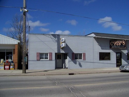
115 N State St, Hillman, MI 49746

Property Detail
115 N State St
044-210-000-004-00
T31N R4E SEC 23 N 1/2 OF LOT 4 BLK 10 VILLAGE OF HILLMAN
Drycleanerlaundryservice
MONTMORENCY
B and X Area of moderate flood hazard, usually the area between the limits of the 100-year and 500-year floods.
Michigan
2024
4
2025
0.10 AC
910100
Michigan North Central Area
2,464 SF
Other Market Areas
NEARBY LISTINGS FOR SALE OR LEASE
-
-
View all Hillman listings for sale on LoopNet.com
DEMOGRAPHICS near 115 N State St
1 mile
3 mile
5 mile
2025 Total Population
471
1,016
1,866
2030 Population
475
1,029
1,895
Pop Growth 2025-2030
+ 0.85%
+ 1.28%
+ 1.55%
Average Age
49
48
48
2025 Total Households
217
462
840
HH Growth 2025-2030
+ 0.92%
+ 1.30%
+ 1.90%
Median Household Inc
$41,750
$44,890
$46,132
Avg Household Size
2.10
2.20
2.20
2025 Avg HH Vehicles
2.00
2.00
2.00
Median Home Value
$141,228
$154,166
$161,792
Median Year Built
1971
1972
1973
Nearby Places
Map Layers
Map Styles
 Street
 Aerial
Layers
 Traffic
 Biking
Places
Listings with unknown addresses are not visible on the map
- Restaurants
- Banks
- Shops
- Fitness
- Groceries
SALE & LEASE HISTORY
LISTING DATE
SALE/LEASE

May 22, 2019
For Sale
Aug 28, 2018
For Sale
Nearby Properties
Address
Land Use
TOTAL SIZE
Lot Size
Zoning
Address
Land Use
TOTAL SIZE
Lot Size
Zoning
30,018 SF
1.60 AC
Address
Land Use
TOTAL SIZE
Lot Size
Zoning
7,200 SF
2.94 AC
CI
Address
Land Use
TOTAL SIZE
Lot Size
Zoning
11,380 SF
40 AC
AG
Address
Land Use
TOTAL SIZE
Lot Size
Zoning
20,000 SF
4.16 AC
AG
Address
Land Use
TOTAL SIZE
Lot Size
Zoning
4.50 AC
Address
Land Use
TOTAL SIZE
Lot Size
Zoning
15,918 SF
10.01 AC
Address
Land Use
TOTAL SIZE
Lot Size
Zoning
13,184 SF
2.30 AC
CI
Address
Land Use
TOTAL SIZE
Lot Size
Zoning
9,400 SF
8.57 AC
AG
Address
Land Use
TOTAL SIZE
Lot Size
Zoning
Address
Land Use
TOTAL SIZE
Lot Size
Zoning
9,100 SF
1.89 AC
AG
Address
Land Use
TOTAL SIZE
Lot Size
Zoning
Address
Land Use
TOTAL SIZE
Lot Size
Zoning
11,020 SF
5.34 AC
AG
Address
Land Use
TOTAL SIZE
Lot Size
Zoning
5,460 SF
5.24 AC
AG
Address
Land Use
TOTAL SIZE
Lot Size
Zoning
2,519 SF
10.29 AC
AG
Address
Land Use
TOTAL SIZE
Lot Size
Zoning
3,248 SF
60.12 AC
Address
Land Use
TOTAL SIZE
Lot Size
Zoning
2,380 SF
0.40 AC
Address
Land Use
TOTAL SIZE
Lot Size
Zoning
15,739 SF
1.44 AC
Address
Land Use
TOTAL SIZE
Lot Size
Zoning
8,000 SF
6.60 AC
AG
Address
Land Use
TOTAL SIZE
Lot Size
Zoning
7,260 SF
10.04 AC
Address
Land Use
TOTAL SIZE
Lot Size
Zoning
Address
Land Use
TOTAL SIZE
Lot Size
Zoning
6,400 SF
5.58 AC
AG
Address
Land Use
TOTAL SIZE
Lot Size
Zoning
4,352 SF
12.28 AC
AG
Address
Land Use
TOTAL SIZE
Lot Size
Zoning
8,613 SF
1.46 AC
Address
Land Use
TOTAL SIZE
Lot Size
Zoning
2,480 SF
1.18 AC
Address
Land Use
TOTAL SIZE
Lot Size
Zoning
4,900 SF
2.49 AC
CI
Address
Land Use
TOTAL SIZE
Lot Size
Zoning
8,640 SF
9.59 AC
Address
Land Use
TOTAL SIZE
Lot Size
Zoning
4,048 SF
0.84 AC
Address
Land Use
TOTAL SIZE
Lot Size
Zoning
2,059 SF
1.96 AC
AG
Address
Land Use
TOTAL SIZE
Lot Size
Zoning
0.48 AC
CI
Address
Land Use
TOTAL SIZE
Lot Size
Zoning
1,800 SF
1.49 AC
CI
The World's #1 Commercial Real Estate Marketplace
Connect with us
© 2026 CoStar Group
The information above has been obtained from sources believed reliable. While we do not doubt its accuracy we have not verified it and make no guarantee, warranty or representation about it. It is your responsibility to independently confirm its accuracy and completeness. Any projections, opinions, assumptions, or estimates used are for example only and do not represent the current or future performance of the property. The value of this transaction to you depends on tax and other factors which should be evaluated by your tax, financial, and legal advisors. You and your advisors should conduct a careful, independent investigation of the property to determine to your satisfaction the suitability of the property for your needs.