Property Record
115 Roberts Rd, Grindstone, PA 15442


Property Detail
115 Roberts Rd
30-04-0013-03
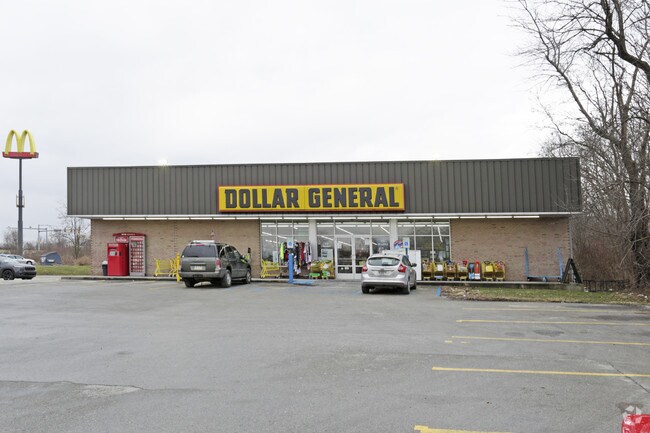
3.27 AC DISCOUNT STORE (DG)
Storebuilding
FAYETTE
B and X Area of moderate flood hazard, usually the area between the limits of the 100-year and 500-year floods.
Pennsylvania
2025
3.27 AC
2026
Fayette County
261402
Pittsburgh
10,250 SF
Pittsburgh, PA
NEARBY LISTINGS FOR SALE OR LEASE
DEMOGRAPHICS near 115 Roberts Rd
1 mile
3 mile
5 mile
2025 Total Population
1,404
9,038
21,813
2030 Population
1,402
8,938
21,586
Pop Growth 2025-2030
(0.14%)
(1.11%)
(1.04%)
Average Age
44
43
42
2025 Total Households
637
3,994
9,136
HH Growth 2025-2030
(0.31%)
(1.18%)
(0.92%)
Median Household Inc
$50,930
$53,527
$53,732
Avg Household Size
2.20
2.20
2.20
2025 Avg HH Vehicles
2.00
2.00
2.00
Median Home Value
$72,277
$87,740
$115,406
Median Year Built
1948
1948
1949
Nearby Places
Map Layers
Map Styles
 Street
 Aerial
Layers
 Traffic
 Biking
Places
Listings with unknown addresses are not visible on the map
- Restaurants
- Banks
- Shops
- Fitness
- Groceries
PUBLIC TRANSPORTATION
AIRPORT
Arnold Palmer Regional
Drive
Walk
Distance
Arnold Palmer Regional
66 min
45.2 mi
Nearby Properties
Address
Land Use
TOTAL SIZE
Lot Size
Zoning
Address
Land Use
TOTAL SIZE
Lot Size
Zoning
86.38 AC
Address
Land Use
TOTAL SIZE
Lot Size
Zoning
Address
Land Use
TOTAL SIZE
Lot Size
Zoning
27,448 SF
37.76 AC
Address
Land Use
TOTAL SIZE
Lot Size
Zoning
12.20 AC
Address
Land Use
TOTAL SIZE
Lot Size
Zoning
Address
Land Use
TOTAL SIZE
Lot Size
Zoning
11,933 SF
25.13 AC
Address
Land Use
TOTAL SIZE
Lot Size
Zoning
1.80 AC
Address
Land Use
TOTAL SIZE
Lot Size
Zoning
43,918 SF
7.11 AC
Address
Land Use
TOTAL SIZE
Lot Size
Zoning
14,661 SF
17.89 AC
Address
Land Use
TOTAL SIZE
Lot Size
Zoning
11.19 AC
Address
Land Use
TOTAL SIZE
Lot Size
Zoning
107.79 AC
Address
Land Use
TOTAL SIZE
Lot Size
Zoning
53,484 SF
1.35 AC
Address
Land Use
TOTAL SIZE
Lot Size
Zoning
88,738 SF
25 AC
Address
Land Use
TOTAL SIZE
Lot Size
Zoning
25.44 AC
Address
Land Use
TOTAL SIZE
Lot Size
Zoning
4,730 SF
2.14 AC
Address
Land Use
TOTAL SIZE
Lot Size
Zoning
4.50 AC
Address
Land Use
TOTAL SIZE
Lot Size
Zoning
10.09 AC
Address
Land Use
TOTAL SIZE
Lot Size
Zoning
65,094 SF
55.11 AC
Address
Land Use
TOTAL SIZE
Lot Size
Zoning
9,624 SF
6.04 AC
Address
Land Use
TOTAL SIZE
Lot Size
Zoning
0.48 AC
Address
Land Use
TOTAL SIZE
Lot Size
Zoning
26,563 SF
0.92 AC
Address
Land Use
TOTAL SIZE
Lot Size
Zoning
10.50 AC
Address
Land Use
TOTAL SIZE
Lot Size
Zoning
30,748 SF
2.96 AC
Address
Land Use
TOTAL SIZE
Lot Size
Zoning
5.81 AC
Address
Land Use
TOTAL SIZE
Lot Size
Zoning
2.97 AC
Address
Land Use
TOTAL SIZE
Lot Size
Zoning
1,420 SF
119.32 AC
Address
Land Use
TOTAL SIZE
Lot Size
Zoning
24,850 SF
0.52 AC
Address
Land Use
TOTAL SIZE
Lot Size
Zoning
2.85 AC
Address
Land Use
TOTAL SIZE
Lot Size
Zoning
Address
Land Use
TOTAL SIZE
Lot Size
Zoning
1,812 SF
2.86 AC
The World's #1 Commercial Real Estate Marketplace
Connect with us
© 2026 CoStar Group
The information above has been obtained from sources believed reliable. While we do not doubt its accuracy we have not verified it and make no guarantee, warranty or representation about it. It is your responsibility to independently confirm its accuracy and completeness. Any projections, opinions, assumptions, or estimates used are for example only and do not represent the current or future performance of the property. The value of this transaction to you depends on tax and other factors which should be evaluated by your tax, financial, and legal advisors. You and your advisors should conduct a careful, independent investigation of the property to determine to your satisfaction the suitability of the property for your needs.