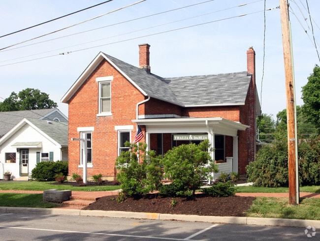
Property Record
119 S High St, Dublin, OH 43017


NEARBY LISTINGS FOR SALE OR LEASE
Property Detail
119 S High St
Columbus, OH
Daniel Wrights Add To Dublin
273-000075
S HIGH ST WRIGHT PT LOTS 3-4
Storemultistory
Franklin
X
Ohio
39049C0151K
3-4
2024
0.14 AC
2025
Dublin
006238
Columbus
1,563 SF
DEMOGRAPHICS near 119 S High St
1 Mile
3 Mile
5 Mile
2024 Total Population
9,395
90,262
208,048
2029 Population
9,480
89,883
210,639
Pop Growth 2024-2029
+ 0.90%
(0.42%)
+ 1.25%
Average Age
39
38
39
2024 Total Households
4,301
37,804
85,337
HH Growth 2024-2029
+ 1.07%
(0.39%)
+ 1.02%
Median Household Inc
$83,586
$91,328
$99,565
Avg Household Size
2.10
2.30
2.40
2024 Avg HH Vehicles
2.00
2.00
2.00
Median Home Value
$346,386
$335,739
$362,002
Median Year Built
1987
1990
1988
Nearby Places
Map Layers
Map Styles
 Street
 Aerial
- Restaurants
- Banks
- Shops
- Fitness
- Groceries
PUBLIC TRANSPORTATION
AIRPORT
John Glenn Columbus International
DRIVE
WALK
Distance
John Glenn Columbus International
29 min
20.9 mi
Rickenbacker International
DRIVE
WALK
Distance
Rickenbacker International
38 min
28.0 mi
SALE & LEASE HISTORY
LISTING DATE
SALE/LEASE

Mar 17, 2021
For Lease
Feb 03, 2021
For Lease
Apr 27, 2023
For Lease
Nearby Properties
Address
Land Use
TOTAL SIZE
Lot Size
Zoning
Address
Land Use
TOTAL SIZE
Lot Size
Zoning
182,845 SF
325.61 AC
Address
Land Use
TOTAL SIZE
Lot Size
Zoning
768,498 SF
55.17 AC
Address
Land Use
TOTAL SIZE
Lot Size
Zoning
464,088 SF
45.57 AC
Address
Land Use
TOTAL SIZE
Lot Size
Zoning
182,845 SF
325.61 AC
Address
Land Use
TOTAL SIZE
Lot Size
Zoning
256,984 SF
10.49 AC
Address
Land Use
TOTAL SIZE
Lot Size
Zoning
419,285 SF
17.19 AC
Address
Land Use
TOTAL SIZE
Lot Size
Zoning
260,092 SF
29.05 AC
Address
Land Use
TOTAL SIZE
Lot Size
Zoning
549,907 SF
35.81 AC
Address
Land Use
TOTAL SIZE
Lot Size
Zoning
297,024 SF
71.76 AC
Address
Land Use
TOTAL SIZE
Lot Size
Zoning
46,231 SF
27.42 AC
Address
Land Use
TOTAL SIZE
Lot Size
Zoning
557,021 SF
21.28 AC
Address
Land Use
TOTAL SIZE
Lot Size
Zoning
232,579 SF
54.30 AC
Address
Land Use
TOTAL SIZE
Lot Size
Zoning
237,100 SF
12.81 AC
Address
Land Use
TOTAL SIZE
Lot Size
Zoning
173,618 SF
1.13 AC
Address
Land Use
TOTAL SIZE
Lot Size
Zoning
223,270 SF
1.30 AC
Address
Land Use
TOTAL SIZE
Lot Size
Zoning
284,923 SF
15.78 AC
Address
Land Use
TOTAL SIZE
Lot Size
Zoning
200,609 SF
21.87 AC
Address
Land Use
TOTAL SIZE
Lot Size
Zoning
178,568 SF
31.62 AC
Address
Land Use
TOTAL SIZE
Lot Size
Zoning
95,447 SF
58.80 AC
Address
Land Use
TOTAL SIZE
Lot Size
Zoning
367,614 SF
10.63 AC
Address
Land Use
TOTAL SIZE
Lot Size
Zoning
160,958 SF
11.93 AC
Address
Land Use
TOTAL SIZE
Lot Size
Zoning
115,032 SF
12.81 AC
Address
Land Use
TOTAL SIZE
Lot Size
Zoning
47,334 SF
29.34 AC
Address
Land Use
TOTAL SIZE
Lot Size
Zoning
129,283 SF
56.69 AC
Address
Land Use
TOTAL SIZE
Lot Size
Zoning
110,180 SF
29.07 AC
Address
Land Use
TOTAL SIZE
Lot Size
Zoning
42,494 SF
0.19 AC
Address
Land Use
TOTAL SIZE
Lot Size
Zoning
67,186 SF
21.51 AC
Address
Land Use
TOTAL SIZE
Lot Size
Zoning
143,277 SF
15.54 AC
Address
Land Use
TOTAL SIZE
Lot Size
Zoning
414,372 SF
24.87 AC
Address
Land Use
TOTAL SIZE
Lot Size
Zoning
216,795 SF
10.21 AC
The World's #1 Commercial Real Estate Marketplace
Connect with us
© 2026 CoStar Group
The information above has been obtained from sources believed reliable. While we do not doubt its accuracy we have not verified it and make no guarantee, warranty or representation about it. It is your responsibility to independently confirm its accuracy and completeness. Any projections, opinions, assumptions, or estimates used are for example only and do not represent the current or future performance of the property. The value of this transaction to you depends on tax and other factors which should be evaluated by your tax, financial, and legal advisors. You and your advisors should conduct a careful, independent investigation of the property to determine to your satisfaction the suitability of the property for your needs.