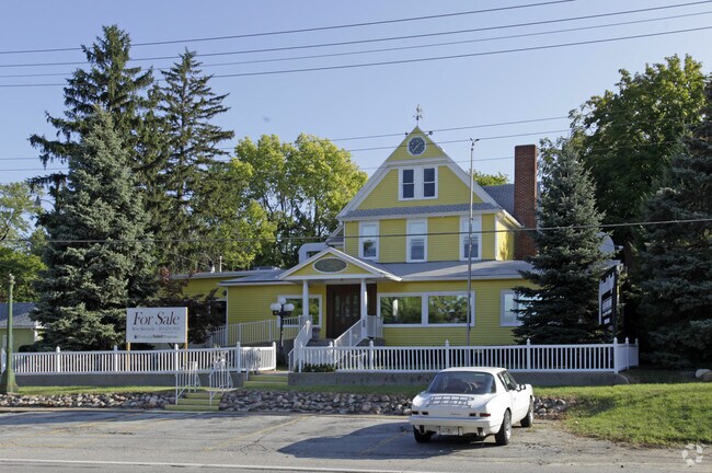
Property Record
115 S Whittaker St, New Buffalo, MI 49117

NEARBY LISTINGS FOR SALE OR LEASE
Property Detail
115 S Whittaker St
Niles-Benton Harbor, MI
New Buffalo
11-62-0340-0383-00-1
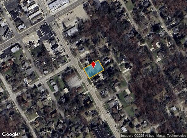
COM AT NW COR OF LOT 11 BLK 36 VILL PLAT OF NEW BUFFALO TH S30DEGE ON WHITTAKER AVE 106' TH N60DEGE 162' TH N30DEGW 106' TH S60DEGW 162' TO BEG
Commercialnec
Berrien
X
Michigan
26021C0336D
11
2024
0.39 AC
2025
Other Market Areas
011302
DEMOGRAPHICS near 115 S Whittaker St
1 Mile
3 Mile
5 Mile
2024 Total Population
2,966
5,312
9,778
2029 Population
3,138
5,643
10,386
Pop Growth 2024-2029
+ 5.80%
+ 6.23%
+ 6.22%
Average Age
48
49
50
2024 Total Households
1,420
2,495
4,627
HH Growth 2024-2029
+ 5.77%
+ 6.25%
+ 6.31%
Median Household Inc
$66,079
$68,749
$74,131
Avg Household Size
2.10
2.10
2.10
2024 Avg HH Vehicles
2.00
2.00
2.00
Median Home Value
$327,489
$358,179
$365,926
Median Year Built
1972
1980
1978
Nearby Places
Map Layers
Map Styles
 Street
 Aerial
- Restaurants
- Banks
- Shops
- Fitness
- Groceries
PUBLIC TRANSPORTATION
COMMUTER RAIL
DRIVE
WALK
Distance
1 min
7 min
0.3 mi
Carroll Avenue (Michigan City) Station (South Shore Line - Northern Indiana Commuter Transportation District (South Shore Line))
DRIVE
WALK
Distance
Carroll Avenue (Michigan City) Station (South Shore Line - Northern Indiana Commuter Transportation District (South Shore Line))
16 min
9.7 mi
AIRPORT
South Bend International
DRIVE
WALK
Distance
South Bend International
53 min
32.7 mi
Nearby Properties
Address
Land Use
TOTAL SIZE
Lot Size
Zoning
Address
Land Use
TOTAL SIZE
Lot Size
Zoning
29,124 SF
14.50 AC
I-1
Address
Land Use
TOTAL SIZE
Lot Size
Zoning
9,000 SF
10.19 AC
GCD
Address
Land Use
TOTAL SIZE
Lot Size
Zoning
44,978 SF
2.08 AC
C-2
Address
Land Use
TOTAL SIZE
Lot Size
Zoning
0.50 AC
SELECTZONI
Address
Land Use
TOTAL SIZE
Lot Size
Zoning
61,856 SF
2.52 AC
C-2
Address
Land Use
TOTAL SIZE
Lot Size
Zoning
30,221 SF
23.62 AC
Address
Land Use
TOTAL SIZE
Lot Size
Zoning
35,378 SF
3.94 AC
SELECTZONI
Address
Land Use
TOTAL SIZE
Lot Size
Zoning
43,365 SF
2.40 AC
SELECTZONI
Address
Land Use
TOTAL SIZE
Lot Size
Zoning
8,998 SF
2.73 AC
GCD
Address
Land Use
TOTAL SIZE
Lot Size
Zoning
7,464 SF
2.40 AC
GCD
Address
Land Use
TOTAL SIZE
Lot Size
Zoning
0.95 AC
SELECTZONI
Address
Land Use
TOTAL SIZE
Lot Size
Zoning
14,642 SF
0.30 AC
CBD
Address
Land Use
TOTAL SIZE
Lot Size
Zoning
86.91 AC
Address
Land Use
TOTAL SIZE
Lot Size
Zoning
0.57 AC
R-1
Address
Land Use
TOTAL SIZE
Lot Size
Zoning
0.57 AC
R-1
Address
Land Use
TOTAL SIZE
Lot Size
Zoning
0.57 AC
R-1
Address
Land Use
TOTAL SIZE
Lot Size
Zoning
0.80 AC
SELECTZONI
Address
Land Use
TOTAL SIZE
Lot Size
Zoning
70,091 SF
15.94 AC
SELECTZONI
Address
Land Use
TOTAL SIZE
Lot Size
Zoning
8,680 SF
5.10 AC
SELECTZONI
Address
Land Use
TOTAL SIZE
Lot Size
Zoning
0.20 AC
Address
Land Use
TOTAL SIZE
Lot Size
Zoning
0.84 AC
SELECTZONI
Address
Land Use
TOTAL SIZE
Lot Size
Zoning
15,198 SF
0.80 AC
CBD
Address
Land Use
TOTAL SIZE
Lot Size
Zoning
0.76 AC
WM
Address
Land Use
TOTAL SIZE
Lot Size
Zoning
21,854 SF
0.70 AC
CBD
Address
Land Use
TOTAL SIZE
Lot Size
Zoning
0.75 AC
SELECTZONI
Address
Land Use
TOTAL SIZE
Lot Size
Zoning
7,910 SF
0.41 AC
CBD
Address
Land Use
TOTAL SIZE
Lot Size
Zoning
0.71 AC
SELECTZONI
Address
Land Use
TOTAL SIZE
Lot Size
Zoning
3,721 SF
2.50 AC
GCD
Address
Land Use
TOTAL SIZE
Lot Size
Zoning
0.68 AC
SELECTZONI
The World's #1 Commercial Real Estate Marketplace
Connect with us
© 2025 CoStar Group
The information above has been obtained from sources believed reliable. While we do not doubt its accuracy we have not verified it and make no guarantee, warranty or representation about it. It is your responsibility to independently confirm its accuracy and completeness. Any projections, opinions, assumptions, or estimates used are for example only and do not represent the current or future performance of the property. The value of this transaction to you depends on tax and other factors which should be evaluated by your tax, financial, and legal advisors. You and your advisors should conduct a careful, independent investigation of the property to determine to your satisfaction the suitability of the property for your needs.