Property Record
115 Tabor Rd, Morris Plains, NJ 07950


NEARBY LISTINGS FOR SALE OR LEASE
Property Detail
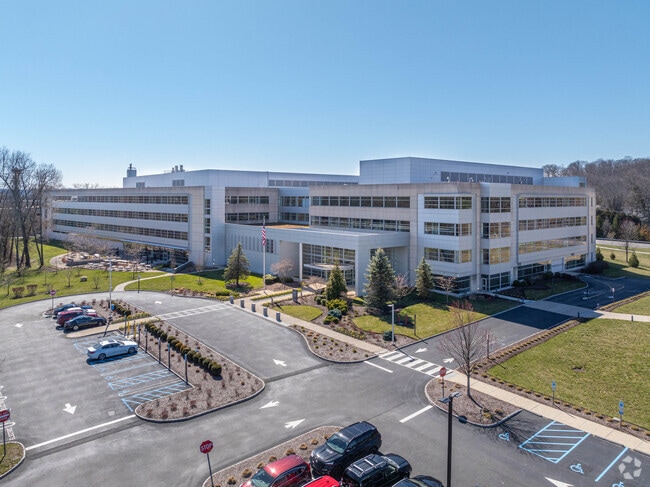
115 Tabor Rd
Northern New Jersey
Mcneil Ppc Inc
Newark, NJ
Morris
23-00151-0000-00002-02
New Jersey
Officebuilding
2.2
2024
38.86 AC
2025
Parsippany
042302
DEMOGRAPHICS near 115 Tabor Rd
1 Mile
3 Mile
5 Mile
2024 Total Population
7,521
69,347
148,641
2029 Population
7,602
69,502
149,125
Pop Growth 2024-2029
+ 1.08%
+ 0.22%
+ 0.33%
Average Age
42
41
42
2024 Total Households
2,943
26,561
56,380
HH Growth 2024-2029
+ 1.19%
+ 0.30%
+ 0.44%
Median Household Inc
$135,388
$130,854
$131,546
Avg Household Size
2.50
2.50
2.50
2024 Avg HH Vehicles
2.00
2.00
2.00
Median Home Value
$639,449
$560,762
$592,609
Median Year Built
1970
1970
1969
Nearby Places
Map Layers
Map Styles
 Street
 Aerial
- Restaurants
- Banks
- Shops
- Fitness
- Groceries
PUBLIC TRANSPORTATION
COMMUTER RAIL
Morris Plains (Morris & Essex Morristown Line - NJ Transit Commuter Rail (NJ Transit))
DRIVE
WALK
Distance
Morris Plains (Morris & Essex Morristown Line - NJ Transit Commuter Rail (NJ Transit))
4 min
10 min
0.5 mi
Morristown (Morris & Essex Morristown Line - NJ Transit Commuter Rail (NJ Transit))
DRIVE
WALK
Distance
Morristown (Morris & Essex Morristown Line - NJ Transit Commuter Rail (NJ Transit))
8 min
3.8 mi
AIRPORT
Newark Liberty International
DRIVE
WALK
Distance
Newark Liberty International
34 min
24.3 mi
Freight Ports
Maher Terminal
DRIVE
WALK
Distance
Maher Terminal
37 min
24.8 mi
SALE & LEASE HISTORY
LISTING DATE
SALE/LEASE

Oct 08, 2019
For Lease
Nearby Properties
Address
Land Use
TOTAL SIZE
Lot Size
Zoning
Address
Land Use
TOTAL SIZE
Lot Size
Zoning
2,023 SF
136.41 AC
R-R
Address
Land Use
TOTAL SIZE
Lot Size
Zoning
596 SF
64.81 AC
OBRL
Address
Land Use
TOTAL SIZE
Lot Size
Zoning
1.55 AC
Address
Land Use
TOTAL SIZE
Lot Size
Zoning
2.82 AC
Address
Land Use
TOTAL SIZE
Lot Size
Zoning
Address
Land Use
TOTAL SIZE
Lot Size
Zoning
18.42 AC
RM
Address
Land Use
TOTAL SIZE
Lot Size
Zoning
0.36 AC
UR
Address
Land Use
TOTAL SIZE
Lot Size
Zoning
114,267 SF
27.26 AC
SED5
Address
Land Use
TOTAL SIZE
Lot Size
Zoning
3.13 AC
CBD
Address
Land Use
TOTAL SIZE
Lot Size
Zoning
14.50 AC
RG
Address
Land Use
TOTAL SIZE
Lot Size
Zoning
257,220 SF
30.83 AC
SED5
Address
Land Use
TOTAL SIZE
Lot Size
Zoning
32 AC
R-1M
Address
Land Use
TOTAL SIZE
Lot Size
Zoning
0.57 AC
CBD
Address
Land Use
TOTAL SIZE
Lot Size
Zoning
88,345 SF
15.67 AC
R-7
Address
Land Use
TOTAL SIZE
Lot Size
Zoning
0.41 AC
UR
Address
Land Use
TOTAL SIZE
Lot Size
Zoning
0.35 AC
UR
Address
Land Use
TOTAL SIZE
Lot Size
Zoning
1.71 AC
Address
Land Use
TOTAL SIZE
Lot Size
Zoning
377,114 SF
40.64 AC
SD10
Address
Land Use
TOTAL SIZE
Lot Size
Zoning
Address
Land Use
TOTAL SIZE
Lot Size
Zoning
203,590 SF
24.98 AC
SD10
Address
Land Use
TOTAL SIZE
Lot Size
Zoning
13.45 AC
IP
Address
Land Use
TOTAL SIZE
Lot Size
Zoning
25.14 AC
I-B3
Address
Land Use
TOTAL SIZE
Lot Size
Zoning
2,380 SF
1.32 AC
RC
Address
Land Use
TOTAL SIZE
Lot Size
Zoning
26,967 SF
14.06 AC
OB-4
Address
Land Use
TOTAL SIZE
Lot Size
Zoning
2.70 AC
Address
Land Use
TOTAL SIZE
Lot Size
Zoning
22.85 AC
B-3
Address
Land Use
TOTAL SIZE
Lot Size
Zoning
11,441 SF
109.20 AC
OSGU
Address
Land Use
TOTAL SIZE
Lot Size
Zoning
0.76 AC
UR
Address
Land Use
TOTAL SIZE
Lot Size
Zoning
23.15 AC
SD10
The World's #1 Commercial Real Estate Marketplace
Connect with us
© 2026 CoStar Group
The information above has been obtained from sources believed reliable. While we do not doubt its accuracy we have not verified it and make no guarantee, warranty or representation about it. It is your responsibility to independently confirm its accuracy and completeness. Any projections, opinions, assumptions, or estimates used are for example only and do not represent the current or future performance of the property. The value of this transaction to you depends on tax and other factors which should be evaluated by your tax, financial, and legal advisors. You and your advisors should conduct a careful, independent investigation of the property to determine to your satisfaction the suitability of the property for your needs.