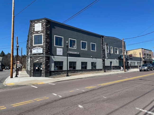
Property Record
1140 S Main Ave, Scranton, PA 18504

NEARBY LISTINGS FOR SALE OR LEASE
-
-
-
-
-
-
-
No Photo
-
-
View all Scranton listings for lease on LoopNet.com
Property Detail
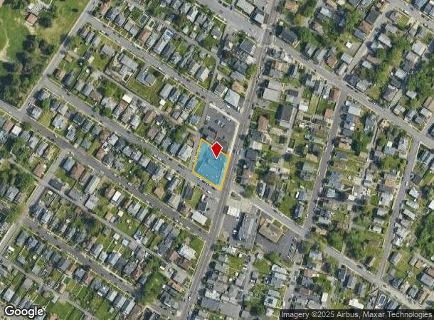
1140 S Main Ave
Scranton--Wilkes-Barre--Hazelton, PA
The Round Woods Park
15613050012
138X138X140X138 ROUND WOODS PARK L 4&5&6 B 5 W-22 B-005 L-004 P-019
Taxexempt
Lackawanna
X
Pennsylvania
42069C0214D
4
2025
0.13 AC
2025
I-81 Corridor
102200
Philadelphia
DEMOGRAPHICS near 1140 S Main Ave
1 Mile
3 Mile
5 Mile
2024 Total Population
12,122
78,385
117,585
2029 Population
11,979
77,835
116,562
Pop Growth 2024-2029
(1.18%)
(0.70%)
(0.87%)
Average Age
39
40
41
2024 Total Households
5,051
31,175
48,061
HH Growth 2024-2029
(1.21%)
(0.69%)
(0.89%)
Median Household Inc
$45,335
$49,848
$55,037
Avg Household Size
2.30
2.30
2.20
2024 Avg HH Vehicles
1.00
1.00
2.00
Median Home Value
$114,671
$136,984
$147,924
Median Year Built
1946
1948
1948
Nearby Places
Map Layers
Map Styles
 Street
 Aerial
- Restaurants
- Banks
- Shops
- Fitness
- Groceries
PUBLIC TRANSPORTATION
AIRPORT
Wilkes-Barre/Scranton International
DRIVE
WALK
Distance
Wilkes-Barre/Scranton International
15 min
8.2 mi
Freight Ports
Maher Terminal
DRIVE
WALK
Distance
Maher Terminal
148 min
117.6 mi
SALE & LEASE HISTORY
LISTING DATE
SALE/LEASE

Mar 23, 2021
For Lease
Jun 26, 2024
For Lease
Nearby Properties
Address
Land Use
TOTAL SIZE
Lot Size
Zoning
Address
Land Use
TOTAL SIZE
Lot Size
Zoning
2.62 AC
Address
Land Use
TOTAL SIZE
Lot Size
Zoning
Address
Land Use
TOTAL SIZE
Lot Size
Zoning
Address
Land Use
TOTAL SIZE
Lot Size
Zoning
Address
Land Use
TOTAL SIZE
Lot Size
Zoning
2.40 AC
Address
Land Use
TOTAL SIZE
Lot Size
Zoning
2.30 AC
Address
Land Use
TOTAL SIZE
Lot Size
Zoning
4.20 AC
Address
Land Use
TOTAL SIZE
Lot Size
Zoning
15.50 AC
Address
Land Use
TOTAL SIZE
Lot Size
Zoning
3.86 AC
Address
Land Use
TOTAL SIZE
Lot Size
Zoning
0.99 AC
Address
Land Use
TOTAL SIZE
Lot Size
Zoning
12.88 AC
Address
Land Use
TOTAL SIZE
Lot Size
Zoning
Address
Land Use
TOTAL SIZE
Lot Size
Zoning
4.85 AC
Address
Land Use
TOTAL SIZE
Lot Size
Zoning
Address
Land Use
TOTAL SIZE
Lot Size
Zoning
Address
Land Use
TOTAL SIZE
Lot Size
Zoning
2.65 AC
Address
Land Use
TOTAL SIZE
Lot Size
Zoning
0.27 AC
Address
Land Use
TOTAL SIZE
Lot Size
Zoning
36.41 AC
Address
Land Use
TOTAL SIZE
Lot Size
Zoning
Address
Land Use
TOTAL SIZE
Lot Size
Zoning
Address
Land Use
TOTAL SIZE
Lot Size
Zoning
3.86 AC
Address
Land Use
TOTAL SIZE
Lot Size
Zoning
Address
Land Use
TOTAL SIZE
Lot Size
Zoning
26.80 AC
Address
Land Use
TOTAL SIZE
Lot Size
Zoning
47.24 AC
Address
Land Use
TOTAL SIZE
Lot Size
Zoning
Address
Land Use
TOTAL SIZE
Lot Size
Zoning
3.11 AC
Address
Land Use
TOTAL SIZE
Lot Size
Zoning
9.55 AC
Address
Land Use
TOTAL SIZE
Lot Size
Zoning
Address
Land Use
TOTAL SIZE
Lot Size
Zoning
34.52 AC
Address
Land Use
TOTAL SIZE
Lot Size
Zoning
The World's #1 Commercial Real Estate Marketplace
Connect with us
© 2025 CoStar Group
The information above has been obtained from sources believed reliable. While we do not doubt its accuracy we have not verified it and make no guarantee, warranty or representation about it. It is your responsibility to independently confirm its accuracy and completeness. Any projections, opinions, assumptions, or estimates used are for example only and do not represent the current or future performance of the property. The value of this transaction to you depends on tax and other factors which should be evaluated by your tax, financial, and legal advisors. You and your advisors should conduct a careful, independent investigation of the property to determine to your satisfaction the suitability of the property for your needs.