Property Record
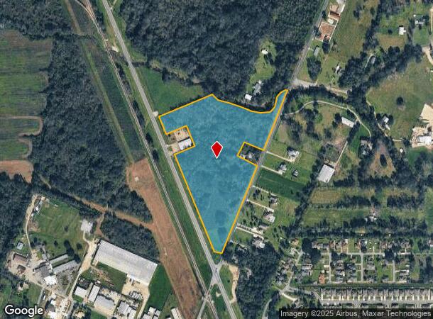
1150 Bayou Paul Ln, Saint Gabriel, LA 70776

NEARBY LISTINGS FOR SALE OR LEASE
Property Detail
1150 Bayou Paul Ln
Baton Rouge, LA
H678
04-10567200
ACRES - 18.837 PART BAYOU PAUL PLTN, SEC. 14 & 38, T8SR1E & SEC. 6, T9SR1E BEING ALL SECS. LYING N & E LA. HWY. 30 (EXCEPT PO
Agriculturalland
Iberville
AE
Louisiana
22047C0240D
2-a,a-2
2024
18.29 AC
2024
West Baton Rouge
953200
Baton Rouge
DEMOGRAPHICS near 1150 Bayou Paul Ln
1 Mile
3 Mile
5 Mile
2024 Total Population
2,735
11,733
40,212
2029 Population
2,652
11,433
39,360
Pop Growth 2024-2029
(3.03%)
(2.56%)
(2.12%)
Average Age
42
38
37
2024 Total Households
738
3,925
15,251
HH Growth 2024-2029
(3.25%)
(2.62%)
(2.24%)
Median Household Inc
$99,542
$101,961
$69,301
Avg Household Size
2.40
2.60
2.50
2024 Avg HH Vehicles
2.00
2.00
2.00
Median Home Value
$359,249
$363,913
$301,179
Median Year Built
2007
2007
2000
Nearby Places
Map Layers
Map Styles
 Street
 Aerial
- Restaurants
- Banks
- Shops
- Fitness
- Groceries
PUBLIC TRANSPORTATION
AIRPORT
Baton Rouge Metro Ryan Field
DRIVE
WALK
Distance
Baton Rouge Metro Ryan Field
32 min
19.9 mi
Freight Ports
Port of Greater Baton Rouge
DRIVE
WALK
Distance
Port of Greater Baton Rouge
26 min
14.5 mi
Nearby Properties
Address
Land Use
TOTAL SIZE
Lot Size
Zoning
Address
Land Use
TOTAL SIZE
Lot Size
Zoning
Address
Land Use
TOTAL SIZE
Lot Size
Zoning
Address
Land Use
TOTAL SIZE
Lot Size
Zoning
116.97 AC
Address
Land Use
TOTAL SIZE
Lot Size
Zoning
20,000 SF
133.53 AC
Address
Land Use
TOTAL SIZE
Lot Size
Zoning
793.42 AC
Address
Land Use
TOTAL SIZE
Lot Size
Zoning
17.79 AC
Address
Land Use
TOTAL SIZE
Lot Size
Zoning
Address
Land Use
TOTAL SIZE
Lot Size
Zoning
Address
Land Use
TOTAL SIZE
Lot Size
Zoning
Address
Land Use
TOTAL SIZE
Lot Size
Zoning
Address
Land Use
TOTAL SIZE
Lot Size
Zoning
Address
Land Use
TOTAL SIZE
Lot Size
Zoning
Address
Land Use
TOTAL SIZE
Lot Size
Zoning
Address
Land Use
TOTAL SIZE
Lot Size
Zoning
Address
Land Use
TOTAL SIZE
Lot Size
Zoning
Address
Land Use
TOTAL SIZE
Lot Size
Zoning
Address
Land Use
TOTAL SIZE
Lot Size
Zoning
3,840 SF
14 AC
Address
Land Use
TOTAL SIZE
Lot Size
Zoning
46.99 AC
Address
Land Use
TOTAL SIZE
Lot Size
Zoning
Address
Land Use
TOTAL SIZE
Lot Size
Zoning
Address
Land Use
TOTAL SIZE
Lot Size
Zoning
Address
Land Use
TOTAL SIZE
Lot Size
Zoning
4,800 SF
70.16 AC
Address
Land Use
TOTAL SIZE
Lot Size
Zoning
Address
Land Use
TOTAL SIZE
Lot Size
Zoning
Address
Land Use
TOTAL SIZE
Lot Size
Zoning
Address
Land Use
TOTAL SIZE
Lot Size
Zoning
Address
Land Use
TOTAL SIZE
Lot Size
Zoning
Address
Land Use
TOTAL SIZE
Lot Size
Zoning
Address
Land Use
TOTAL SIZE
Lot Size
Zoning
Address
Land Use
TOTAL SIZE
Lot Size
Zoning
The World's #1 Commercial Real Estate Marketplace
Connect with us
© 2025 CoStar Group
The information above has been obtained from sources believed reliable. While we do not doubt its accuracy we have not verified it and make no guarantee, warranty or representation about it. It is your responsibility to independently confirm its accuracy and completeness. Any projections, opinions, assumptions, or estimates used are for example only and do not represent the current or future performance of the property. The value of this transaction to you depends on tax and other factors which should be evaluated by your tax, financial, and legal advisors. You and your advisors should conduct a careful, independent investigation of the property to determine to your satisfaction the suitability of the property for your needs.