Property Record
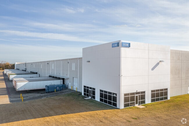
1150 E Cleveland St, Hutchins, TX 75141


NEARBY LISTINGS FOR SALE OR LEASE
Property Detail
1150 E Cleveland St
Dallas-Fort Worth-Arlington, TX
Commerce 45
121544100A0020000
COMMERCE 45 BLK A LT 2 ACS 32.557 INT201800159345 DD06132018 CO-DC 1544100A00200 4CU1544100A
Warehouse
Dallas
AE
Texas
48113C0514L
2
2024
32.56 AC
2025
SE Dallas/I-45
016902
Dallas/Ft Worth
500,380 SF
DEMOGRAPHICS near 1150 E Cleveland St
1 Mile
3 Mile
5 Mile
2024 Total Population
3,109
13,112
81,193
2029 Population
3,146
13,224
81,555
Pop Growth 2024-2029
+ 1.19%
+ 0.85%
+ 0.45%
Average Age
38
34
34
2024 Total Households
307
3,244
23,360
HH Growth 2024-2029
+ 3.58%
+ 0.80%
+ 0.35%
Median Household Inc
$49,999
$44,818
$38,495
Avg Household Size
3.40
3.30
3.30
2024 Avg HH Vehicles
2.00
2.00
2.00
Median Home Value
$120,329
$128,697
$124,813
Median Year Built
1982
1990
1974
Nearby Places
Map Layers
Map Styles
 Street
 Aerial
- Restaurants
- Banks
- Shops
- Fitness
- Groceries
PUBLIC TRANSPORTATION
AIRPORT
Dallas Love Field
DRIVE
WALK
Distance
Dallas Love Field
28 min
17.2 mi
Dallas-Fort Worth International
DRIVE
WALK
Distance
Dallas-Fort Worth International
43 min
33.1 mi
Freight Ports
Port of Shreveport
DRIVE
WALK
Distance
Port of Shreveport
208 min
193.1 mi
Nearby Properties
Address
Land Use
TOTAL SIZE
Lot Size
Zoning
Address
Land Use
TOTAL SIZE
Lot Size
Zoning
1,097,520 SF
58.28 AC
Address
Land Use
TOTAL SIZE
Lot Size
Zoning
1,073,520 SF
55.17 AC
Z123
Address
Land Use
TOTAL SIZE
Lot Size
Zoning
1,039,360 SF
64.13 AC
Z123
Address
Land Use
TOTAL SIZE
Lot Size
Zoning
1,033,503 SF
51.34 AC
Address
Land Use
TOTAL SIZE
Lot Size
Zoning
1,004,674 SF
63.47 AC
Z123
Address
Land Use
TOTAL SIZE
Lot Size
Zoning
999,728 SF
48.45 AC
Z319
Address
Land Use
TOTAL SIZE
Lot Size
Zoning
1,013,833 SF
54.39 AC
Z102
Address
Land Use
TOTAL SIZE
Lot Size
Zoning
960,665 SF
46.03 AC
Z31
Address
Land Use
TOTAL SIZE
Lot Size
Zoning
800,737 SF
45.33 AC
Z123
Address
Land Use
TOTAL SIZE
Lot Size
Zoning
799,765 SF
45.66 AC
Z31
Address
Land Use
TOTAL SIZE
Lot Size
Zoning
754,897 SF
42.75 AC
Z123
Address
Land Use
TOTAL SIZE
Lot Size
Zoning
698,880 SF
37.31 AC
Z31
Address
Land Use
TOTAL SIZE
Lot Size
Zoning
290,000 SF
51.91 AC
Z123
Address
Land Use
TOTAL SIZE
Lot Size
Zoning
362,767 SF
101.01 AC
Z115
Address
Land Use
TOTAL SIZE
Lot Size
Zoning
648,960 SF
52.23 AC
Z06
Address
Land Use
TOTAL SIZE
Lot Size
Zoning
588,500 SF
32.61 AC
Z123
Address
Land Use
TOTAL SIZE
Lot Size
Zoning
540,000 SF
40.02 AC
Z67
Address
Land Use
TOTAL SIZE
Lot Size
Zoning
571,880 SF
19.42 AC
Z123
Address
Land Use
TOTAL SIZE
Lot Size
Zoning
696,622 SF
37.79 AC
Z116
Address
Land Use
TOTAL SIZE
Lot Size
Zoning
587,000 SF
33.94 AC
Z123
Address
Land Use
TOTAL SIZE
Lot Size
Zoning
626,100 SF
30.45 AC
Z398
Address
Land Use
TOTAL SIZE
Lot Size
Zoning
309,110 SF
68.88 AC
Z31
Address
Land Use
TOTAL SIZE
Lot Size
Zoning
502,000 SF
79.24 AC
Z239
Address
Land Use
TOTAL SIZE
Lot Size
Zoning
488,780 SF
41.74 AC
Z06
Address
Land Use
TOTAL SIZE
Lot Size
Zoning
450,000 SF
48.15 AC
Z123
Address
Land Use
TOTAL SIZE
Lot Size
Zoning
395,099 SF
37.29 AC
Z123
Address
Land Use
TOTAL SIZE
Lot Size
Zoning
349,936 SF
24.34 AC
Z31
Address
Land Use
TOTAL SIZE
Lot Size
Zoning
307,008 SF
16.09 AC
Z321
Address
Land Use
TOTAL SIZE
Lot Size
Zoning
249,600 SF
13.89 AC
Z123
The World's #1 Commercial Real Estate Marketplace
Connect with us
© 2025 CoStar Group
The information above has been obtained from sources believed reliable. While we do not doubt its accuracy we have not verified it and make no guarantee, warranty or representation about it. It is your responsibility to independently confirm its accuracy and completeness. Any projections, opinions, assumptions, or estimates used are for example only and do not represent the current or future performance of the property. The value of this transaction to you depends on tax and other factors which should be evaluated by your tax, financial, and legal advisors. You and your advisors should conduct a careful, independent investigation of the property to determine to your satisfaction the suitability of the property for your needs.