Property Record
11500 Sheridan Blvd, Westminster, CO 80020
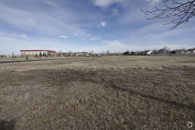

Property Detail
11500 Sheridan Blvd
Denver-Aurora-Centennial, CO
SUB:L.I.F.E. PUD DESC: TRACTS 1 3 4 AND 5 AND EXC ROAD AND EXC PARC AND EXC RDS 9/2702A
1719-06-3-04-001
Adams
Religious
Colorado
0
18.54 AC
2025
Northwest Denver
009408
Denver
45,138 SF
NEARBY LISTINGS FOR SALE OR LEASE
DEMOGRAPHICS near 11500 Sheridan Blvd
1 mile
3 mile
5 mile
2024 Total Population
13,061
110,087
278,688
2029 Population
13,221
112,867
285,700
Pop Growth 2024-2029
+ 1.23%
+ 2.53%
+ 2.52%
Average Age
41
40
39
2024 Total Households
4,956
43,131
108,635
HH Growth 2024-2029
+ 1.51%
+ 2.82%
+ 2.76%
Median Household Inc
$124,769
$109,356
$96,906
Avg Household Size
2.60
2.50
2.50
2024 Avg HH Vehicles
2.00
2.00
2.00
Median Home Value
$677,908
$624,020
$542,512
Median Year Built
1996
1991
1988
Nearby Places
Map Layers
Map Styles
 Street
 Aerial
Transit
 Traffic
 Biking
Places
Listings with unknown addresses are not visible on the map
- Restaurants
- Banks
- Shops
- Fitness
- Groceries
PUBLIC TRANSPORTATION
COMMUTER RAIL
Northglenn - 112Th Station Track 2 (Union Station to Eastlake & 124th Station - Regional Transportation District)
Drive
Walk
Distance
Northglenn - 112Th Station Track 2 (Union Station to Eastlake & 124th Station - Regional Transportation District)
14 min
7.1 mi
Northglenn - 112Th Station Track 1 (Union Station to Eastlake & 124th Station - Regional Transportation District)
Drive
Walk
Distance
Northglenn - 112Th Station Track 1 (Union Station to Eastlake & 124th Station - Regional Transportation District)
14 min
7.1 mi
AIRPORT
Denver International
Drive
Walk
Distance
Denver International
41 min
33.0 mi
Freight Ports
Tulsa Port Of Catoosa
Drive
Walk
Distance
Tulsa Port Of Catoosa
739 min
716.8 mi
Nearby Properties
Address
Land Use
TOTAL SIZE
Lot Size
Zoning
Address
Land Use
TOTAL SIZE
Lot Size
Zoning
216,285 SF
6 AC
Address
Land Use
TOTAL SIZE
Lot Size
Zoning
1,031,000 SF
31.98 AC
Address
Land Use
TOTAL SIZE
Lot Size
Zoning
117,775 SF
34.58 AC
GA; PUD
Address
Land Use
TOTAL SIZE
Lot Size
Zoning
539,891 SF
30.35 AC
Address
Land Use
TOTAL SIZE
Lot Size
Zoning
99,497 SF
11.02 AC
Address
Land Use
TOTAL SIZE
Lot Size
Zoning
209,009 SF
22.30 AC
Address
Land Use
TOTAL SIZE
Lot Size
Zoning
1,440 SF
41.30 AC
Address
Land Use
TOTAL SIZE
Lot Size
Zoning
174,398 SF
33.34 AC
PF; PROL;
Address
Land Use
TOTAL SIZE
Lot Size
Zoning
159,724 SF
8.11 AC
Address
Land Use
TOTAL SIZE
Lot Size
Zoning
577,088 SF
18.94 AC
PUD
Address
Land Use
TOTAL SIZE
Lot Size
Zoning
674,481 SF
21.06 AC
Address
Land Use
TOTAL SIZE
Lot Size
Zoning
250,701 SF
14.14 AC
Address
Land Use
TOTAL SIZE
Lot Size
Zoning
528,256 SF
3.87 AC
PUD
Address
Land Use
TOTAL SIZE
Lot Size
Zoning
121,639 SF
25.99 AC
Address
Land Use
TOTAL SIZE
Lot Size
Zoning
34,584 SF
13.70 AC
PUD
Address
Land Use
TOTAL SIZE
Lot Size
Zoning
78,008 SF
5.01 AC
PUD
Address
Land Use
TOTAL SIZE
Lot Size
Zoning
203,755 SF
39.65 AC
R-1
Address
Land Use
TOTAL SIZE
Lot Size
Zoning
127,434 SF
7.53 AC
Address
Land Use
TOTAL SIZE
Lot Size
Zoning
406,720 SF
17.59 AC
Address
Land Use
TOTAL SIZE
Lot Size
Zoning
141,741 SF
5.58 AC
Address
Land Use
TOTAL SIZE
Lot Size
Zoning
419,774 SF
11.38 AC
PUD
Address
Land Use
TOTAL SIZE
Lot Size
Zoning
172,200 SF
10.94 AC
Address
Land Use
TOTAL SIZE
Lot Size
Zoning
310,000 SF
26.51 AC
Address
Land Use
TOTAL SIZE
Lot Size
Zoning
315,637 SF
8.56 AC
Address
Land Use
TOTAL SIZE
Lot Size
Zoning
155,081 SF
7.42 AC
Address
Land Use
TOTAL SIZE
Lot Size
Zoning
297,172 SF
24.11 AC
Address
Land Use
TOTAL SIZE
Lot Size
Zoning
147,443 SF
21.06 AC
Address
Land Use
TOTAL SIZE
Lot Size
Zoning
275,421 SF
7.79 AC
Address
Land Use
TOTAL SIZE
Lot Size
Zoning
390,308 SF
12.35 AC
PUD
Address
Land Use
TOTAL SIZE
Lot Size
Zoning
307,396 SF
6.68 AC
PUD
The World's #1 Commercial Real Estate Marketplace
Connect with us
© 2026 CoStar Group
The information above has been obtained from sources believed reliable. While we do not doubt its accuracy we have not verified it and make no guarantee, warranty or representation about it. It is your responsibility to independently confirm its accuracy and completeness. Any projections, opinions, assumptions, or estimates used are for example only and do not represent the current or future performance of the property. The value of this transaction to you depends on tax and other factors which should be evaluated by your tax, financial, and legal advisors. You and your advisors should conduct a careful, independent investigation of the property to determine to your satisfaction the suitability of the property for your needs.