Property Record
11501 Bain School Rd, Mint Hill, NC 28227


Save to a Folder
{{folder.Name}}
{{folder.ListingIds.length}} Properties
{{folder.ListingIds.length}} Property
Create a New Folder
Property Detail
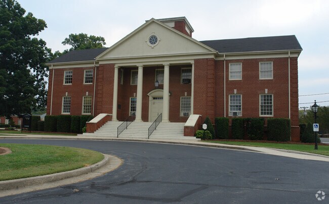
11501 Bain School Rd
197-033-38
Mecklenburg
Religious
North Carolina
R
38
B and X Area of moderate flood hazard, usually the area between the limits of the 100-year and 500-year floods.
13.35 AC
0
East Charlotte
2025
Charlotte
005714
Charlotte-Concord-Gastonia, NC-SC
73,255 SF
NEARBY LISTINGS FOR SALE OR LEASE
-
-
View all Mint Hill listings for sale on LoopNet.com
DEMOGRAPHICS near 11501 Bain School Rd
1 mile
3 mile
5 mile
2025 Total Population
3,631
31,112
116,023
2030 Population
3,974
33,796
125,988
Pop Growth 2025-2030
+ 9.45%
+ 8.63%
+ 8.59%
Average Age
43
42
40
2025 Total Households
1,328
11,212
42,070
HH Growth 2025-2030
+ 9.49%
+ 8.67%
+ 8.71%
Median Household Inc
$113,693
$102,586
$85,443
Avg Household Size
2.70
2.70
2.70
2025 Avg HH Vehicles
2.00
2.00
2.00
Median Home Value
$460,156
$460,268
$396,317
Median Year Built
1999
1994
1994
Nearby Places
Map Layers
Map Styles
 Street
 Aerial
Layers
 Traffic
 Biking
Places
Listings with unknown addresses are not visible on the map
- Restaurants
- Banks
- Shops
- Fitness
- Groceries
PUBLIC TRANSPORTATION
AIRPORT
Concord-Padgett Regional
Drive
Walk
Distance
Concord-Padgett Regional
25 min
18.6 mi
Charlotte/Douglas International
Drive
Walk
Distance
Charlotte/Douglas International
37 min
20.3 mi
Freight Ports
North Charleston Terminal
Drive
Walk
Distance
North Charleston Terminal
242 min
212.4 mi
Nearby Properties
Address
Land Use
TOTAL SIZE
Lot Size
Zoning
Address
Land Use
TOTAL SIZE
Lot Size
Zoning
539,702 SF
83.70 AC
I
Address
Land Use
TOTAL SIZE
Lot Size
Zoning
187,371 SF
7.31 AC
Address
Land Use
TOTAL SIZE
Lot Size
Zoning
333,774 SF
64.04 AC
I
Address
Land Use
TOTAL SIZE
Lot Size
Zoning
96,071 SF
7.44 AC
Address
Land Use
TOTAL SIZE
Lot Size
Zoning
239,983 SF
21.41 AC
I-G(CD)
Address
Land Use
TOTAL SIZE
Lot Size
Zoning
78,372 SF
14.08 AC
IGCUD
Address
Land Use
TOTAL SIZE
Lot Size
Zoning
58,134 SF
5.08 AC
IGCUD
Address
Land Use
TOTAL SIZE
Lot Size
Zoning
86,432 SF
20.01 AC
I
Address
Land Use
TOTAL SIZE
Lot Size
Zoning
40,890 SF
2.92 AC
O-A DO-B(C
Address
Land Use
TOTAL SIZE
Lot Size
Zoning
80,888 SF
8.20 AC
Address
Land Use
TOTAL SIZE
Lot Size
Zoning
77,438 SF
4.26 AC
BD
Address
Land Use
TOTAL SIZE
Lot Size
Zoning
36,480 SF
12.21 AC
NRD STALLI
Address
Land Use
TOTAL SIZE
Lot Size
Zoning
67,080 SF
7.99 AC
Address
Land Use
TOTAL SIZE
Lot Size
Zoning
62,619 SF
11.93 AC
I-G(CD)
Address
Land Use
TOTAL SIZE
Lot Size
Zoning
77,876 SF
26.47 AC
R
Address
Land Use
TOTAL SIZE
Lot Size
Zoning
45,974 SF
9.85 AC
O-A DO-B(C
Address
Land Use
TOTAL SIZE
Lot Size
Zoning
60,402 SF
10.46 AC
BP
Address
Land Use
TOTAL SIZE
Lot Size
Zoning
34,114 SF
8.50 AC
R(CD)
Address
Land Use
TOTAL SIZE
Lot Size
Zoning
18.70 AC
R
Address
Land Use
TOTAL SIZE
Lot Size
Zoning
54,876 SF
6.35 AC
R
Address
Land Use
TOTAL SIZE
Lot Size
Zoning
21,001 SF
20.22 AC
R
Address
Land Use
TOTAL SIZE
Lot Size
Zoning
54,308 SF
7.54 AC
BPCUD
Address
Land Use
TOTAL SIZE
Lot Size
Zoning
20,808 SF
1.56 AC
B-D DO-B
Address
Land Use
TOTAL SIZE
Lot Size
Zoning
44,478 SF
5.41 AC
B-P(CD)
Address
Land Use
TOTAL SIZE
Lot Size
Zoning
20,470 SF
3.43 AC
B-P
Address
Land Use
TOTAL SIZE
Lot Size
Zoning
58,284 SF
4.01 AC
B-D
Address
Land Use
TOTAL SIZE
Lot Size
Zoning
37,444 SF
6.55 AC
R
Address
Land Use
TOTAL SIZE
Lot Size
Zoning
10,852 SF
10.64 AC
BG
Address
Land Use
TOTAL SIZE
Lot Size
Zoning
52,600 SF
4.32 AC
The World's #1 Commercial Real Estate Marketplace
Connect with us
© 2026 CoStar Group
The information above has been obtained from sources believed reliable. While we do not doubt its accuracy we have not verified it and make no guarantee, warranty or representation about it. It is your responsibility to independently confirm its accuracy and completeness. Any projections, opinions, assumptions, or estimates used are for example only and do not represent the current or future performance of the property. The value of this transaction to you depends on tax and other factors which should be evaluated by your tax, financial, and legal advisors. You and your advisors should conduct a careful, independent investigation of the property to determine to your satisfaction the suitability of the property for your needs.