Property Record
11501 E 63Rd St, Raytown, MO 64133


Save to a Folder
{{folder.Name}}
{{folder.ListingIds.length}} Properties
{{folder.ListingIds.length}} Property
Create a New Folder
Property Detail
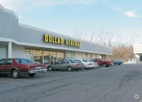
11501 E 63Rd St
45-140-01-68-00-0-00-000
SEC-4 TWP-48 RNG-32 PT OF SE 1/4 DAF: N 1/2 OF E 1/2 NE SE C ONTG 9.4 AC.
Regionalshoppingcenterormallwithanchorstore
JACKSON
B and X Area of moderate flood hazard, usually the area between the limits of the 100-year and 500-year floods.
Missouri
2024
9.22 AC
2025
East Jackson County
012703
Kansas City
86,614 SF
Kansas City, MO-KS
NEARBY LISTINGS FOR SALE OR LEASE
DEMOGRAPHICS near 11501 E 63Rd St
1 mile
3 mile
5 mile
2025 Total Population
8,076
50,121
126,435
2030 Population
8,088
50,216
126,744
Pop Growth 2025-2030
+ 0.15%
+ 0.19%
+ 0.24%
Average Age
43
41
41
2025 Total Households
3,298
20,996
52,226
HH Growth 2025-2030
+ 0.15%
+ 0.17%
+ 0.24%
Median Household Inc
$80,314
$68,016
$67,798
Avg Household Size
2.40
2.30
2.30
2025 Avg HH Vehicles
2.00
2.00
2.00
Median Home Value
$208,533
$174,598
$185,900
Median Year Built
1969
1965
1968
Nearby Places
Map Layers
Map Styles
 Street
 Aerial
Layers
 Traffic
 Biking
Places
Listings with unknown addresses are not visible on the map
- Restaurants
- Banks
- Shops
- Fitness
- Groceries
PUBLIC TRANSPORTATION
COMMUTER RAIL
Independence Amtrak Station (Lincoln Service Missouri River Runner - Amtrak, Missouri River Runner - Amtrak)
Drive
Walk
Distance
Independence Amtrak Station (Lincoln Service Missouri River Runner - Amtrak, Missouri River Runner - Amtrak)
14 min
6.2 mi
Lee's Summit Amtrak (Lincoln Service Missouri River Runner - Amtrak, Missouri River Runner - Amtrak)
Drive
Walk
Distance
Lee's Summit Amtrak (Lincoln Service Missouri River Runner - Amtrak, Missouri River Runner - Amtrak)
17 min
9.1 mi
AIRPORT
Kansas City International
Drive
Walk
Distance
Kansas City International
45 min
34.9 mi
Freight Ports
Tulsa Port Of Catoosa
Drive
Walk
Distance
Tulsa Port Of Catoosa
269 min
237.9 mi
Nearby Properties
Address
Land Use
TOTAL SIZE
Lot Size
Zoning
Address
Land Use
TOTAL SIZE
Lot Size
Zoning
175,318 SF
26.37 AC
Address
Land Use
TOTAL SIZE
Lot Size
Zoning
137,428 SF
27.76 AC
Address
Land Use
TOTAL SIZE
Lot Size
Zoning
210,008 SF
16.89 AC
Address
Land Use
TOTAL SIZE
Lot Size
Zoning
168,184 SF
18.63 AC
Address
Land Use
TOTAL SIZE
Lot Size
Zoning
389,227 SF
33.30 AC
Address
Land Use
TOTAL SIZE
Lot Size
Zoning
134,082 SF
1.79 AC
Address
Land Use
TOTAL SIZE
Lot Size
Zoning
42,188 SF
7.82 AC
Address
Land Use
TOTAL SIZE
Lot Size
Zoning
147,000 SF
Address
Land Use
TOTAL SIZE
Lot Size
Zoning
173,321 SF
40 AC
Address
Land Use
TOTAL SIZE
Lot Size
Zoning
45,832 SF
8.61 AC
Address
Land Use
TOTAL SIZE
Lot Size
Zoning
103,866 SF
13.29 AC
Address
Land Use
TOTAL SIZE
Lot Size
Zoning
Address
Land Use
TOTAL SIZE
Lot Size
Zoning
145,569 SF
16.90 AC
Address
Land Use
TOTAL SIZE
Lot Size
Zoning
80,433 SF
7.24 AC
Address
Land Use
TOTAL SIZE
Lot Size
Zoning
176,132 SF
0.27 AC
Address
Land Use
TOTAL SIZE
Lot Size
Zoning
111,617 SF
9.12 AC
Address
Land Use
TOTAL SIZE
Lot Size
Zoning
73,434 SF
10.35 AC
Address
Land Use
TOTAL SIZE
Lot Size
Zoning
81,990 SF
3.47 AC
Address
Land Use
TOTAL SIZE
Lot Size
Zoning
175,442 SF
11.54 AC
Address
Land Use
TOTAL SIZE
Lot Size
Zoning
103,500 SF
1.37 AC
Address
Land Use
TOTAL SIZE
Lot Size
Zoning
43,750 SF
6.05 AC
Address
Land Use
TOTAL SIZE
Lot Size
Zoning
58,800 SF
5.72 AC
Address
Land Use
TOTAL SIZE
Lot Size
Zoning
20,498 SF
9.45 AC
Address
Land Use
TOTAL SIZE
Lot Size
Zoning
43,200 SF
4.37 AC
Address
Land Use
TOTAL SIZE
Lot Size
Zoning
35,646 SF
3.25 AC
Address
Land Use
TOTAL SIZE
Lot Size
Zoning
67,570 SF
5.71 AC
Address
Land Use
TOTAL SIZE
Lot Size
Zoning
47,086 SF
8.20 AC
Address
Land Use
TOTAL SIZE
Lot Size
Zoning
47,099 SF
3.55 AC
Address
Land Use
TOTAL SIZE
Lot Size
Zoning
22,913 SF
151.50 AC
Address
Land Use
TOTAL SIZE
Lot Size
Zoning
49,839 SF
2.97 AC
The World's #1 Commercial Real Estate Marketplace
Connect with us
© 2026 CoStar Group
The information above has been obtained from sources believed reliable. While we do not doubt its accuracy we have not verified it and make no guarantee, warranty or representation about it. It is your responsibility to independently confirm its accuracy and completeness. Any projections, opinions, assumptions, or estimates used are for example only and do not represent the current or future performance of the property. The value of this transaction to you depends on tax and other factors which should be evaluated by your tax, financial, and legal advisors. You and your advisors should conduct a careful, independent investigation of the property to determine to your satisfaction the suitability of the property for your needs.