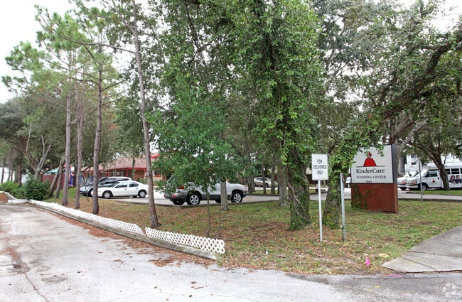
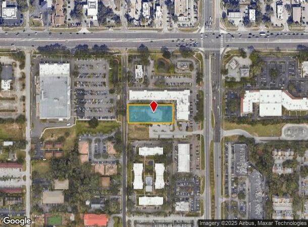
Property Record
11501 N 53Rd St, Temple Terrace, FL 33617
NEARBY LISTINGS FOR SALE OR LEASE
Property Detail
11501 N 53Rd St
Tampa-St. Petersburg-Clearwater, FL
Temple Terraces
T-15-28-19-54V-000010-D0000.0
TEMPLE TERRACES LOT D BLOCK 10
Daycare
Hillsborough
X
Florida
12057C0217H
d
0
0.87 AC
2024
Northeast Tampa
010701
Tampa/St Petersburg
6,383 SF
DEMOGRAPHICS near 11501 N 53Rd St
1 Mile
3 Mile
5 Mile
2024 Total Population
16,224
118,198
236,197
2029 Population
17,605
128,793
257,823
Pop Growth 2024-2029
+ 8.51%
+ 8.96%
+ 9.16%
Average Age
36
35
37
2024 Total Households
6,115
48,408
92,923
HH Growth 2024-2029
+ 8.67%
+ 9.10%
+ 9.34%
Median Household Inc
$42,245
$41,510
$43,657
Avg Household Size
2.40
2.30
2.40
2024 Avg HH Vehicles
2.00
1.00
1.00
Median Home Value
$264,086
$231,720
$236,263
Median Year Built
1982
1984
1982
Nearby Places
Map Layers
Map Styles
 Street
 Aerial
- Restaurants
- Banks
- Shops
- Fitness
- Groceries
PUBLIC TRANSPORTATION
COMMUTER RAIL
DRIVE
WALK
Distance
19 min
10.0 mi
AIRPORT
Tampa International
DRIVE
WALK
Distance
Tampa International
30 min
17.0 mi
St Pete-Clearwater International
DRIVE
WALK
Distance
St Pete-Clearwater International
47 min
27.1 mi
Freight Ports
Port of Tampa Bay
DRIVE
WALK
Distance
Port of Tampa Bay
23 min
11.6 mi
Nearby Properties
Address
Land Use
TOTAL SIZE
Lot Size
Zoning
Address
Land Use
TOTAL SIZE
Lot Size
Zoning
4,011,409 SF
1,561.04 AC
UC
Address
Land Use
TOTAL SIZE
Lot Size
Zoning
1,181,974 SF
23.01 AC
SPI-UC-2
Address
Land Use
TOTAL SIZE
Lot Size
Zoning
775,847 SF
290.33 AC
PD
Address
Land Use
TOTAL SIZE
Lot Size
Zoning
606,020 SF
28.56 AC
PD
Address
Land Use
TOTAL SIZE
Lot Size
Zoning
514,860 SF
47.74 AC
SPI-UC-2
Address
Land Use
TOTAL SIZE
Lot Size
Zoning
702,607 SF
63.42 AC
RCP
Address
Land Use
TOTAL SIZE
Lot Size
Zoning
671,677 SF
72.27 AC
RMFA
Address
Land Use
TOTAL SIZE
Lot Size
Zoning
727,236 SF
61.10 AC
CU
Address
Land Use
TOTAL SIZE
Lot Size
Zoning
348,850 SF
4.45 AC
PD
Address
Land Use
TOTAL SIZE
Lot Size
Zoning
302,910 SF
29.81 AC
PD
Address
Land Use
TOTAL SIZE
Lot Size
Zoning
355,261 SF
22 AC
CU
Address
Land Use
TOTAL SIZE
Lot Size
Zoning
405,529 SF
26.82 AC
SPI-UC-1
Address
Land Use
TOTAL SIZE
Lot Size
Zoning
594,270 SF
22.99 AC
PD
Address
Land Use
TOTAL SIZE
Lot Size
Zoning
290,322 SF
12.51 AC
SPI-UC-1
Address
Land Use
TOTAL SIZE
Lot Size
Zoning
306,031 SF
16.15 AC
PD-A
Address
Land Use
TOTAL SIZE
Lot Size
Zoning
345,992 SF
20.90 AC
SPI-UC-1
Address
Land Use
TOTAL SIZE
Lot Size
Zoning
287,530 SF
9.09 AC
PD
Address
Land Use
TOTAL SIZE
Lot Size
Zoning
351,811 SF
70.56 AC
CU
Address
Land Use
TOTAL SIZE
Lot Size
Zoning
381,714 SF
4.66 AC
PD
Address
Land Use
TOTAL SIZE
Lot Size
Zoning
475,272 SF
19.44 AC
PD
Address
Land Use
TOTAL SIZE
Lot Size
Zoning
154,301 SF
19.84 AC
PD
Address
Land Use
TOTAL SIZE
Lot Size
Zoning
322,637 SF
18.12 AC
PD
Address
Land Use
TOTAL SIZE
Lot Size
Zoning
264,202 SF
12.86 AC
PD
Address
Land Use
TOTAL SIZE
Lot Size
Zoning
374,282 SF
13.50 AC
PD
Address
Land Use
TOTAL SIZE
Lot Size
Zoning
342,686 SF
4.30 AC
PD
Address
Land Use
TOTAL SIZE
Lot Size
Zoning
706,512 SF
76.54 AC
PD
Address
Land Use
TOTAL SIZE
Lot Size
Zoning
207,965 SF
20.94 AC
PD-A
Address
Land Use
TOTAL SIZE
Lot Size
Zoning
300,022 SF
5.16 AC
PD
Address
Land Use
TOTAL SIZE
Lot Size
Zoning
307,647 SF
4.86 AC
PD
Address
Land Use
TOTAL SIZE
Lot Size
Zoning
598,043 SF
48.18 AC
PD
The World's #1 Commercial Real Estate Marketplace
Connect with us
© 2025 CoStar Group
The information above has been obtained from sources believed reliable. While we do not doubt its accuracy we have not verified it and make no guarantee, warranty or representation about it. It is your responsibility to independently confirm its accuracy and completeness. Any projections, opinions, assumptions, or estimates used are for example only and do not represent the current or future performance of the property. The value of this transaction to you depends on tax and other factors which should be evaluated by your tax, financial, and legal advisors. You and your advisors should conduct a careful, independent investigation of the property to determine to your satisfaction the suitability of the property for your needs.