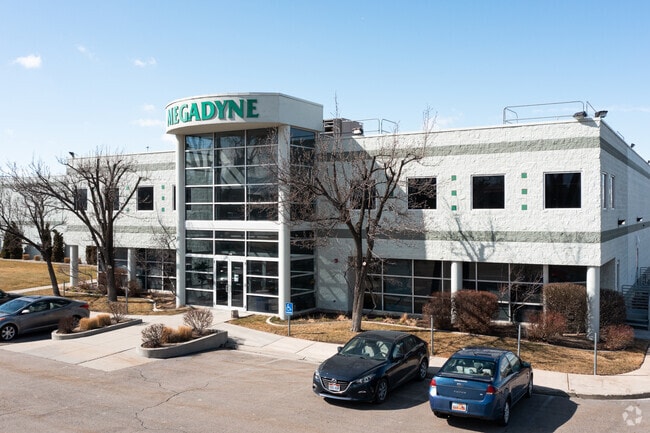
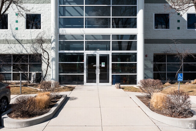
Property Record
11506 S State St, Draper, UT 84020


NEARBY LISTINGS FOR SALE OR LEASE
Property Detail
11506 S State St
27-24-426-007-0000
BEG S 833.50 FT & W 71.04 FT FR E 1/4 COR OF SEC 24, T 3S, R1W, SLM; W 326.72 FT; S 2^20 W 132 FT; W 137.22 FT; N 6^2323 W 404.79 FT; E 523.32 FT; S 2^2133 E 229.99 FT; S1^1248 W 40.64 FT TO BEG. 3.58 AC. 5242-1125 6333-2132 6520-2576 6791-0704 8454-
Officebuilding
Salt Lake
X
Utah
49035C0442G
3.58 AC
2024
Draper
2025
Salt Lake City
112825
Salt Lake City, UT
50,640 SF
DEMOGRAPHICS near 11506 S State St
1 Mile
3 Mile
5 Mile
2024 Total Population
10,199
96,559
260,233
2029 Population
10,282
98,270
263,625
Pop Growth 2024-2029
+ 0.81%
+ 1.77%
+ 1.30%
Average Age
35
38
37
2024 Total Households
3,627
31,118
84,002
HH Growth 2024-2029
+ 0.55%
+ 1.89%
+ 1.29%
Median Household Inc
$91,118
$100,884
$99,152
Avg Household Size
2.80
3.00
3.00
2024 Avg HH Vehicles
2.00
2.00
2.00
Median Home Value
$571,110
$558,395
$545,204
Median Year Built
1999
1995
1995
Nearby Places
Map Layers
Map Styles
 Street
 Aerial
- Restaurants
- Banks
- Shops
- Fitness
- Groceries
PUBLIC TRANSPORTATION
TRANSIT/SUBWAY
Crescent View Station (Blue Line - Utah Transit Authority (UTA))
DRIVE
WALK
Distance
Crescent View Station (Blue Line - Utah Transit Authority (UTA))
2 min
16 min
0.8 mi
COMMUTER RAIL
South Jordan Station (FrontRunner - Utah Transit Authority (UTA))
DRIVE
WALK
Distance
South Jordan Station (FrontRunner - Utah Transit Authority (UTA))
4 min
2.0 mi
Draper Station (FrontRunner - Utah Transit Authority (UTA))
DRIVE
WALK
Distance
Draper Station (FrontRunner - Utah Transit Authority (UTA))
7 min
3.0 mi
AIRPORT
Salt Lake City International
DRIVE
WALK
Distance
Salt Lake City International
26 min
20.8 mi
Provo Municipal
DRIVE
WALK
Distance
Provo Municipal
40 min
30.5 mi
Freight Ports
Port of Stockton
DRIVE
WALK
Distance
Port of Stockton
726 min
711.2 mi
Nearby Properties
Address
Land Use
TOTAL SIZE
Lot Size
Zoning
Address
Land Use
TOTAL SIZE
Lot Size
Zoning
258,000 SF
13.25 AC
1D
Address
Land Use
TOTAL SIZE
Lot Size
Zoning
40,495 SF
33.28 AC
RM-1
Address
Land Use
TOTAL SIZE
Lot Size
Zoning
774,515 SF
87.50 AC
M-1
Address
Land Use
TOTAL SIZE
Lot Size
Zoning
1,055,572 SF
8.31 AC
CR
Address
Land Use
TOTAL SIZE
Lot Size
Zoning
210,421 SF
6.87 AC
CR
Address
Land Use
TOTAL SIZE
Lot Size
Zoning
153,245 SF
27.10 AC
PUD137
Address
Land Use
TOTAL SIZE
Lot Size
Zoning
566,327 SF
7.02 AC
CBD-O
Address
Land Use
TOTAL SIZE
Lot Size
Zoning
458,458 SF
6.05 AC
MU
Address
Land Use
TOTAL SIZE
Lot Size
Zoning
224,049 SF
5.29 AC
MU
Address
Land Use
TOTAL SIZE
Lot Size
Zoning
372,355 SF
13.80 AC
C-F
Address
Land Use
TOTAL SIZE
Lot Size
Zoning
106,318 SF
4.46 AC
CBD-O
Address
Land Use
TOTAL SIZE
Lot Size
Zoning
398,320 SF
40 AC
1110
Address
Land Use
TOTAL SIZE
Lot Size
Zoning
392,144 SF
30.63 AC
1113
Address
Land Use
TOTAL SIZE
Lot Size
Zoning
186,651 SF
35.87 AC
C-R
Address
Land Use
TOTAL SIZE
Lot Size
Zoning
280,668 SF
12 AC
CBD
Address
Land Use
TOTAL SIZE
Lot Size
Zoning
81,865 SF
19.46 AC
Z-C-FF
Address
Land Use
TOTAL SIZE
Lot Size
Zoning
277,938 SF
13.90 AC
CSD-DD
Address
Land Use
TOTAL SIZE
Lot Size
Zoning
359,628 SF
4.53 AC
TSD
Address
Land Use
TOTAL SIZE
Lot Size
Zoning
197,645 SF
19.51 AC
1122
Address
Land Use
TOTAL SIZE
Lot Size
Zoning
34,872 SF
11.59 AC
c-f
Address
Land Use
TOTAL SIZE
Lot Size
Zoning
379,911 SF
5.78 AC
mu
Address
Land Use
TOTAL SIZE
Lot Size
Zoning
192,626 SF
5.72 AC
CF
Address
Land Use
TOTAL SIZE
Lot Size
Zoning
126,531 SF
11.50 AC
1244
Address
Land Use
TOTAL SIZE
Lot Size
Zoning
551,648 SF
31.71 AC
C B D
Address
Land Use
TOTAL SIZE
Lot Size
Zoning
311,202 SF
0.01 AC
4180
Address
Land Use
TOTAL SIZE
Lot Size
Zoning
416,562 SF
7.48 AC
CSDDPM
Address
Land Use
TOTAL SIZE
Lot Size
Zoning
101,790 SF
5.69 AC
PUD(16
Address
Land Use
TOTAL SIZE
Lot Size
Zoning
115,637 SF
36.38 AC
TSD
Address
Land Use
TOTAL SIZE
Lot Size
Zoning
198,479 SF
2.52 AC
MU
Address
Land Use
TOTAL SIZE
Lot Size
Zoning
374,097 SF
6.87 AC
CSDDPM
The World's #1 Commercial Real Estate Marketplace
Connect with us
© 2025 CoStar Group
The information above has been obtained from sources believed reliable. While we do not doubt its accuracy we have not verified it and make no guarantee, warranty or representation about it. It is your responsibility to independently confirm its accuracy and completeness. Any projections, opinions, assumptions, or estimates used are for example only and do not represent the current or future performance of the property. The value of this transaction to you depends on tax and other factors which should be evaluated by your tax, financial, and legal advisors. You and your advisors should conduct a careful, independent investigation of the property to determine to your satisfaction the suitability of the property for your needs.