Property Record
11507 Maple Brook Dr, Louisville, KY 40241


NEARBY LISTINGS FOR SALE OR LEASE
-
-
View all Louisville listings for sale on LoopNet.com
Property Detail
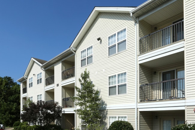
11507 Maple Brook Dr
001404050000
TRACT 3 MINOR PLAT DB 6838 X 176, 10.86 AC +/-
Apartment
Jefferson
AE
Kentucky
21111C0019F
10.86 AC
2025
Outer East End
2025
Louisville
010320
Louisville-Jefferson County, KY-IN
17,352 SF
DEMOGRAPHICS near 11507 Maple Brook Dr
1 Mile
3 Mile
5 Mile
2024 Total Population
9,762
57,318
132,344
2029 Population
9,640
57,387
132,344
Pop Growth 2024-2029
(1.25%)
+ 0.12%
0.00%
Average Age
38
41
42
2024 Total Households
3,993
23,192
54,775
HH Growth 2024-2029
(1.33%)
(0.08%)
(0.20%)
Median Household Inc
$72,961
$97,015
$95,471
Avg Household Size
2.40
2.40
2.40
2024 Avg HH Vehicles
2.00
2.00
2.00
Median Home Value
$251,291
$321,655
$332,093
Median Year Built
1993
1994
1989
Nearby Places
Map Layers
Map Styles
 Street
 Aerial
- Restaurants
- Banks
- Shops
- Fitness
- Groceries
PUBLIC TRANSPORTATION
AIRPORT
Louisville Muhammad Ali International
DRIVE
WALK
Distance
Louisville Muhammad Ali International
31 min
18.5 mi
Freight Ports
Port of Toledo
DRIVE
WALK
Distance
Port of Toledo
342 min
295.9 mi
Nearby Properties
Address
Land Use
TOTAL SIZE
Lot Size
Zoning
Address
Land Use
TOTAL SIZE
Lot Size
Zoning
39,200 SF
38.66 AC
C2-COMMERC
Address
Land Use
TOTAL SIZE
Lot Size
Zoning
Address
Land Use
TOTAL SIZE
Lot Size
Zoning
2,922 SF
23.24 AC
R4-RESIDEN
Address
Land Use
TOTAL SIZE
Lot Size
Zoning
160,000 SF
421.24 AC
PEC-PLANNE
Address
Land Use
TOTAL SIZE
Lot Size
Zoning
9.74 AC
Address
Land Use
TOTAL SIZE
Lot Size
Zoning
11.92 AC
OTF-OFFICE
Address
Land Use
TOTAL SIZE
Lot Size
Zoning
10.31 AC
Address
Land Use
TOTAL SIZE
Lot Size
Zoning
9.68 AC
Address
Land Use
TOTAL SIZE
Lot Size
Zoning
4,940 SF
17.11 AC
R4-RESIDEN
Address
Land Use
TOTAL SIZE
Lot Size
Zoning
17,628 SF
19.19 AC
R7-RESIDEN
Address
Land Use
TOTAL SIZE
Lot Size
Zoning
1,582 SF
4.25 AC
R4-RESIDEN
Address
Land Use
TOTAL SIZE
Lot Size
Zoning
2,325 SF
17.65 AC
R7-RESIDEN
Address
Land Use
TOTAL SIZE
Lot Size
Zoning
Address
Land Use
TOTAL SIZE
Lot Size
Zoning
4,560 SF
24.41 AC
R6-RESIDEN
Address
Land Use
TOTAL SIZE
Lot Size
Zoning
21,340 SF
17.43 AC
R7-RESIDEN
Address
Land Use
TOTAL SIZE
Lot Size
Zoning
15.48 AC
R4-RESIDEN
Address
Land Use
TOTAL SIZE
Lot Size
Zoning
142,751 SF
48.49 AC
PEC-PLANNE
Address
Land Use
TOTAL SIZE
Lot Size
Zoning
11,484 SF
13.83 AC
R7-RESIDEN
Address
Land Use
TOTAL SIZE
Lot Size
Zoning
4,283 SF
25.65 AC
R6-RESIDEN
Address
Land Use
TOTAL SIZE
Lot Size
Zoning
6.90 AC
C2-COMMERC
Address
Land Use
TOTAL SIZE
Lot Size
Zoning
23,284 SF
19.61 AC
R5A-RESIDE
Address
Land Use
TOTAL SIZE
Lot Size
Zoning
62,500 SF
59.16 AC
PEC-PLANNE
Address
Land Use
TOTAL SIZE
Lot Size
Zoning
699,508 SF
55.04 AC
PEC-PLANNE
Address
Land Use
TOTAL SIZE
Lot Size
Zoning
20.36 AC
PEC-PLANNE
Address
Land Use
TOTAL SIZE
Lot Size
Zoning
27,471 SF
13.24 AC
R7-RESIDEN
Address
Land Use
TOTAL SIZE
Lot Size
Zoning
1,093 SF
8.62 AC
R4-RESIDEN
Address
Land Use
TOTAL SIZE
Lot Size
Zoning
112,959 SF
6.94 AC
Address
Land Use
TOTAL SIZE
Lot Size
Zoning
62,840 SF
29.42 AC
PEC-PLANNE
Address
Land Use
TOTAL SIZE
Lot Size
Zoning
The World's #1 Commercial Real Estate Marketplace
Connect with us
© 2026 CoStar Group
The information above has been obtained from sources believed reliable. While we do not doubt its accuracy we have not verified it and make no guarantee, warranty or representation about it. It is your responsibility to independently confirm its accuracy and completeness. Any projections, opinions, assumptions, or estimates used are for example only and do not represent the current or future performance of the property. The value of this transaction to you depends on tax and other factors which should be evaluated by your tax, financial, and legal advisors. You and your advisors should conduct a careful, independent investigation of the property to determine to your satisfaction the suitability of the property for your needs.