Property Record
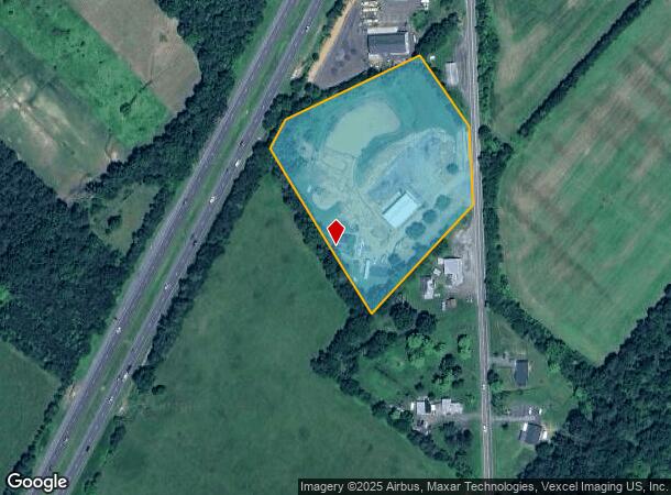
11520 James Madison St, Remington, VA 22734


NEARBY LISTINGS FOR SALE OR LEASE
Property Detail
11520 James Madison St
6888-25-5994
Lee Mag Dis
Multipleuses
NOT PROVIDED. PARCEL NUMBER 8256
X
Fauquier
51061C0416D
Virginia
2025
5.44 AC
2025
Fauquier County/Vint Hill
930706
Washington, DC
2,312 SF
Washington-Arlington-Alexandria, DC-VA-MD-WV
DEMOGRAPHICS near 11520 James Madison St
1 Mile
3 Mile
5 Mile
2024 Total Population
778
11,181
13,988
2029 Population
816
11,748
14,705
Pop Growth 2024-2029
+ 4.88%
+ 5.07%
+ 5.13%
Average Age
36
37
37
2024 Total Households
259
3,748
4,729
HH Growth 2024-2029
+ 4.63%
+ 5.15%
+ 5.20%
Median Household Inc
$94,117
$91,601
$92,564
Avg Household Size
3.00
3.00
2.90
2024 Avg HH Vehicles
2.00
2.00
2.00
Median Home Value
$331,097
$331,408
$344,804
Median Year Built
1987
1989
1989
Nearby Places
- Restaurants
- Banks
- Shops
- Fitness
- Groceries
SALE & LEASE HISTORY
LISTING DATE
SALE/LEASE

Jul 03, 2017
For Sale
Nearby Properties
Address
Land Use
TOTAL SIZE
Lot Size
Zoning
Address
Land Use
TOTAL SIZE
Lot Size
Zoning
71,126 SF
8.06 AC
RES, 4 DWE
Address
Land Use
TOTAL SIZE
Lot Size
Zoning
17,840 SF
5.57 AC
RES GARDEN
Address
Land Use
TOTAL SIZE
Lot Size
Zoning
10 AC
RES, 2 DWE
Address
Land Use
TOTAL SIZE
Lot Size
Zoning
1,125 SF
33.43 AC
RES 4 DWEL
Address
Land Use
TOTAL SIZE
Lot Size
Zoning
90,294 SF
3.58 AC
MUBEALETON
Address
Land Use
TOTAL SIZE
Lot Size
Zoning
14,520 SF
10.15 AC
PLANNED RE
Address
Land Use
TOTAL SIZE
Lot Size
Zoning
347 SF
106.38 AC
RES DIST M
Address
Land Use
TOTAL SIZE
Lot Size
Zoning
2,544 SF
10.60 AC
COMMERCIAL
Address
Land Use
TOTAL SIZE
Lot Size
Zoning
600 SF
233.85 AC
BP
Address
Land Use
TOTAL SIZE
Lot Size
Zoning
1,536 SF
391.54 AC
AGRICULTUR
Address
Land Use
TOTAL SIZE
Lot Size
Zoning
25,848 SF
0.99 AC
R1 RES SIN
Address
Land Use
TOTAL SIZE
Lot Size
Zoning
6,000 SF
9.23 AC
LI
Address
Land Use
TOTAL SIZE
Lot Size
Zoning
10,712 SF
2 AC
RES, 4 DWE
Address
Land Use
TOTAL SIZE
Lot Size
Zoning
6,124 SF
2.29 AC
COMMERCIAL
Address
Land Use
TOTAL SIZE
Lot Size
Zoning
3,024 SF
9.98 AC
PLANNED RE
Address
Land Use
TOTAL SIZE
Lot Size
Zoning
1,200 SF
214.15 AC
AGRICULTUR
Address
Land Use
TOTAL SIZE
Lot Size
Zoning
1,560 SF
45.10 AC
AGRICULTUR
Address
Land Use
TOTAL SIZE
Lot Size
Zoning
13,184 SF
0.29 AC
COMMERCIAL
Address
Land Use
TOTAL SIZE
Lot Size
Zoning
11,590 SF
1.58 AC
COMMERCIAL
Address
Land Use
TOTAL SIZE
Lot Size
Zoning
5,400 SF
1.72 AC
COMMERCIAL
Address
Land Use
TOTAL SIZE
Lot Size
Zoning
235.05 AC
PLANNED RE
Address
Land Use
TOTAL SIZE
Lot Size
Zoning
65.72 AC
INDUSTRIAL
Address
Land Use
TOTAL SIZE
Lot Size
Zoning
130,600 SF
10.74 AC
INDUSTRIAL
Address
Land Use
TOTAL SIZE
Lot Size
Zoning
8,400 SF
1.04 AC
COMMERCIAL
Address
Land Use
TOTAL SIZE
Lot Size
Zoning
5,970 SF
1.97 AC
RES GARDEN
Address
Land Use
TOTAL SIZE
Lot Size
Zoning
1,760 SF
75 AC
INDUSTRIAL
Address
Land Use
TOTAL SIZE
Lot Size
Zoning
8,200 SF
0.19 AC
COMMERCIAL
Address
Land Use
TOTAL SIZE
Lot Size
Zoning
5,032 SF
1.01 AC
COMMERCIAL
Address
Land Use
TOTAL SIZE
Lot Size
Zoning
8.93 AC
COMMERCIAL
The World's #1 Commercial Real Estate Marketplace
Connect with us
© 2025 CoStar Group
The information above has been obtained from sources believed reliable. While we do not doubt its accuracy we have not verified it and make no guarantee, warranty or representation about it. It is your responsibility to independently confirm its accuracy and completeness. Any projections, opinions, assumptions, or estimates used are for example only and do not represent the current or future performance of the property. The value of this transaction to you depends on tax and other factors which should be evaluated by your tax, financial, and legal advisors. You and your advisors should conduct a careful, independent investigation of the property to determine to your satisfaction the suitability of the property for your needs.