Property Record
11521 E Skelly Dr, Tulsa, OK 74128


NEARBY LISTINGS FOR SALE OR LEASE
Property Detail
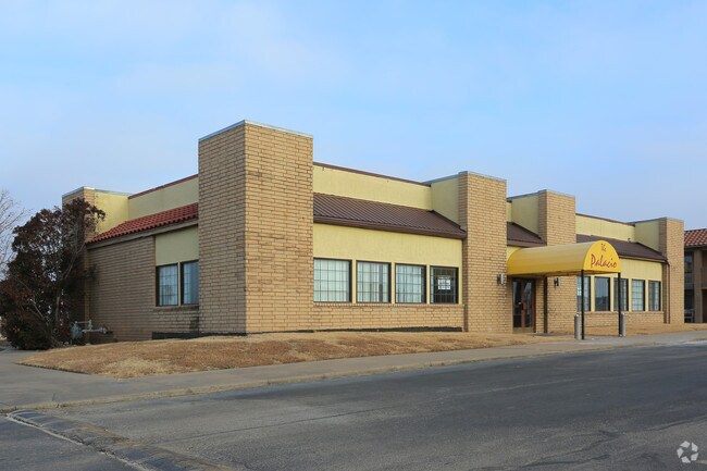
11521 E Skelly Dr
Tulsa, OK
Crossroads Mall Addn
10300-94-05-00030
PRT LT 1 BEG 435SW & 14.35W & 22.83SW MOST ELY COR LT 1 TH SW230.01 NW237.11 NE148.61 SE34.42 SW28.38 SE194.38 POB BLK 1
Commercialnec
Tulsa
X
Oklahoma
40131C0350J
1
2025
0.92 AC
2025
East Tulsa
007309
Tulsa
6,102 SF
DEMOGRAPHICS near 11521 E Skelly Dr
1 Mile
3 Mile
5 Mile
2024 Total Population
10,843
71,841
142,583
2029 Population
11,184
74,176
147,331
Pop Growth 2024-2029
+ 3.14%
+ 3.25%
+ 3.33%
Average Age
36
35
36
2024 Total Households
3,870
26,151
55,369
HH Growth 2024-2029
+ 3.23%
+ 3.37%
+ 3.37%
Median Household Inc
$44,214
$45,933
$47,761
Avg Household Size
2.60
2.60
2.50
2024 Avg HH Vehicles
2.00
2.00
2.00
Median Home Value
$76,697
$118,952
$133,335
Median Year Built
1969
1972
1970
Nearby Places
Map Layers
Map Styles
 Street
 Aerial
- Restaurants
- Banks
- Shops
- Fitness
- Groceries
PUBLIC TRANSPORTATION
AIRPORT
Tulsa International
DRIVE
WALK
Distance
Tulsa International
12 min
8.4 mi
Freight Ports
Port of Shreveport
DRIVE
WALK
Distance
Port of Shreveport
1 min
291.1 mi
SALE & LEASE HISTORY
LISTING DATE
SALE/LEASE

Sep 24, 2016
For Sale
Jan 17, 2017
For Sale
Nearby Properties
Address
Land Use
TOTAL SIZE
Lot Size
Zoning
Address
Land Use
TOTAL SIZE
Lot Size
Zoning
350,741 SF
28.01 AC
CS
Address
Land Use
TOTAL SIZE
Lot Size
Zoning
349,823 SF
203.39 AC
IL
Address
Land Use
TOTAL SIZE
Lot Size
Zoning
77,346 SF
8.59 AC
RS3
Address
Land Use
TOTAL SIZE
Lot Size
Zoning
112,556 SF
11.07 AC
CH
Address
Land Use
TOTAL SIZE
Lot Size
Zoning
73,294 SF
10.08 AC
RS3
Address
Land Use
TOTAL SIZE
Lot Size
Zoning
103,248 SF
8.87 AC
IL
Address
Land Use
TOTAL SIZE
Lot Size
Zoning
106,270 SF
9.47 AC
RM0
Address
Land Use
TOTAL SIZE
Lot Size
Zoning
124,648 SF
21.23 AC
IL
Address
Land Use
TOTAL SIZE
Lot Size
Zoning
62,352 SF
4.88 AC
CS
Address
Land Use
TOTAL SIZE
Lot Size
Zoning
86,980 SF
2.74 AC
RM1
Address
Land Use
TOTAL SIZE
Lot Size
Zoning
66,324 SF
12.85 AC
CS
Address
Land Use
TOTAL SIZE
Lot Size
Zoning
101,090 SF
1.70 AC
RS2
Address
Land Use
TOTAL SIZE
Lot Size
Zoning
32,370 SF
45.90 AC
AG
Address
Land Use
TOTAL SIZE
Lot Size
Zoning
40,626 SF
2.25 AC
CS
Address
Land Use
TOTAL SIZE
Lot Size
Zoning
55,425 SF
2.96 AC
IL
Address
Land Use
TOTAL SIZE
Lot Size
Zoning
28,465 SF
6.71 AC
RS3
Address
Land Use
TOTAL SIZE
Lot Size
Zoning
24,113 SF
3.54 AC
CS
Address
Land Use
TOTAL SIZE
Lot Size
Zoning
56,531 SF
7.79 AC
RS3
Address
Land Use
TOTAL SIZE
Lot Size
Zoning
498,836 SF
50.22 AC
CS
Address
Land Use
TOTAL SIZE
Lot Size
Zoning
49,953 SF
2.36 AC
OL
Address
Land Use
TOTAL SIZE
Lot Size
Zoning
30,291 SF
4.49 AC
AG
Address
Land Use
TOTAL SIZE
Lot Size
Zoning
673,050 SF
52.77 AC
IM
Address
Land Use
TOTAL SIZE
Lot Size
Zoning
18,325 SF
3.05 AC
CS
Address
Land Use
TOTAL SIZE
Lot Size
Zoning
75.35 AC
AG
Address
Land Use
TOTAL SIZE
Lot Size
Zoning
40,202 SF
2.93 AC
RM0
Address
Land Use
TOTAL SIZE
Lot Size
Zoning
293,564 SF
23.75 AC
RM1
Address
Land Use
TOTAL SIZE
Lot Size
Zoning
14,237 SF
2.28 AC
CS
Address
Land Use
TOTAL SIZE
Lot Size
Zoning
265,350 SF
11.85 AC
RM1
Address
Land Use
TOTAL SIZE
Lot Size
Zoning
34,158 SF
4.89 AC
RS2
The World's #1 Commercial Real Estate Marketplace
Connect with us
© 2025 CoStar Group
The information above has been obtained from sources believed reliable. While we do not doubt its accuracy we have not verified it and make no guarantee, warranty or representation about it. It is your responsibility to independently confirm its accuracy and completeness. Any projections, opinions, assumptions, or estimates used are for example only and do not represent the current or future performance of the property. The value of this transaction to you depends on tax and other factors which should be evaluated by your tax, financial, and legal advisors. You and your advisors should conduct a careful, independent investigation of the property to determine to your satisfaction the suitability of the property for your needs.