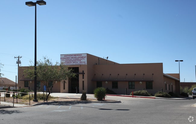
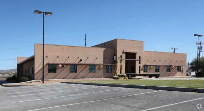
Property Record
1155 N Fourth St, Anthony, NM 88021

Property Detail
1155 N Fourth St
Commercialacreage
S: 26 T: 26S R: 3E
CR1
Dona Ana
B and X Area of moderate flood hazard, usually the area between the limits of the 100-year and 500-year floods.
New Mexico
0
2 AC
2025
Other Market Areas
001808
Las Cruces, NM
6,756 SF
18-15982
NEARBY LISTINGS FOR SALE OR LEASE
DEMOGRAPHICS near 1155 N Fourth St
1 mile
3 mile
5 mile
2025 Total Population
6,841
14,135
24,886
2030 Population
6,867
14,260
25,201
Pop Growth 2025-2030
+ 0.38%
+ 0.88%
+ 1.27%
Average Age
35
36
37
2025 Total Households
2,123
4,444
7,508
HH Growth 2025-2030
+ 0.33%
+ 0.92%
+ 1.25%
Median Household Inc
$32,544
$44,838
$45,634
Avg Household Size
3.20
3.20
3.10
2025 Avg HH Vehicles
2.00
2.00
2.00
Median Home Value
$132,524
$151,023
$146,716
Median Year Built
1991
1990
1989
Nearby Places
Map Layers
Map Styles
 Street
 Aerial
Layers
 Traffic
 Biking
Places
Listings with unknown addresses are not visible on the map
- Restaurants
- Banks
- Shops
- Fitness
- Groceries
PUBLIC TRANSPORTATION
AIRPORT
El Paso International
Drive
Walk
Distance
El Paso International
49 min
30.5 mi
Nearby Properties
Address
Land Use
TOTAL SIZE
Lot Size
Zoning
Address
Land Use
TOTAL SIZE
Lot Size
Zoning
308,798 SF
44.59 AC
C1
Address
Land Use
TOTAL SIZE
Lot Size
Zoning
11,911 SF
13.67 AC
C1
Address
Land Use
TOTAL SIZE
Lot Size
Zoning
128,261 SF
52.29 AC
M2
Address
Land Use
TOTAL SIZE
Lot Size
Zoning
32,950 SF
35.70 AC
Address
Land Use
TOTAL SIZE
Lot Size
Zoning
28,213 SF
1.77 AC
Address
Land Use
TOTAL SIZE
Lot Size
Zoning
21,356 SF
23.42 AC
C1
Address
Land Use
TOTAL SIZE
Lot Size
Zoning
53,714 SF
3.54 AC
Address
Land Use
TOTAL SIZE
Lot Size
Zoning
14,735 SF
1.85 AC
C1
Address
Land Use
TOTAL SIZE
Lot Size
Zoning
38,488 SF
37.19 AC
C1
Address
Land Use
TOTAL SIZE
Lot Size
Zoning
80,382 SF
8 AC
Address
Land Use
TOTAL SIZE
Lot Size
Zoning
1 SF
Address
Land Use
TOTAL SIZE
Lot Size
Zoning
15,368 SF
12.45 AC
Address
Land Use
TOTAL SIZE
Lot Size
Zoning
18,020 SF
10 AC
Address
Land Use
TOTAL SIZE
Lot Size
Zoning
40,963 SF
20 AC
REM
Address
Land Use
TOTAL SIZE
Lot Size
Zoning
42,836 SF
4.12 AC
C1
Address
Land Use
TOTAL SIZE
Lot Size
Zoning
38,958 SF
6.30 AC
Address
Land Use
TOTAL SIZE
Lot Size
Zoning
8,418 SF
221.51 AC
CR1
Address
Land Use
TOTAL SIZE
Lot Size
Zoning
52,954 SF
5.20 AC
Address
Land Use
TOTAL SIZE
Lot Size
Zoning
17,730 SF
17.67 AC
Address
Land Use
TOTAL SIZE
Lot Size
Zoning
36,176 SF
10 AC
Address
Land Use
TOTAL SIZE
Lot Size
Zoning
3,339 SF
22.29 AC
Address
Land Use
TOTAL SIZE
Lot Size
Zoning
14,518 SF
1.75 AC
Address
Land Use
TOTAL SIZE
Lot Size
Zoning
12,968 SF
2.50 AC
C2
Address
Land Use
TOTAL SIZE
Lot Size
Zoning
15,996 SF
2.23 AC
Address
Land Use
TOTAL SIZE
Lot Size
Zoning
10,294 SF
0.87 AC
Address
Land Use
TOTAL SIZE
Lot Size
Zoning
7,557 SF
0.80 AC
C2
Address
Land Use
TOTAL SIZE
Lot Size
Zoning
44,800 SF
13.24 AC
C1
Address
Land Use
TOTAL SIZE
Lot Size
Zoning
7,720 SF
1.03 AC
Address
Land Use
TOTAL SIZE
Lot Size
Zoning
3,843 SF
1.92 AC
C1
Address
Land Use
TOTAL SIZE
Lot Size
Zoning
3,023 SF
0.96 AC
C1
The World's #1 Commercial Real Estate Marketplace
Connect with us
© 2026 CoStar Group
The information above has been obtained from sources believed reliable. While we do not doubt its accuracy we have not verified it and make no guarantee, warranty or representation about it. It is your responsibility to independently confirm its accuracy and completeness. Any projections, opinions, assumptions, or estimates used are for example only and do not represent the current or future performance of the property. The value of this transaction to you depends on tax and other factors which should be evaluated by your tax, financial, and legal advisors. You and your advisors should conduct a careful, independent investigation of the property to determine to your satisfaction the suitability of the property for your needs.