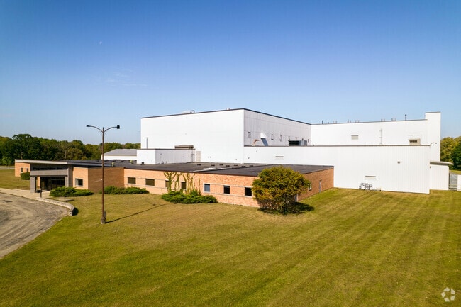
Property Record
1155 Prairie Hill Rd, Rockton, IL 61072


NEARBY LISTINGS FOR SALE OR LEASE
Property Detail
1155 Prairie Hill Rd
03-12-452-003
COMM 1145.54 FT W SE COR SEC N 144.79FT TO POB NW 400.13 FT SW 301.64 FT NW211.06 FT NE 315.26 FT NW 70.92 FT NW97.91 FT NE 106.6 FT NW 35.19 FT NE 1
Industrialgeneral
Winnebago
AE
Illinois
17201C0130E
21.80 AC
2024
I-39 Cor/Winnebago Cy
2024
Chicago
004002
Rockford, IL
111,639 SF
DEMOGRAPHICS near 1155 Prairie Hill Rd
1 Mile
3 Mile
5 Mile
2024 Total Population
2,881
32,206
63,243
2029 Population
2,829
32,080
63,134
Pop Growth 2024-2029
(1.80%)
(0.39%)
(0.17%)
Average Age
40
39
39
2024 Total Households
1,205
12,331
24,074
HH Growth 2024-2029
(1.83%)
(0.35%)
(0.12%)
Median Household Inc
$54,827
$63,420
$65,643
Avg Household Size
2.30
2.50
2.50
2024 Avg HH Vehicles
2.00
2.00
2.00
Median Home Value
$143,221
$140,669
$148,712
Median Year Built
1979
1970
1969
Nearby Places
Map Layers
Map Styles
 Street
 Aerial
- Restaurants
- Banks
- Shops
- Fitness
- Groceries
PUBLIC TRANSPORTATION
AIRPORT
Chicago/Rockford International
DRIVE
WALK
Distance
Chicago/Rockford International
43 min
23.5 mi
Freight Ports
Port Milwaukee
DRIVE
WALK
Distance
Port Milwaukee
94 min
78.1 mi
SALE & LEASE HISTORY
LISTING DATE
SALE/LEASE

Sep 30, 2021
For Sale
Dec 10, 2018
For Lease
Nearby Properties
Address
Land Use
TOTAL SIZE
Lot Size
Zoning
Address
Land Use
TOTAL SIZE
Lot Size
Zoning
202,676 SF
16.36 AC
Address
Land Use
TOTAL SIZE
Lot Size
Zoning
0.84 AC
Address
Land Use
TOTAL SIZE
Lot Size
Zoning
33.53 AC
Address
Land Use
TOTAL SIZE
Lot Size
Zoning
131,218 SF
1.65 AC
Address
Land Use
TOTAL SIZE
Lot Size
Zoning
48,036 SF
1.26 AC
Address
Land Use
TOTAL SIZE
Lot Size
Zoning
52,026 SF
1.99 AC
Address
Land Use
TOTAL SIZE
Lot Size
Zoning
47,561 SF
0.58 AC
Address
Land Use
TOTAL SIZE
Lot Size
Zoning
57,745 SF
9.24 AC
Address
Land Use
TOTAL SIZE
Lot Size
Zoning
66,654 SF
1.63 AC
Address
Land Use
TOTAL SIZE
Lot Size
Zoning
23,715 SF
1.61 AC
Address
Land Use
TOTAL SIZE
Lot Size
Zoning
66.74 AC
Address
Land Use
TOTAL SIZE
Lot Size
Zoning
0.39 AC
Address
Land Use
TOTAL SIZE
Lot Size
Zoning
38,644 SF
0.98 AC
Address
Land Use
TOTAL SIZE
Lot Size
Zoning
6.03 AC
Address
Land Use
TOTAL SIZE
Lot Size
Zoning
14,440 SF
1.72 AC
Address
Land Use
TOTAL SIZE
Lot Size
Zoning
8 AC
CN - COMM
Address
Land Use
TOTAL SIZE
Lot Size
Zoning
Address
Land Use
TOTAL SIZE
Lot Size
Zoning
12.78 AC
Address
Land Use
TOTAL SIZE
Lot Size
Zoning
29,488 SF
2.05 AC
Address
Land Use
TOTAL SIZE
Lot Size
Zoning
32,433 SF
0.29 AC
Address
Land Use
TOTAL SIZE
Lot Size
Zoning
31,920 SF
0.68 AC
Address
Land Use
TOTAL SIZE
Lot Size
Zoning
18,548 SF
1.54 AC
Address
Land Use
TOTAL SIZE
Lot Size
Zoning
34,903 SF
2.08 AC
Address
Land Use
TOTAL SIZE
Lot Size
Zoning
Address
Land Use
TOTAL SIZE
Lot Size
Zoning
20,835 SF
0.66 AC
Address
Land Use
TOTAL SIZE
Lot Size
Zoning
17,327 SF
1.75 AC
Address
Land Use
TOTAL SIZE
Lot Size
Zoning
40,749 SF
1.25 AC
Address
Land Use
TOTAL SIZE
Lot Size
Zoning
37,396 SF
0.77 AC
Address
Land Use
TOTAL SIZE
Lot Size
Zoning
218,074 SF
39.93 AC
IG GENERAL
Address
Land Use
TOTAL SIZE
Lot Size
Zoning
150,668 SF
89.27 AC
The World's #1 Commercial Real Estate Marketplace
Connect with us
© 2025 CoStar Group
The information above has been obtained from sources believed reliable. While we do not doubt its accuracy we have not verified it and make no guarantee, warranty or representation about it. It is your responsibility to independently confirm its accuracy and completeness. Any projections, opinions, assumptions, or estimates used are for example only and do not represent the current or future performance of the property. The value of this transaction to you depends on tax and other factors which should be evaluated by your tax, financial, and legal advisors. You and your advisors should conduct a careful, independent investigation of the property to determine to your satisfaction the suitability of the property for your needs.